
From public transportation to bikes, there are plenty of ways to get around Pittsburgh © Pgiam / Getty Images
At about half the size of its cross-commonwealth neighbor Philadelphia, Pittsburgh is a walkable Pennsylvania city with loads of transportation options.
You can ping back and forth from some of the city’s most prominent landmarks, including the stadiums, museums and parks, by foot, though the traffic-heavy city is more difficult to navigate by car. Finding street parking is a challenge, and garages fill up quickly on weekdays, when people commute in for work. But don't worry, we're here to help. Here are the best ways to get around Pittsburgh.

Navigating Pittsburgh in a car can be tricky
Taking public transport or walking often gets you to your destination faster than driving, though car rental agencies are plentiful in the area.
The biggest frustration is traffic. The city is one of the most congested in the country, and though traffic volume dipped around the pandemic, it's generally been on the rise in recent years. You can come to a standstill for several light cycles in the busiest parts of the city. Some of the worst areas around town include Interstate 376 to the airport and Rte 28 to Etna/Highland Park/Aspinwall.
Many streets are very narrow, and it can be a tight squeeze to get down them alongside the on-street parking. Finding parking is a challenge throughout Pittsburgh’s 90 neighborhoods.
13 free things to do in Pittsburgh
You often see people mark the spot in front of their house when they aren’t there with the “Pittsburgh parking chair” – be forewarned that, no matter how desperate you are for a space, people don’t take kindly to the chairs being removed and their spots being taken. Garages are a better bet. Many offer discounted parking at night and on weekends. You can also try the ParkPGH app to find parking.
If you drive on freeways or into tunnels, beware of drivers who stop in short merge areas or tunnel entrances instead of sliding into the flow of traffic – visitors to the area aren’t prepared for the sudden change in momentum. It’s definitely a Pittsburgh thing.
Taxis and rideshare apps are uber-popular
Lyft and Uber launched in 2014 in Pittsburgh, and they have been so successful that a few years ago, the Pittsburgh Transportation Group phased out its Pittsburgh Yellow Cab, which had been in business since 1913. PTG relaunched the brand as zTrip, an app-driven service.
The rideshares remain popular in the city, with up to 10,000 drivers in the area.

The bus is the best way to reach some parts of town
The bus system provides longer connections for Pittsburgh visitors, with 700 buses servicing more than 7000 stops in Allegheny County. If you want to go from Downtown to Pittsburgh International Airport, take the 28X-Airport Flyer. Want to go to places in the East End, such as Swissvale or Shadyside? The bus is again your best bet (and you also get to travel on a bus-only road, pretty cool).
You can use TransitApp and Moovit to see real-time updates and alerts on local public transit times.
Take the Light Rail for shorter trips
The Port Authority operates the light-rail system as well as the bus system in Pittsburgh. The Light Rail is for shorter rides, perfect for getting to a neighborhood that’s just out of walking distance – say, from South Hills to Downtown and the North Shore.
The Light Rail makes stops at 27 stations, including the sports stadiums and Rivers Casino. You can ride for free between the First Side and North Shore stations, and kids up to age 5 ride free system-wide with a paying adult, which makes this a preferred method of travel for families.
One quirk you’ll want to be aware of: you pay after you ride if you’re going away from Downtown. But you pay before you ride if you’re going downtown.
Look for the overhead signs by the tracks to find the direction the car is heading; audio announcements also tell you if you aren’t certain.
Pittsburgh's best neighborhoods
Explore the city on foot
Why do you see so many Pittsburghers walking down the street instead of taking public transport? Because it’s faster, and sidewalks are everywhere. You can hoof from one end of Downtown to the other in less than half an hour. The Fort Pitt and Fort Duquesne bridges both have dedicated pedestrian walkways.

Take the incline for spectacular views
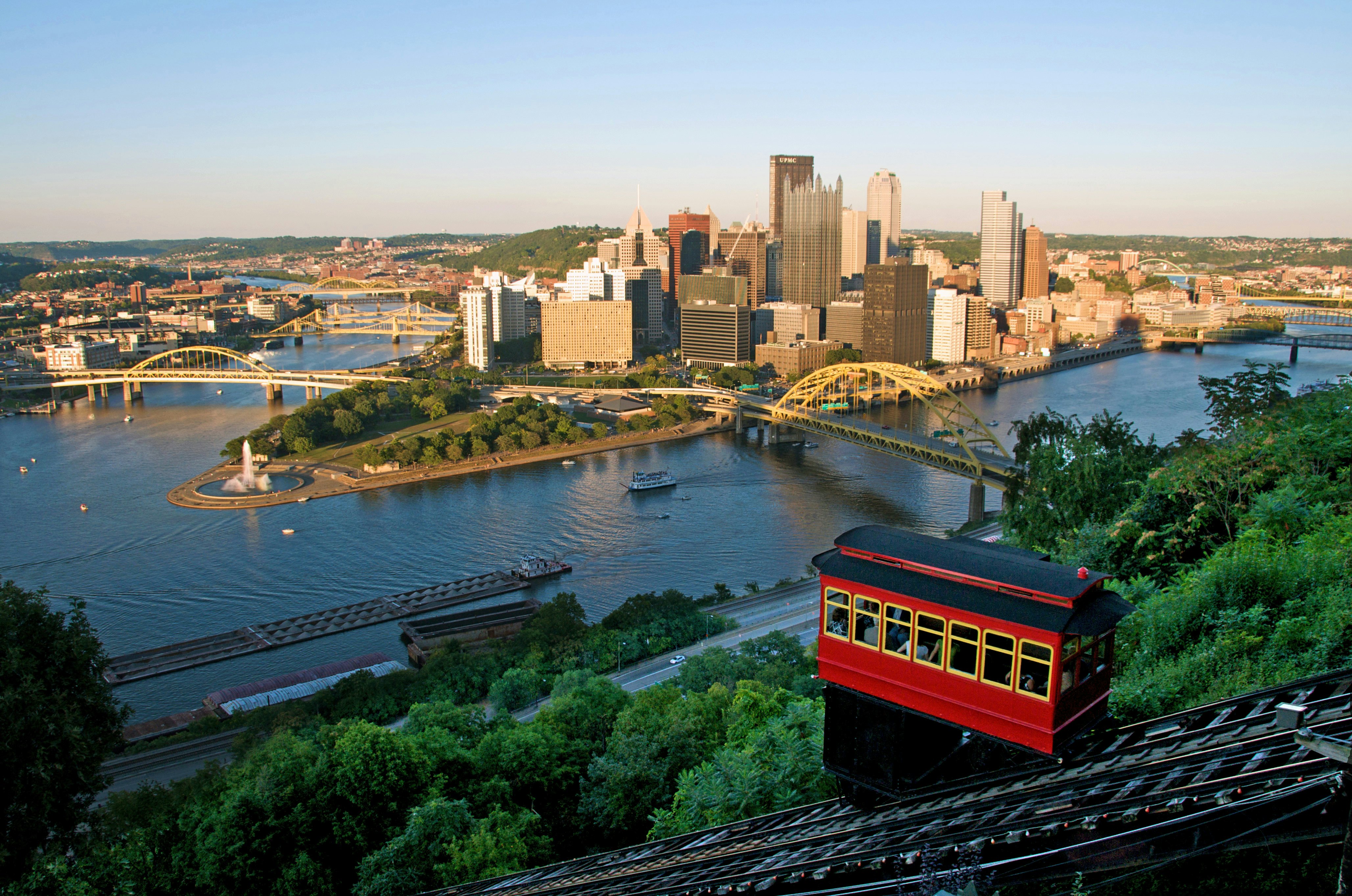
By far the coolest way to travel – though also the least practical, since it only takes you two places – are the city’s two inclines, also referred to as funicular railways. They are balanced cars that travel up and down the incline to the top of Mt Washington.
The cars run every 15 minutes year-round and throughout much of the day. As a transport method, they are limited. When you get to the top or bottom, you don’t have the method of transport you arrived on (so, say, if you drove to the incline and road down, then your car is still in Mt Washington). But if you just want to go to a restaurant or do a little light sightseeing, you should give the inclines a try. They’re fun.
Best things to do in Pittsburgh with kids
Rent a bike to neighborhood-hop
Bike commuting has doubled over the past decade in Pittsburgh, and the city has ambitious plans to expand biking lanes throughout the area, such as a new one added in Hazelwood.
Now known as POGOH, Pittsburgh’s bike-share system rebranded in May 2022 with 38 stations and a fleet of 350 new bikes, half of which are e-assist. For pay-as-you-go rides, it'll cost $3.50 per 30 minutes to rent a traditional pedal bike, and $5 per 30 minutes for an e-assist bike.
Downtown offers dedicated bike lanes, so you don’t have to worry about avoiding traffic as you pedal from hotel to restaurant. You may encounter trouble finding places to park your bike in the summer, when outdoor dining eats up outdoor real estate, so bike shares with dedicated way stations may be the best way to cycle.
Top 6 day trips from Pittsburgh
Accessible transportation in Pittsburgh
ACCESS provides advanced-reservation transportation across Allegheny County, with services from six providers and 300 vehicles. Call (412) 562-5353 or Relay 711 to reserve a ride.
Rideshares are the least-reliable form of transportation for those with mobility devices. Touch base before booking on what accommodations can be offered, and book well ahead to build in time for any delays.
For more information on accessible travel, check out our online resources.
Transport Passes
A Port Authority ConnectCard can carry you throughout the city. It’s like a debit card used for travel that you can buy at the Downtown Service Station and Downtown light rail station, and then add money as you go. You get a small discount ($2.50 vs. $2.75 for cash) on one-way trips on light rail and buses when you use the card.
Take your United States (USA) trip with Lonely Planet Journeys
Time to book that trip to United States (USA)
Lonely Planet Journeys takes you there with fully customizable trips to top destinations – all crafted by our local experts.


