Advertisement
Puerto Rico may be small but it is also perfectly formed when it comes to incredible attractions.
The island has a wide array of delicious food, lush landscapes, wildlife and culture jam-packed into an area only 100 by 35 miles and is a great place to visit throughout the year. Its relatively small size also makes Puerto Rico an ideal road trip destination. Here, no drive is too long or too far, and it’s easy to embrace “island time” and savor every beach, roadside kiosk and photo op along the way.
From north to south, east to west, mountains to beaches, the Atlantic Ocean to the Caribbean Sea, here are the best road trips in Puerto Rico.
Advertisement
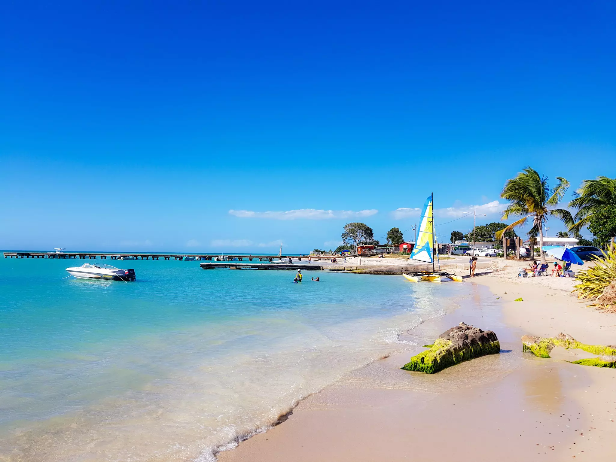
1. Atlantic coastline along Route 681
Best for dramatic coastline
Start/Finish: Barceloneta – Arecibo
Approximate distance: 11.5 miles
The northern coastal roads of Barceloneta and Arecibo offer easy drives by the seascapes of the rugged, dramatic Atlantic shore. Start your journey on Route 684 north and follow the farmlands along the river until the road becomes coastal Route 681.
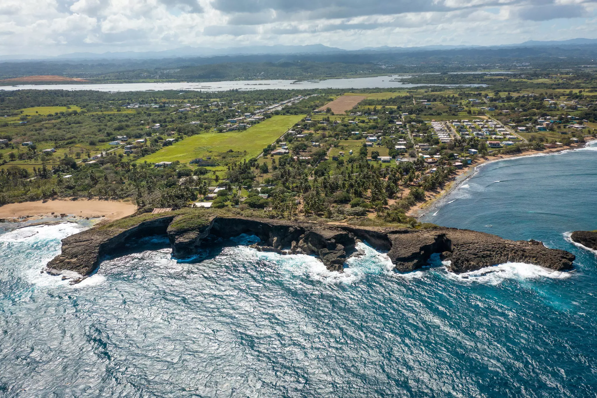
Make a quick pit stop at Rolyn’s seafood kiosk, known for manta-ray empanadillas (turnovers), as you make your way to Cueva del Indio (the Indian Cave). Listed on the National Register of Historic Places and featured in movies including Pirates of the Caribbean, this seaside grotto has Taino petroglyphs dating back nearly a millennium.
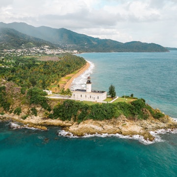
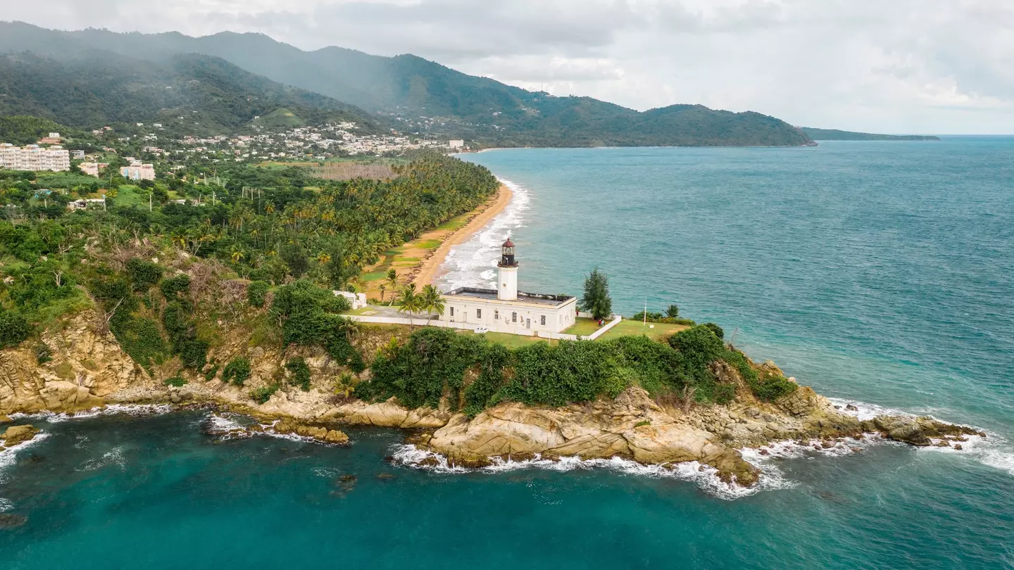
Any seafood restaurant further along the road – Salitre Meson Costero is a local favorite – makes a great spot for lunch or dinner. We recommend unwinding at La Poza del Obispo, with its turquoise waters, towering limestone rock formations and historic lighthouse.
End your day in Islote, where countless bars look out over the sea and afford ideal spots to take in the sunset with a refreshing drink in hand.
Planning tip: You’ll come across plenty of beaches en route, but swimmers beware: the tide is strong on the north shore, with large waves in the winter months that are perhaps better suited to surfing.
2. The chinchorro route
Best for roadside restaurants
Start/Finish: Bayamón – Comerío
Approximate distance: 23 miles
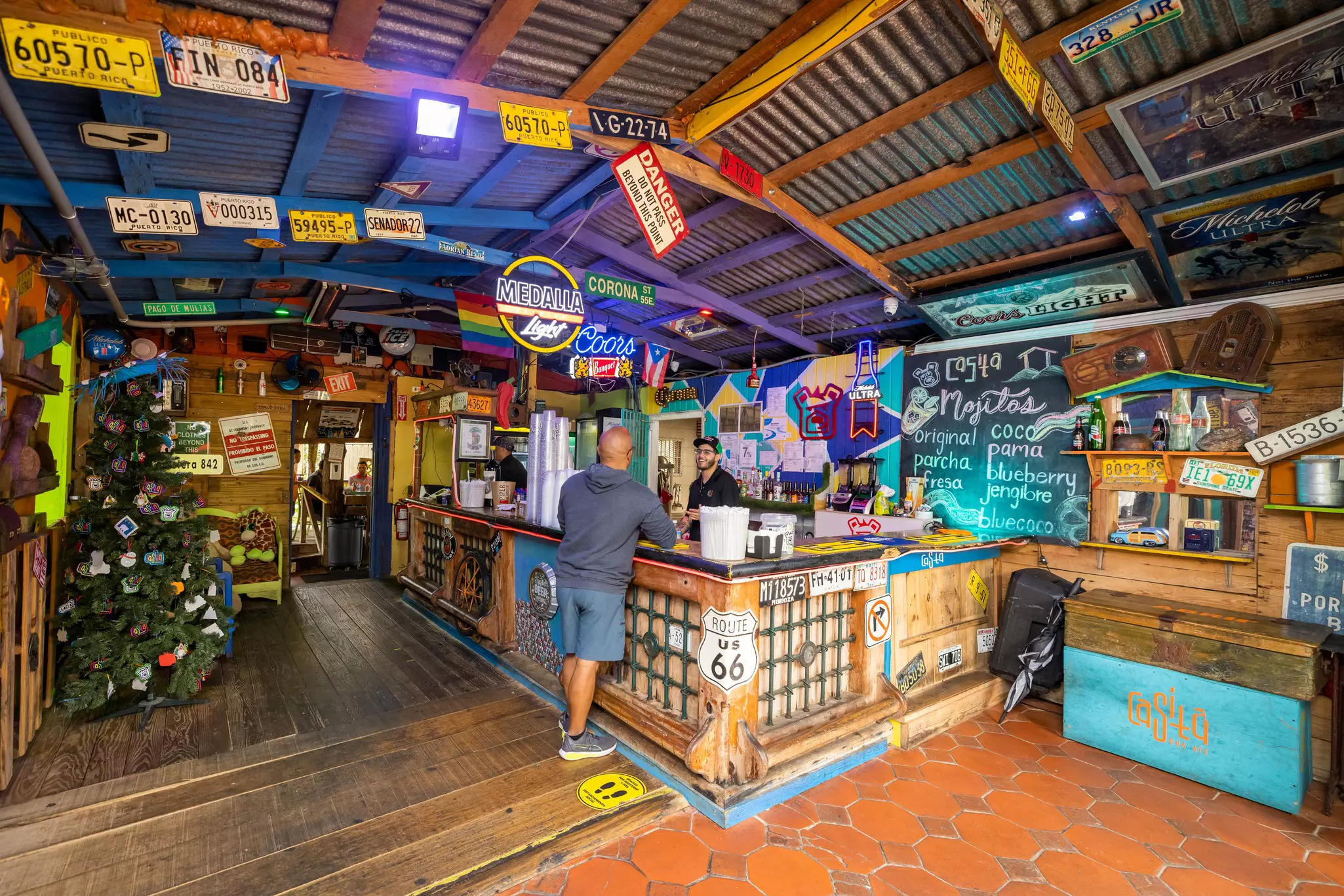
A chinchorro is a small, typically roadside restaurant or kiosk that serves all kinds of Puerto Rican foods, especially the deep-fried variety. No road trip experience in Puerto Rico is complete without a day spent chinchorreando, which usually consists of scenic drives through the mountains with stops at various establishments to experience food, drinks and sweeping views of the lush countryside along the way.
Start in Bayamón, a suburb of San Juan, and head southwest towards Naranjito on Route 167. Snap a photo at the Mirador al Puente Colgante (hanging bridge) or keep going to the many chinchorros along Route 152, including Caldosos, Calichi Gastro Bar and Asador San Miguel.
From there, continue south to Comerío on Route 809 to Doña Elena Bar & Rest. for some of the best carne ahumada (smoked pork) on the island.
Advertisement
Planning tip: Head out for your drive on a weekend afternoon or evening, and chances are you'll catch some live music performances at the chinchorros.
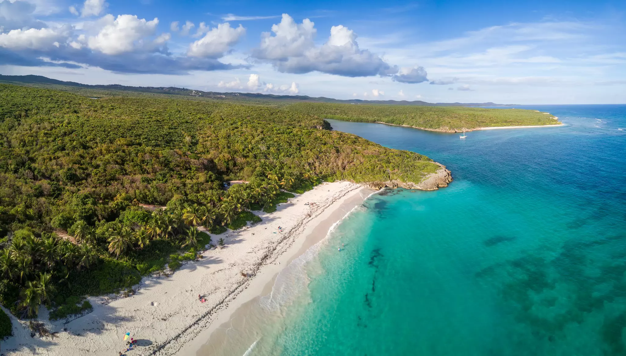
3. The Beach Route
Best for a family day by the sea
Start/Finish: Cabo Rojo (loop)
Approximate distance: 18 miles
The southwestern region of Cabo Rojo is home to some of Puerto Rico’s best beaches. The beauty and serene waters of the Caribbean Sea make them especially popular with local families on weekends.
Start your beach tour at the palm-fringed Playa Buyé. From there, take a quick stroll to explore the trails and limestone formations of the Punta Guaniquilla Nature Reserve.
Stop at the Boquerón boardwalk for lunch and grab a photo at the Muelle de la Libertad (Freedom Pier). Next up is Combate Beach, with its shining white sands and endless beach bars, followed by the Corozo Salt Flats, whose pink landscapes make for a somewhat bizarre but stunning backdrop for a quick walk.
End your day at La Playuela, a pristine half-moon bay with incredible views of the Cabo Rojo Lighthouse, limestone cliffs and the Caribbean Sea.
Planning tip: Avoid the crowds on this route by visiting during the week.
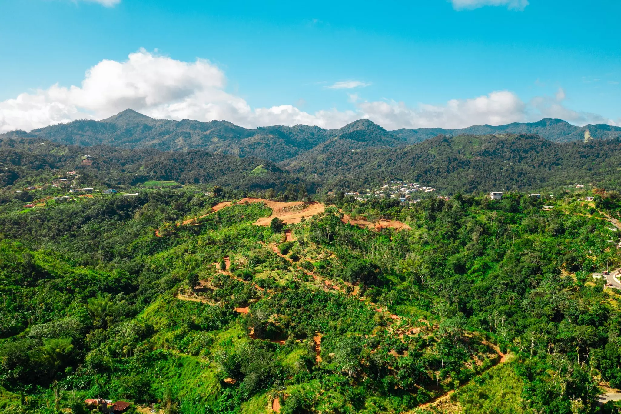
4. The Ruta Panorámica
Best coast-to-coast route
Start/Finish: Maunabo – Mayagüez
Approximate distance: 167 miles (allow 2–3 days for the entire route)
Puerto Rico’s most famous scenic drive is a 167-mile-long network of roads crossing the island from coast to coast through the central highlands. The itinerary is aptly named La Ruta Panorámica (the Panoramic Route).
Since the drive includes plenty of narrow two-lane mountain roads with hairpin turns, cliff drops and sharp climbs, this is a trip for the adventurous traveler. But the brave will be rewarded with an epic journey from the beach to the mountains, from jungles to lakes – with breathtaking views, nature and plenty of great eats along the way.
The route officially begins in Maunabo (located on the eastern part of the island) and ends in Mayagüez (on the west coast), passing through 15 other municipalities along the way. You can choose to drive the whole route and cross the entire island or opt for a smaller section if you’re pressed for time.
There are plenty of highlights, depending on what strikes your fancy. Nature enthusiasts can enjoy strolling along the beach at Punta Tuna Nature Reserve and Lighthouse, rappelling at Cañón de San Cristóbal, hiking Toro Negro Forest or kayaking Lake Garzas.
Foodies will want to stop in Guavate, known as the Ruta del Lechón (Pork Highway) and famous for its slow-roasted pork, or at one (or more) of the many chinchorros along the way.
Planning tip: Several charming options for lodging along the route include Hacienda Juanita in Maricao, Parador Villas Sotomayor in Adjuntas, and El Pretexto in Cayey – book in advance and take your time as you meander across the island’s interior.
5. Vieques by ferry
Best for a laid-back vibe
Start/Finish: Ceiba – Vieques
Approximate distance: 50 miles (including round-trip ferry)
Often overlooked by visitors, Vieques is located 7 miles off the east coast of the big island of Puerto Rico. Famous for its undeveloped beach coves, lush vegetation and roaming Paso Fino horses, it has a laid-back, small-town vibe that makes it the perfect place to escape the hustle and bustle of its (much) bigger neighbor.
To explore the island by car, take the cargo ferry from Ceiba (approximately 30 minutes) or catch a 25-minute flight from San Juan and rent a car upon arrival.
Start your trip at Sun Bay Beach, one of the most popular beaches thanks to well-maintained facilities: lifeguards, bathrooms, showers and a restaurant.
Nearby is lovely Esperanza, a small seaside town whose malecón (boardwalk) is dotted with restaurants, bars and guesthouses. From there, head to Playa Negra (Black Sand Beach), where black volcanic sand promises one of the island’s most dramatic beaches. Stop at the Parque de la Ceiba to see the island’s most formidable tree (it’s over 3 centuries old).
Detour: Before catching the ferry back, head to Mosquito Pier, a top fishing and snorkeling spot where you can spot starfish, sea turtles and many varieties of fish. Mosquito Bay Beach (known locally as Starfish Beach) also offers colorful starfish in abundance.
Tips for driving in Puerto Rico
On a tropical island with numerous microclimates, plan for all kinds of weather and terrain. Sudden and powerful rain showers are common here, so be sure to pack a raincoat or umbrella and make sure you feel comfortable driving in inclement weather.
The central highlands are much cooler than the coastal areas, with a light mist or fog rolling in most afternoons. Roads along these mountains are windy and should be driven with caution. Be sure to keep your eyes on the road and your wits about you: signage and road conditions can be lacking in less-traveled areas, with some epic potholes even on heavily trafficked roads.
Navigation apps can be hit or miss, so expect some backtracking – consider it a chance to discover and enjoy even more of this magical island. Also, always have cash handy, as most local businesses only accept cash or ATH Movil (Puerto Rico’s version of Venmo/PayPal).
Advertisement