
Get inspired by five of our favorite road trip itineraries through Colombia © Frazao Studio Latino / Getty Images
With photo-ready panoramas around seemingly every mountain bend and countless secondary roads leading off to charming little villages, having a vehicle in Colombia is the best way to explore the fascinating rural heartland of the country at your own pace.
While driving here is not without challenges – king-sized potholes, landslides, frequent roadworks and costly tolls to name a few – the rewards are well worth the minor hassles.
Here are some of the most spectacular drives in the country from the majestic mountains of the interior to the soft sands of the Caribbean.
1. Take a loop through Colombia's coffee country
Best for birdwatchers and coffee lovers
Starts and ends in Medellín, 580km (360 miles), 5–7 days
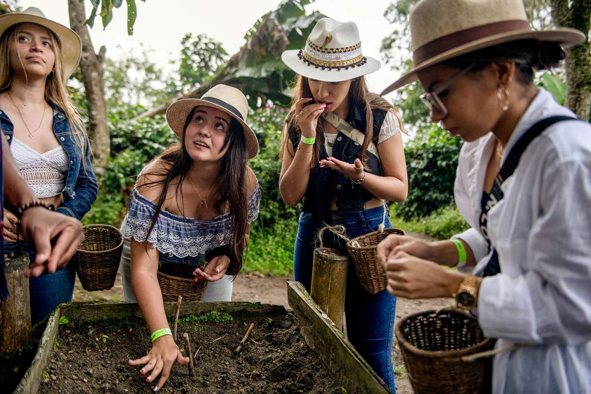
This caffeine-fueled adventure in the Eje Cafetero (Coffee Axis) takes travelers through coffee plantations, that cling impossibly to the steep terrain, to colorful traditional towns, thermal springs and pristine nature reserves.
From Medellín take winding Highway 60 southwest to the town of Jardín with its brooding, oversized neo-Gothic church that towers over the vibrant multi-hued plaza. Make sure you visit the Cueva de Esplendor cave and check out the quirky dance of the Andean Cock-of-the-Rock before taking the dirt road up into the misty moors south of town on the way to the university city of Manizales.
After visiting a nearby working coffee farm or one of the city’s cloud-forest reserves, continue south to Santa Rosa de Cabal to soak in the thermal baths powered by the nearby El Ruiz volcano. Suitably relaxed, continue on the excellent highways south to the vibrant little town of Salento, gateway to the Cocora Valley with its imposing wax palms.
From Salento, it’s possible to hike up into the Los Nevados National Park to check out the glaciers and shimmering mountain lakes. While in town sign up for a bean-to-cup coffee tour to find out how to brew the perfect cup before crossing the valley to the hilltop Filandia, famed for its traditional weavers.
Finally pay a visit to the Rio Barbas Canyon to check out the howler monkeys, butterflies and rich birdlife before returning to Medellín via Highway 20, which runs alongside the powerful Cauca River.
Planning tip: Visitors can buy bags of single-origin coffee to take home directly from many farms in the area; if you don’t see any on display ask your guide. Whole beans travel better than pre-ground packages.

2. Drive to the colonial villages of Boyacá and Santander
Best for architecture and tasty treats
Bogotá to Bucaramanga; 430km (267 miles); 5–6 days
Featuring some of the best preserved colonial architecture in the country, a trip through the sleepy towns of Boyacá and Santander is a voyage into another era.
After leaving behind the sparkling glass towers of Bogotá, the first stop is the well-preserved Villa de Leyva with its cobblestone streets, whitewashed mansions and immense plaza.
Take the back road from Villa to visit the mystical lakes and mist-covered moors of the Santuario de Flora y Fauna Iguaque, birthplace of Muisca goddess Bachué, before joining Highway 62 north to reach Barichara, Colombia’s most perfectly preserved town, with its neatly-tiled adobe houses set around yellow-stone churches that glow in the rich Santander sun.
Make the short drive down the wonderfully scenic winding road into the river canyon to visit the tiny hamlet of Guane with its old-school museum run by the church that showcases intricate indigenous crafts and curious fossils dug up in the surrounding area. Both towns are famed for their indigenous cuisine – don’t leave without trying hormigas culonas or big-bottomed ants, a favorite snack in the region.
Finally, rejoin the highway north that winds through the magnificent Chicamocha Canyon before emerging at the friendly modern city of Bucaramanga.
Planning tip: Due to their proximity to Bogotá, many towns get crowded with day-trippers on weekends, so try to visit during the week for a more tranquil experience.
3. See the landscapes en route from Santa Marta to the Guajira Peninsula
Best for warm waters and indigenous culture
Santa Marta–Cabo de la Vela; 430km (267 miles); 1 week
Taking in some of Colombia’s most striking landscapes, this sun-baked journey from the jungle-covered mountains of the Sierra Nevada to the arid sands of the Guajira Peninsula showcases the country’s incredible cultural and natural diversity.
From Santa Marta, the first port of call is the charming little mountain hamlet of Minca nestled in the mountains high above the town. Bring binoculars to check out the myriad birdlife that inhabit the cloud forest while enjoying a drink by the river.
Crank the air-conditioning before jumping onto the Transversal del Caribe highway which leads east to Tayrona National Park, Colombia’s most enchanting nature reserve. Here boulder-strewn white-sand beaches are bookended by jungle-covered bluffs all backed by the peaks of the Sierra Nevada.
Rejoin the highway and continue east along the park's southern reaches to the bohemian beach town of Palomino where a crystalline river runs from the lush mountains above to a rugged windswept stretch of coast.
After Palomino, the rain-producing Sierra Nevada fades in the rearview mirror and the landscapes transition from rich greens to the earthy shades that surround Riohacha. The Guajira capital is home to an inviting waterfront that is a fine place to buy indigenous Wayúu crafts directly from the artisans.
Get an early start to beat the heat on the road north into the parched lands of the Alta Guajira, turning off the highway onto the sand track that leads through the desert to Cabo de La Vela, where warm Caribbean waters are just steps from charming indigenous-owned guesthouses. It’s best to pick up a Wayúu guide in Uribia before exploring the desert as tracks are unmarked and cellular phone coverage is patchy on the peninsula.
Planning tip: There is next to no commerce in the Alta Guajira so bring plenty of water, snacks and sunscreen from Riohacha.
4. Drive from Cali to the Pacific
Best for wildlife
Cali–Buenaventura; 194km (120 miles); 2–3 days
This short and easy trip follows one of only two roads to the Colombian Pacific, rising up and over the Western Cordillera mountains to the thick jungles of the coastal plain and the wildlife-filled waters just offshore.
Beginning in the hot, bustling city of Cali, head north along the smooth expressway to the Laguna de Sonso wetlands before relaxing in the cool breeze on a boat tour of the nearby Lago Calima.
Next head west on Highway 40 alongside the pretty Dagua River to the hamlet of Cordobá where you’ll need to leave the car before boarding a homemade motorized rail cart for the adrenaline-pumping trip through the jungle to San Cipriano, a tiny village perched beside a stunningly clear river. The last leg of the journey is the short drive downhill to Buenaventura from where boat tours depart for the lost-world panoramas of Bahía Malaga and further out to sea to spot nursing humpback whales.
Planning tip: Humpback whales begin to arrive in the warm Colombian waters around June but numbers peak from August to October. During peak periods, it’s much easier for small groups of travelers to find a boat tour to join.

5. Take a round trip through the Southern Andes
Best for architecture and archaeology
Starts and ends in Popayán; 820km (509 miles); 7–10 days
Stretching south from the edge of the Cauca Valley all the way to the Ecuadorian border, the remote mountains of the Colombian Massif embrace some of the country’s most important cultural sights, which can be visited on an adventurous loop through breathtaking countryside.
Begin in the historic city of Popayán with its whitewashed colonial mansions set around the central plaza. After checking out some of the city’s many intriguing museums, drive up into the mountains to the Puracé National Park, where visitors can check out the moon-like landscape of the sulfur-spewing active craters.
The northern road through the park leads to Tierradentro, a collection of mysterious underground tombs spread amongst the peaks above the tiny hamlet of San Andres de Pisimbalá.
From the lush green surrounds of Tierradentro head down to Neiva on the edges of the Magdalena River from where it’s a short drive to the arid landscapes of the remarkable Desierto de la Tatacoa, a micro-desert complete with towering cacti.
After spending a night of utter tranquility in Tatacoa follow the Magdalena south to its upper reaches to find San Agustín with its enormous fang-toothed stone statues left behind by a long-lost civilization. Driving south on Highway 45 it’s just a couple of hours to Mocoa, where the Andes crash headlong into the Amazon basin in a riot of rushing water and tropical foliage.
From Mocoa there are two options. Experienced drivers with nerves of steel can climb back up into the mountains to Pasto along the hair-raising Highway 10, nicknamed the Trampoline of Death, one of Colombia’s most thrilling roads. From Pasto, the Pan-American highway winds through gorgeous mountain peaks back north to Popayán.
Alternatively, a far less challenging drive involves heading back north to Pitalito and traveling through the ethereal moors of the southern reaches of Puracé National Park back to Popayán with the added bonus of a stop at the relaxing Coconuco hot springs.
Planning tip: In San Agustín leaving the car and hiring horses to visit some of the outlying archaeological sites offers a different perspective of the glorious countryside.


