
Massachusetts' hiking trails are a great way to enjoy the outdoors © Albert Pego / Getty Images / iStockphoto
From the woodsy hills of the Berkshires to the stunning heights of Mt Greylock, Massachusetts offers a handful of challenging and stress-free hikes to explore the state's natural side. Here are seven of our favorites.
Editor's note: Please check the latest travel restrictions before planning any trip and always follow government advice.

Bash Bish Falls
In the very southwest corner of the state, near the New York state line, is Bash Bish Falls, the largest waterfall in Massachusetts. The water feeding the falls runs down a series of gorges before the torrent is sliced in two by a massive boulder perched directly above a pool. There it drops as a picture-perfect double waterfall. These 60ft-high falls are a popular spot for landscape painters to set up their easels.
A short, steep trail leads directly to the falls viewing area from the Massachusetts parking lot. For a gentler walk, continue driving 1 mile west across the state border to the New York parking lot, from where a more level path takes you to the scenic overlook. There used to be stair access to the pool at the bottom of the falls but this is closed off to visitors for the time being. Hikes from both starting points take about 20 minutes each way.
To get there from Great Barrington, take MA 23 west to South Egremont. Turn onto MA 41 south and then take the immediate right onto Mt Washington Rd (which becomes East St) and continue for 7.5 miles. Turn right onto Cross Rd, then right onto West St and continue 1 mile. Turn left onto Falls Rd and follow that for 1.5 miles. The parking lot and trailhead will be on your left.
Monument Mountain and Peeskawso Peak
Monument Mountain is a storied part of Massachusetts – literally. Many fans of American literature know that Nathaniel Hawthorne and Herman Melville hiked Monument Mountain and spent the day discussing the project that would become Moby Dick. Indeed, Pittsfield, Massachusetts still hosts public readings of the famously long novel and leads an annual hike to commemorate the authors' picnic-cum-craft talk.
But long before Melville set up residence in the area, Monument Mountain's sister summit was dubbed Squaw Mountain by colonial settlers – supposedly based on a local legend about a Mohican woman. In 2021, indigenous tribes and local leaders selected a new name, Peeskawso Peak, which swaps the racist and sexist pejorative for the Mohican term for a "virtuous woman." The renaming coincides with a broader plan to emphasize and expand on the region's long Indigenous history in trail signage, museum exhibits, and more.
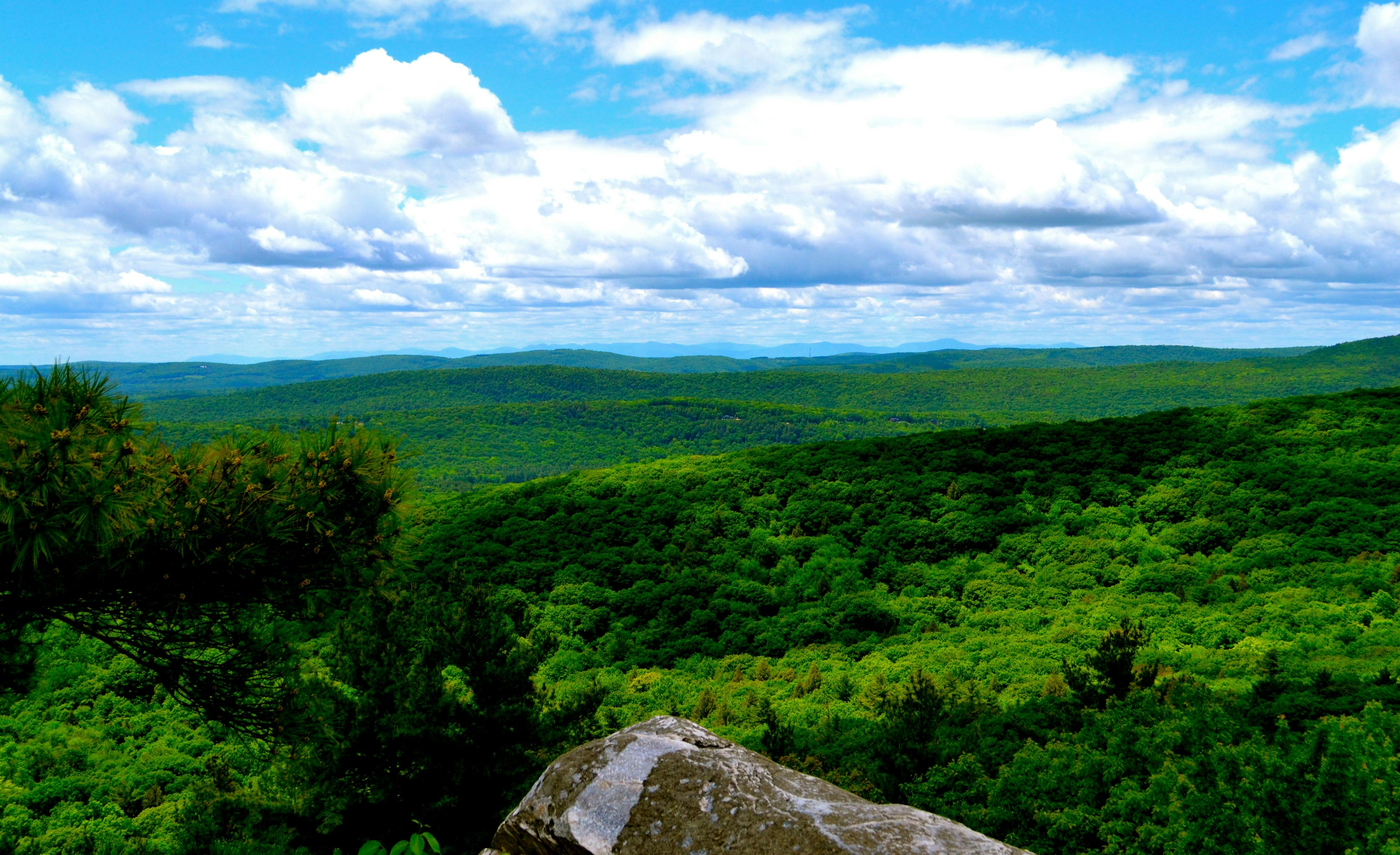
You can see Monument Mountain and Peeskawso Peak yourself less than 5 miles north of Great Barrington center on US 7. Turning right from the parking lot, the 3-mile circular route ascends steeply via the Hickey trail and runs along the cliff edge to Peeskawso Peak and the Devil's Pulpit lookout. From the top you'll get fabulous views all the way to Mt Greylock to the northwest and to the Catskills in New York.

Cape Cod Rail Trail
The mother of all Cape bicycle trails, the Cape Cod Rail Trail runs 22 glorious paved miles through forest, past cranberry bogs and along sandy ponds ideal for a dip. This rural route, formerly used as a railroad line, is one of the finest bike trails in all of New England.
The path begins in Dennis on MA 134 and continues through Nickerson State Park in Brewster, into Orleans and across the Cape Cod National Seashore, all the way to South Wellfleet.
There's a hefty dose of Ye Olde Cape Cod scenery en route and you'll have opportunities to detour into villages for lunch or sightseeing. If you have only enough time to do part of the trail, begin at Nickerson State Park and head for the National Seashore – the landscape is unbeatable.
Bicycle rentals are available at the trailheads in Dennis and Wellfleet and opposite the National Seashore's visitor center in Eastham. There's car parking at all four sites (free except for Nickerson).
The Blue Hills Reservation
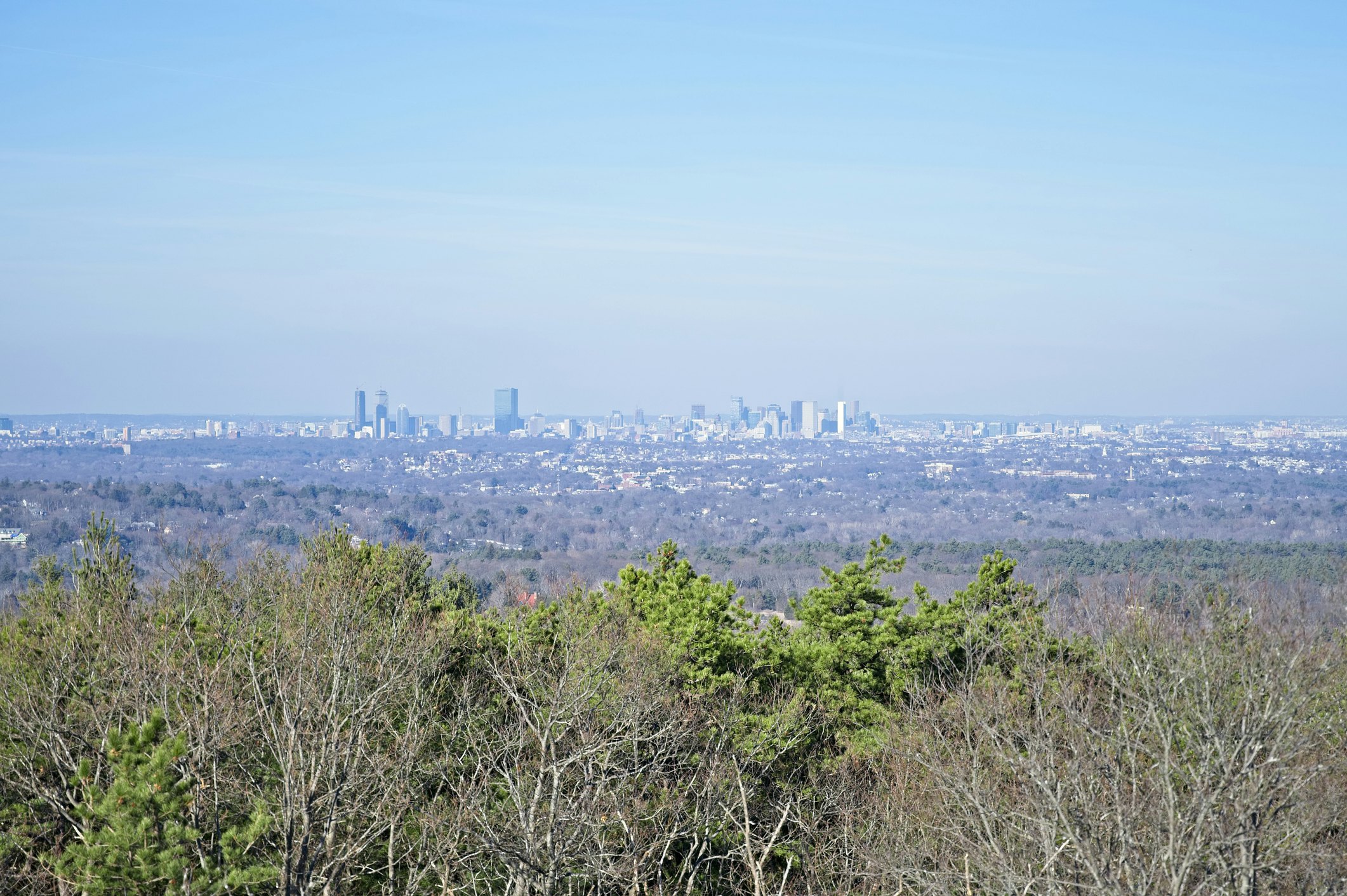
Move over, Griffith Park – there's more than one exurban trail with stunning views of major city skylines. Just twenty minutes outside Boston, the Blue Hills Reservation boasts over a hundred miles of trails, including one with panoramic vantages of Beantown from the summit of Great Blue Hill. Take the Skyline Loop Trail from the Blue Hills Reservation headquarters. It's just three miles from start to finish, but you can expect some glute-burning climbs along the way, particularly as you tackle Hancock Hill via a series of stone steps. Be sure to climb the Eliot Observation Tower at the top for the best glimpse of Boston's glittering buildings.

Mt Greylock trails
Mt Greylock has hikers of all levels covered. Take your pick from 45 miles of hiking trails, along 13 marked routes, including a portion of the Appalachian Trail. Frequent trail pull-overs on the road up – including some that lead to waterfalls – make it easy to get at least a little hike in before reaching the top of Mt Greylock. The road to the top is closed from November to late May, but the trails are open year-round.
Mount Norwottuck
Mount Norwottuck has the distinction of being the highest peak in the Holyokes, a geologically unusual mountain range of ancient volcanic basalt that runs east to west, rather than north to south. Norwottuck affords great views of the surrounding valley, and the trailhead by the Visitor's Center is easily reached from Amherst. You can tackle Norwottuck's summit (1,106ft) in a moderate three mile loop by combining the Robert Frost and Metacomet-Monadnock trails. Along the way, you'll also have a chance to see a series of overhanging ledges known as the Horse Caves, which played a small roll in early American history when insurrectionists hid here after Shay's Rebellion in the late 1780s.
Bartholomew's Cobble
South of Great Barrington, it's easy to kill a few hours at the 329-acre Bartholomew's Cobble, a “cobble” being a high, rocky knoll of limestone, marble or quartzite. Five miles of hiking trails provide routes for enjoying the cobble and the woods, including the strenuous route to the top of Hurlburt's Hill, and the Ledges Trail, which weaves along the Housatonic River.
Tyringham Cobble
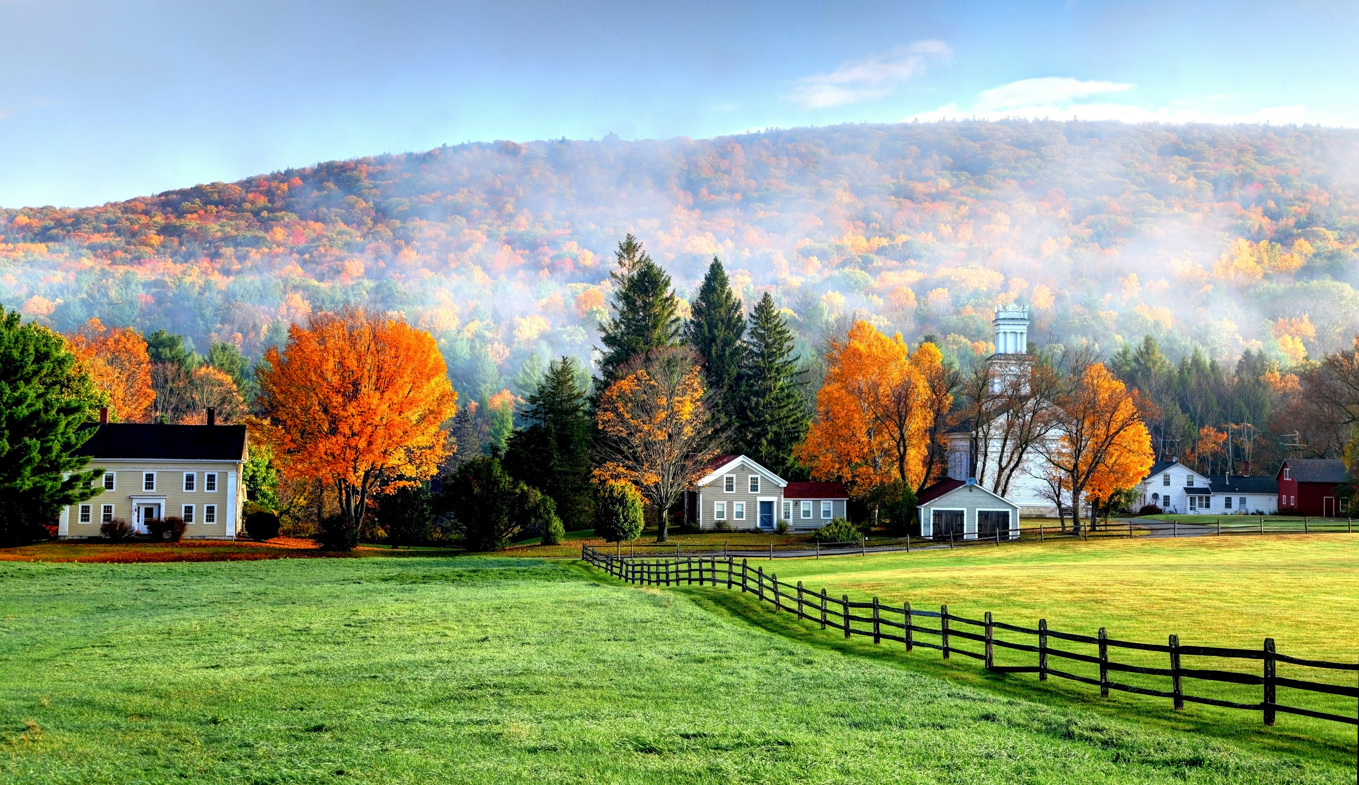
To get some perspective on this tiny village's pastoral splendor, take a 2-mile hike over the knobs of Tyringham Cobble, which offers wildflower-strewn hillsides and spectacular views. Look for wild berries growing in the meadows and the uniquely shaped Rabbit Rock perched along this Berkshires trail.
Dune Shacks Trail
Pull off MA 6 and after a short walk you'll find yourself surrounded by dunes as far as you can see. There's no one trail (keep walking relatively straight and you'll get to a lovely beach) so you can wander the sand hills as you wish. Make sure to bring lots of sunscreen and note the location where you began your walk.
There are just a few spots to park along MA 6. It's accessible by bike (no bike rack, but a few road signs if you want to chance it) or a very long walk from town.
Hoosac Range Trail
Near North Adams, there is an easy 1.6-mile trail to Sunset Rock, where you can pick blueberries in season. If you have more time, take the moderate 6.2-mile trail to Spruce Hill, where you'll be rewarded with open ledges and long views. The trail is known for rocky glacial cliffs and creepy tree formations, caused by wind and ice.
You might also like:
New England's best hiking trails
How to road trip New England on a budget
Massachusetts' 6 best road trips


