How to plan an epic hike through Armenia on the Transcaucasian Trail

Sep 12, 2024 • 9 min read

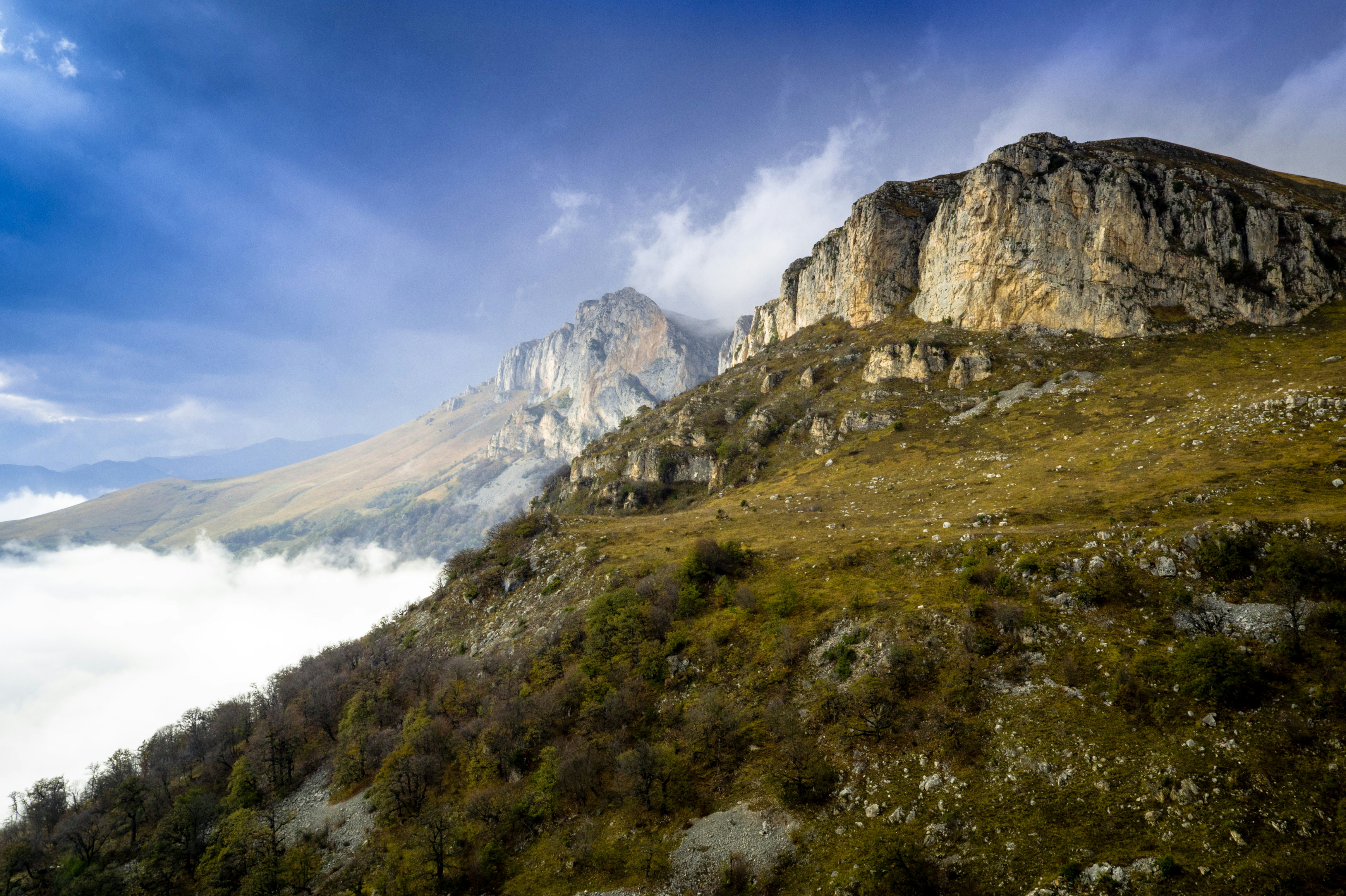
On the Transcaucasian Trail, expect solitude, ever-changing weather and views that will inspire and amaze you © Anna Richards / Lonely Planet
In Lonely Plan-It, we take you step by step through how we put together some of the most complicated travel adventures. Here, travel writer and outdoors enthusiast Anna Richards explains how she hiked the Armenian section of the under-the-radar Transcaucasian Trail.
I knew very little about Armenia before deciding to hike the Transcaucasian Trail (TCT), which winds hundreds of miles through this under-explored country. When I told friends of my plans, most knew little more than the scraps I did – a turbulent, tragic recent history, some vague connection to the Kardashians.
But what I found there simply amazed me: millennia-old monasteries, vast volcanic plateaus and rust-colored gorges that crumbled like breadcrumbs as you hiked them.
The full TCT spans 932 miles (1500km) across Georgia and Armenia. A separate section is in progress to cross Azerbaijan, which would bring the full trail to almost 1900 miles (3000km). Unfortunately, due to current border conflicts, linking the two sections is a far-off goal.

Totaling 516 miles (832km), the Armenian segment of the TCT opened to the public in 2022. I was one of the guinea pigs that got to beta-test when it first opened – although the distance I covered over four weeks (360 miles / 580km) made me feel more like a hamster on a wheel.
Some numbers for context: the USA’s Pacific Crest Trail (PCT) issues 8000 hiker permits a year. Around 3000 thru-hikers attempt the Appalachian Trail annually. Fewer than 100 hikers completed a multiday section of the TCT in 2024 – making this a track that is truly…off the beaten track.
In order to (safely) get away from the hiking masses, you’re going to have to plan ahead. Here’s how to plan a trip to hike the Transcaucasian Trail.

Step 1: Prepare, prepare, prepare
With maps, GPS and careful planning for water
This trail requires a lot of preparation. It should only be hiked between June and September, as outside of this season snow makes parts of the trail inaccessible. (Even when I hiked in August, some snow lingered in the Gegham Mountains.) Yet while the warm summer months clear the trails for hiking, the season brings challenges: in July and August temperatures along much of the route soar to more than 32°C (90°F). Since water is scarce, you’ll need bottles with a few liters’ capacity, as well as a filter-purifier to refill them. To hike the full Armenian section of the TCT you’ll need to allow for around six weeks, hiking almost 20 km per day. If you’d prefer to take it at a more leisurely speed, factor in two months. Fastpackers and trail runners can cover the ground in significantly less time.
It’s essential to download route-planning apps. While there are no physical maps of the TCT, GPX files are available through the TCT website (a suggested donation of US$100 gets you access to route guides, plus a Slack channel run by trail planners and recent hikers). I’m not exaggerating when I say the trail would be impossible without these resources.
Step 2: Pack wisely, and plan for resupply package
There will be lots of gear involved - so really think this through
While there were times that I wished I was an ultralight packer, I don’t regret taking with me such “luxuries” as my Kindle and deodorant. As you pack, keep in mind that you need to be totally self-sufficient for the TCT. This means carrying up to seven days’ worth of food for certain areas, as well as the means to prepare it (cooking or cold soaking).
Much of the TCT requires wild camping, so good gear is essential. Where there are guesthouses, you’ll need cash; you’ll find ATMs in larger towns, though I still recommend having a couple of hundred dollars’ worth of Armenian drams when you start the trail. A guesthouse with breakfast included typically costs around 5000-6000 AMD (US$13-16), and extra meals between 3000-5000 AMD ($7-13). Be prepared for all weather conditions, as the altitude along the way will rise and fall by almost 10,000ft (3000m). A sun hat, a waterproof shell and thermal layers are all musts.
Send yourself resupply packages via the HIKEArmenia office in Yerevan; most towns will have at least a small shop to receive them. For camping gas and other last-minute supplies, Camp.am in Yerevan is your only option. (Remember that you cannot take the plane with camping gas, so you’ll need to buy this in Yerevan.)
An Armenian SIM card (I used UCom) will get you unlimited data for less than $15 per month, and can be renewed at top-up machines in any large town. When you’ve got so much off-road navigation, this is invaluable. Take a copy of your ID to scan.

Step 3: Take the first step
Set out from different starting points for northbound and southbound journeys
Any great journey begins with a single step – though in the case of the TCT, your initial ones will be on airport escalators and rickety buses, before you set out on the trail itself. Fly into Yerevan, Armenia’s capital, then catch a bus from there to either Meghri, at the southern end of the trail (nine hours), or to Gyumri, from where you’ll take a taxi to Lake Arpi to begin the trail southbound. Since buses fill up, call ahead to book using the number listed on bus companies’ Facebook pages (or ask someone to do this for you if you don’t speak Armenian). The day of your journey, the driver will have a list of passengers who have reserved in advance (there are no tickets).
Before you set out for Armenia, decide which direction you’ll be hiking. South-to-north is a baptism of fire, beginning with three days hiking through Arevik National Park, the toughest, remotest part of the trail. If you tackle it first, you’ll know that you’re up to the rest of the hike. I saw no one during this time and had to carry enough water to satiate a camel on a trans-Saharan odyssey, as in the height of summer you may not pass a water source for the full three days. Yet this is also one of the most spectacular sections I experienced. North-to-south is a gentler start, giving you almost six weeks to warm up to tackle Arevik National Park, but by leaving the toughest section until last, you’ll need to rely on food supplies you’ve picked up from local shops, which tend to be heavier than dehydrated meals. Whichever way you hike, the highest section of the trail, the Gegham Mountains, falls in the middle.
Step 4: Embrace Armenian hospitality – but stay safe
Expect near-limitless generosity in the countryside
I took too much food because I hadn’t anticipated the limitless generosity of the nomads, villagers and farmers that I met along the way. Like an army, hungry hikers march on their stomachs, so enjoy it! Hospitality is paramount to Armenians, so when you’re waddling along with a belly as heavy as your backpack, you’ve likely made your hosts very happy. Offers of payment are likely to be perceived as insulting, your best payment is a smile and patient conversation.
As a solo female traveler, I was regularly taken in by families who fed and housed me, and let me shower in their homes (a true luxury). Men may be less likely to be invited to stay, though everyone can expect to be well-fed. Women hiking alone isn't a common sight in the Armenian countryside, use your best judgment and common sense about accepting hospitality along the way.
Where guesthouses are available, always opt for breakfast and dinner. You’ll be supporting rural businesses, and with the quantity (and quality) of what you’re fed, you’ll never regret it.
Step 5: Consider doing just a small section
You’ll see plenty if you only have a week
Many of us don’t have the luxury of taking months of vacation, and even in four weeks I didn’t complete the full length of the TCT’s Armenian section. If you’ve only got a week, I recommend the Gegham Mountains, a green moonscape of remote lakes in volcanic craters, nomadic, yurt-dwelling shepherd families and frequent violent flash storms. It’s the highest part of the Armenian trail – and its wide-open spaces give you a nice (natural) high, too.
From south-to-north (this is the direction I hiked, you can go the other way too!), the other most notable sections of trail are as follows. It begins with the aforementioned Arevik National Park; toothy, foreboding and arid mountains which make for an extremely challenging few days of hiking, although the views over the remote mountains of northern Iran are spectacular. Roughly a week into the trail, hikers reach Vayots Dzor, which rather morbidly translates to the Valley of Woes. Here you’ll find ochre-colored gorges infested in equal measures with Syrian brown bears and millennia-old monasteries. After the Gegham Mountains, the trail briefly joins the banks of Lake Sevan, a vast freshwater lake fed by 28 different rivers, and a popular holiday spot for Armenians. Around four weeks in, hikers arrive in Dilijan National Park, one of the greenest parts of the trail, where the TCT largely winds through woodland. It’s well-marked and a good section for less experienced hikers. Dilijan is also one of the best places in the country to meet fellow backpackers, and it has several hostels.
Lori Province, after Dilijan, is rural, green and punctuated with villages. The Debed Canyon, sandwiched between farmland, is one of the most dramatic sights on the hike, and the cliffs rise to 350m (1148ft) high. Lake Arpi, a high altitude lake near the Georgian border framed by soft hills, bursts with wildflowers in early summer and gives a feeling of total remoteness.

If I could do it again…
I’d do it the same way. On a hike of any length here, the trail is your classroom.
Set aside your preconceptions of what it’s like to do a thru-hike. So you’ve done the GR20? Fantastic: since you’re clearly in great physical shape, much of the TCT won’t be so tough on your body. But instead of a well-marked trail expect lots of bushwhacking, and no cold beer afterwards. Hiked the PCT? Wonderful: you’ve got stamina and are accustomed to being self-sufficient. But expect to multiply the solitude you experienced by a huge factor. On the TCT you can go days without seeing a human face – and when you do, you can expect a large language barrier to contend with. Hikers on the Armenian TCT are almost totally reliant on GPS, so make sure you’ve got a good power bank. Large sections of the trail still have no markings or signposts whatsoever, although this is a work in progress. I’d also recommend carrying a satellite tracker so that you can be located in the event of an emergency. Carry a compass, and if you can get your hands on a physical map, do so.
Most of all, enjoy it. Hiking Armenia is an education about an ancient, rich civilization, and a place that sees comparatively little footfall. A journey here turns you into an explorer.


