Advertisement

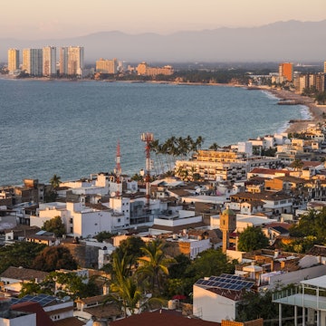
Atlanta is a big city, but it's easy to see the sights with a car or by public transport. Sean Pavone/Shutterstock
As the capital of the great state of Georgia, Atlanta serves up a generous portion of Southern hospitality. Even if this characterful city isn't your end destination, the chances are that you'll drop into Atlanta, either by plane en route to smaller airports dotted around the state, or by road as you make your way towards the coast.
While we recommended taking a few days to enjoy this fun, foodie city, be ready for some challenges on the transportation front. Atlanta's public transit system is far from comprehensive, particularly when it comes to exploring the city’s sprawling metropolitan area.
Advertisement
This means visitors to the city have to be a little bit creative, using a mix of trains, buses and the occasional Uber or taxi, to be able to see everything there is to see and do. If you want to explore all Atlanta has to offer, you'll need your own set of wheels, though it is possible to get to the key sights using public transportation.
Here's what you need to know about getting around in Atlanta, Georgia.
Stretch your budget by taking the train
If you're looking for a low-stress way to explore, the trains operated by MARTA go in four directions from downtown – north, south, east and west. These pocket-friendly urban trains can get you into some of Atlanta’s neighborhoods – including West End, Midtown, Buckhead, and Inman Park – but there are no services to Old 4th Ward, Virginia Highland and Blandtown. The four lines connect at Five Points Station and the Red and Gold lines run to Hartsfield–Jackson Atlanta International Airport.
Note that stops are too widely spaced to be particularly useful for getting around within neighborhoods. Combining the train with MARTA’s more precise and expansive bus system – and renting an e-bike or scooter or taking the occasional Uber – is the most cost-effective and efficient way to get around town.
MARTA buses and trains use a Breeze card to pay for transport. A Breeze card costs $2, and you'll need to load the card with credit to pay for MARTA rides. The standard MARTA fare is $2.50 for a one-way bus or train ride, with up to four transfers allowed within a three-hour window.
Use MARTA buses for shorter hops
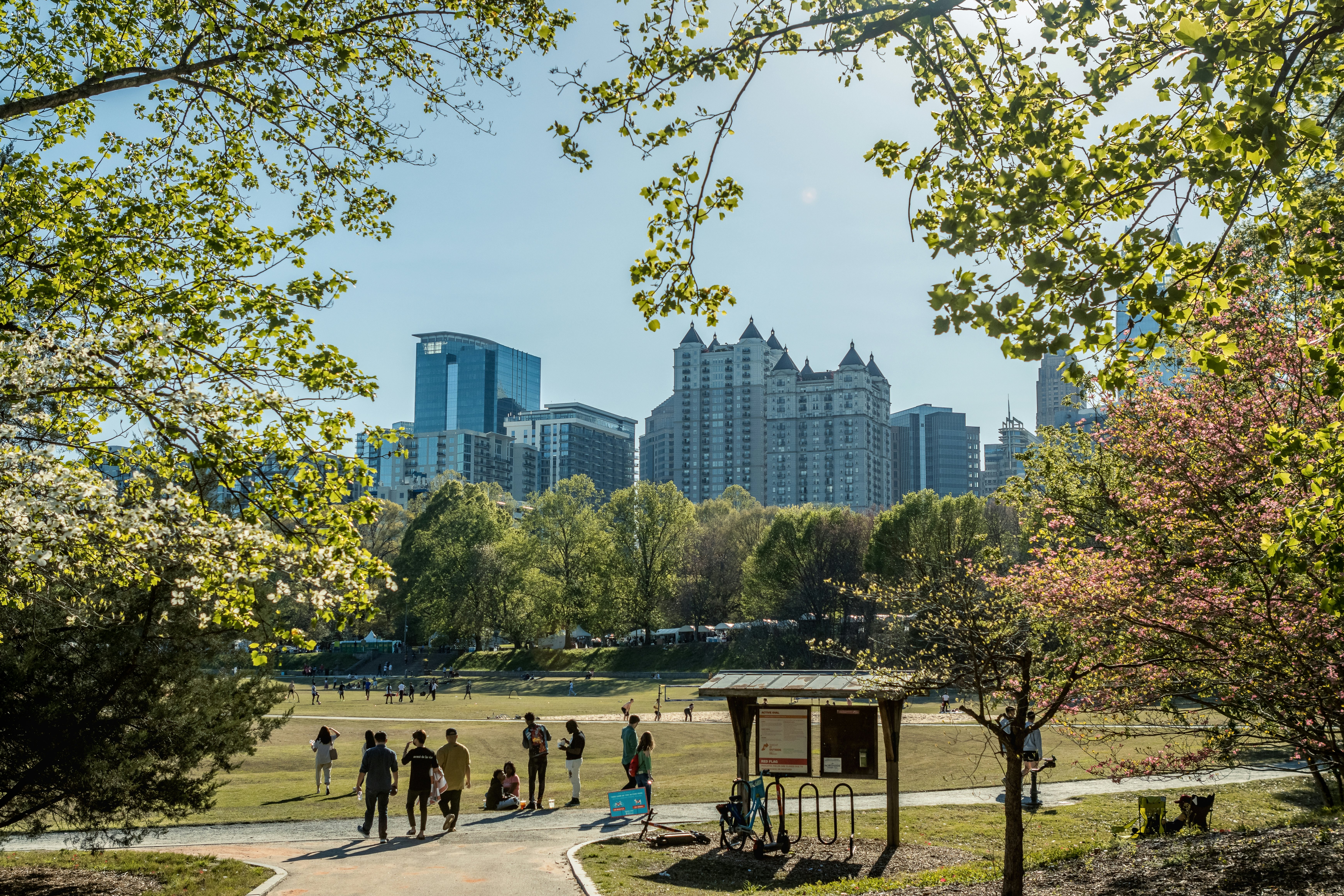
MARTA's bus network covers 91 routes, traversing 1000 miles of Atlanta's streets. City buses are a convenient way to get around within neighborhoods and between neighborhoods, and combining MARTA trains and buses can get you to many of the sights, including urban green spaces such as Piedmont Park and the Atlanta Botanical Garden.
There's a handy online route-planning tool on the MARTA website; fares are the same as for MARTA trains and the Breeze card is the best way to pay.
Advertisement

Check off the major tourist attractions with the Atlanta Streetcar
If you’re looking to tick off some of the major tourist attractions in downtown Atlanta and the Sweet Auburn neighborhoods, the MARTA-run Atlanta Streetcar is the easiest and fastest way to get around. Start your explorations at the Centennial Olympic Park stop, which puts visitors next to the World of Coca-Cola, the showstopper Georgia Aquarium, and the National Center for Civil and Human Rights.
For a $1 one-way fare, or a $3 all-day fare, streetcar passengers can make a 2.7-mile loop that will also drop you next to the Sweet Auburn Market and Martin Luther King Jr National Historic Park. For easy access, the streetcar connects to the Peachtree Center MARTA station.
Get around locally on a rented e-bike or scooter
Once you've arrived at your bus or train stop, consider taking a ride on an e-bike or scooter to get to your final destination. Lime and Bird offer e-bikes and scooters at 200 different stations throughout the city; use the apps to find their dockless bikes and scooters.
Renting an e-bike or scooter usually starts with a base fee ($1 on Bird, $3.50 on Lime, including the first seven minutes) plus a per-minute charge (about $0.39) during the rental period.
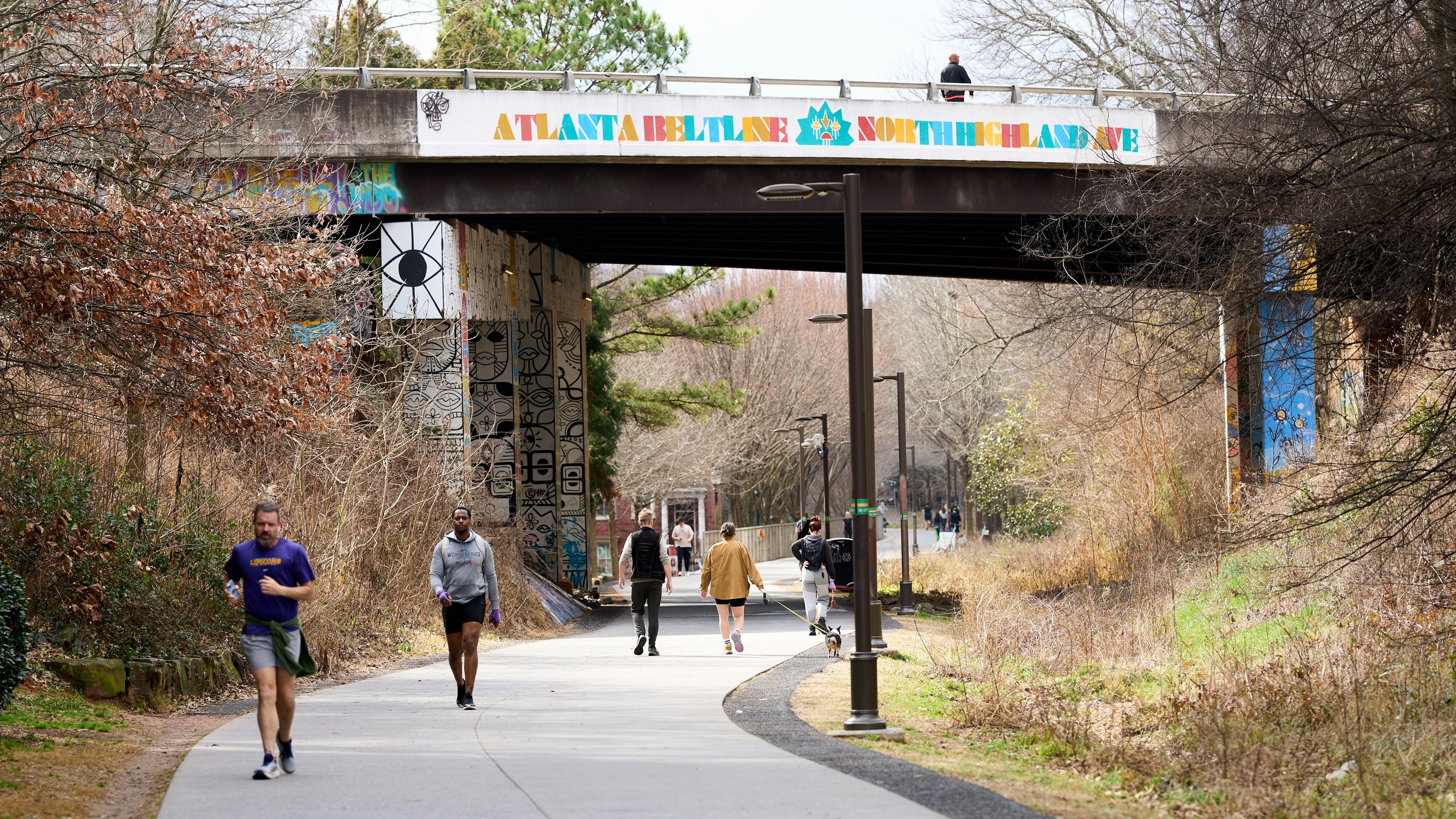
Explore local neighborhoods by biking the BeltLine
The Atlanta BeltLine leads walkers and bikers through Atlanta’s favorite neighborhoods, giving visitors a more intimate view of the A’s best places to live and play. The trails follow the path of an old rail line, making a 22-mile loop around Atlanta. If you don’t have time to see it all, prioritize the Southside trail and the Eastside trail for easy access to local restaurants and shops.
Atlanta also has bike lanes on several streets around the city. The cycle track along Martin Luther King Jr Drive between Northside Drive and James P Brawley Drive is protected by a concrete median, but most lanes run parallel to vehicle traffic.
Use taxis and Uber to save time
It's easy to hire an Uber in Atlanta, and this is a cost-effective way to cover medium-length journeys in town. Lyft also has plenty of Atlanta drivers. You can also use rideshares to get to and from the airport if you don't fancy navigating the MARTA train or bus network with your baggage.
Conventional taxis are easy to find in the center, with taxi stands near popular hotels, malls and key MARTA stations and tourist sights. Flat-rate fares are charged for some popular journeys, such as the trip to or from the airport, and short hops in the Atlanta Business District.

Save car rides for reaching hiking areas and district dining
Atlanta’s suburbs have a lot to offer when it comes to dining and hiking. If you fancy investigating the expanding gastronomy districts in downtown Marietta, or in Chamblee on the Buford Highway, it's usually easiest to travel by car. Cars can easily be hired at the airport or downtown, and they're handy if you plan to take a day trip from the center.
That said, Atlanta's traffic jams are the stuff of legend, so you'll need to use a few hacks to navigate the gridlock. The sections of Interstates 75 and 85 that pass through downtown Atlanta are consistently the busiest sections of road, and alternative street routes also tend to fill up at peak times.
If you want to skip the heavy traffic, ride with others or drive an electric vehicle so you can use the High Occupancy Vehicle (HOV) lane – the lane on the far left with its own left-aligned exits. HOV lanes are found on the I-75, I-85 and I-20, and traffic in these lanes moves a little faster at busy times.
Make sure you pay attention to the signs. North of downtown on I-85, the HOV lane turns into a Peach Pass lane – a lane local drivers pay for to move faster through traffic. If you use a Peach Pass lane without a pass, you face a fine.
Since so many city residents get around by car, you’ll find plenty of parking space at popular areas for outdoor recreation, including the Chattahoochee National Recreation Area, Arabia Mountain and Stone Mountain.
Accessible transportation in Atlanta
The MARTA network is accessible for most users, with elevators at train stations, extra support for passengers with disabilities and wheelchair-accessible buses and trains. The Atlanta Streetcar is also accessible, and the BeltLine was designed to be open to all users, including those with mobility issues.
Advertisement
Take your United States (USA) trip with Lonely Planet Journeys
Time to book that trip to United States (USA)
Lonely Planet Journeys takes you there with fully customizable trips to top destinations – all crafted by our local experts.