Advertisement
10 of the best hiking routes in Türkiye: scenic trails rich in history and culture

Jennifer Hattam
Aug 20, 2025 • 7 min read

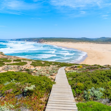
A scenic stretch of the Lycian Way near Fethiye, Türkiye. frantic00/Shutterstock
With its scenic coastlines, rugged mountains, peaceful villages and dramatic natural features, Türkiye is a ideal for any adventurous hiker. While some of the best trails have been mapped by the Culture Routes Society, a nonprofit organization raising awareness of culture-focused hiking in Türkiye, paths aren’t always well-marked, and it can be difficult to get information about hiking routes in English.
Nevertheless, with outdoor activities gaining popularity in Türkiye, more and more local municipalities and community organizations are creating new hiking routes, including urban treks in the capital led by Hiking Istanbul.
Treks through Türkiye’s vast and varied landscapes are best attempted in spring or fall, avoiding the hot summer. However, some high-elevation hikes around the Kaçkar Mountains and Mt Araratare only possible during the summer months. If your time or experience is limited, you may want to hire a guide; trail-sharing sites such as Wikiloc are good resources for those who prefer to go it alone.
Here's our pick of the best hikes in Türkiye.

Advertisement
1. The Lycian Way
Best hike for a blend of nature and history
Distance: 540km (336 miles)
Estimated time to complete: up to 29 days
Level of difficulty: moderate to challenging
Türkiye’s first and best-known long-distance hiking route is a classic. It traverses a vast swath of the Mediterranean shoreline between Fethiye and Antalya, taking in dramatic coastal vistas, secluded beaches and dozens of atmospheric ruins, including the ancient cities of Xanthos, Olympos and Phaselis.
Though the full trek includes some tough mountain sections where hikers must be entirely self-sufficient – which means carrying a tent, food and water – much of the trail can be hiked in manageable one-day sections, staying each night at small pansiyons (guesthouses) that offer a taste of village life and hearty local meals.
Beautiful short sections that don’t require camping include the two-day 22.5km (14 mile) walk from Ovacık to Kabak and the two-day 46km (26 mile) walk from Karaöz to Çıralı. The official start point of the Lycian Way is Ovacık, but many people begin at Fethiye with the 19km (12 mile) hike to Ölüdeniz – a great day walk that passes through the “ghost village” of Kayaköy.
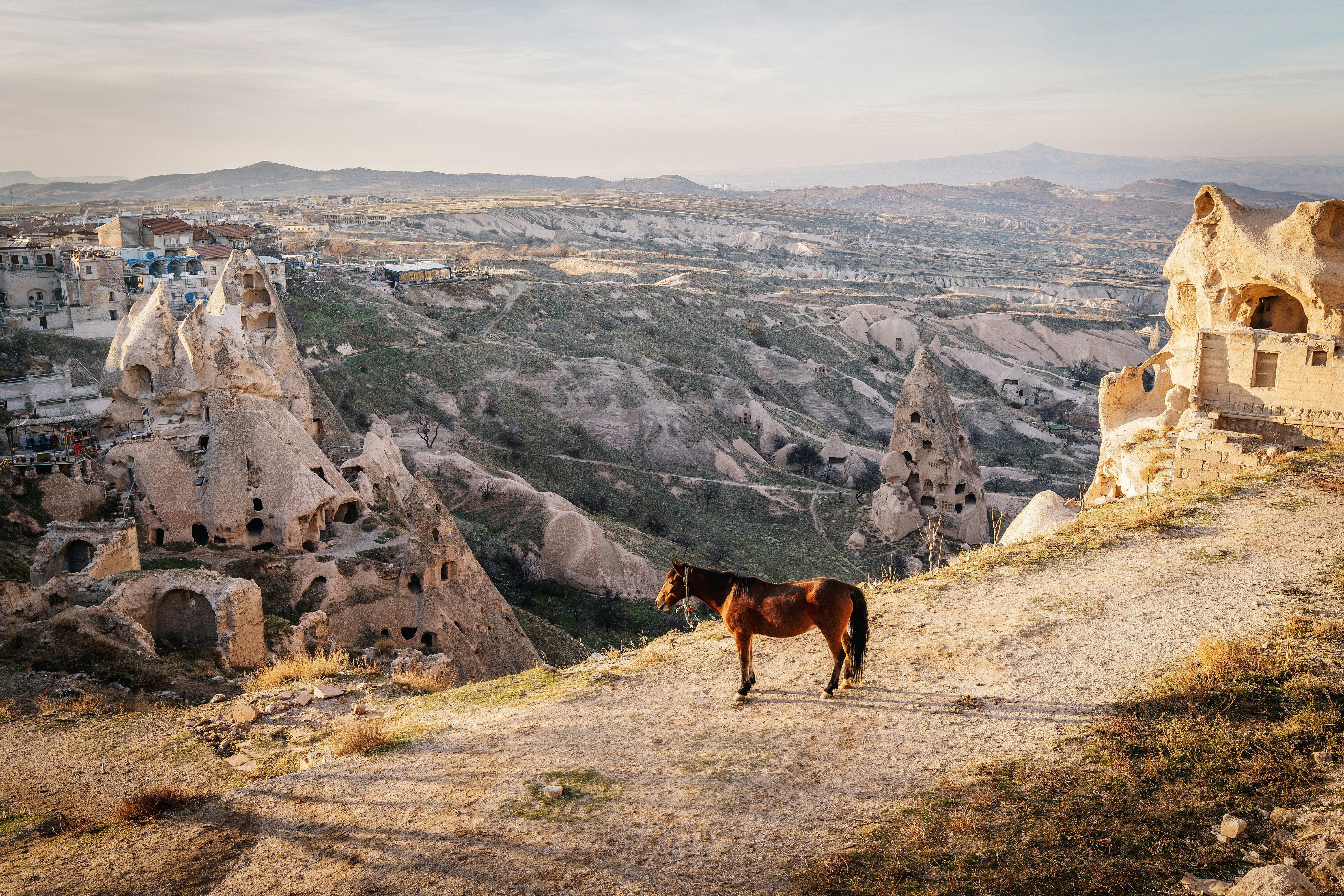
2. Pigeon Valley and Love Valley, Cappadocia
Best day hike
Distance: 11km (7 miles)
Estimated time to complete: 4 hours
Level of difficulty: easy to moderate
Cappadocia is a day-hiker’s dream, with numerous easy-to-follow walking paths winding through its fantastical landscapes. One of the easiest routes to access is this scenic loop hike starting and ending in the town of Göreme, which takes you past the phallic rock formations of Love Valley to the rocky citadel of Uçhisar and back through Pigeon Valley, where you can spot ancient dovecotes carved into the craggy rockfaces.
Other popular Cappadocia day hikes include the connected Red and Rose Valley loops northeast of Göreme, covering 5.5km (3.5 miles) in total, and the lush Ihlara Valley, a 16km (10 mile) gorge with rock-cut churches hidden amidst its cliffs.
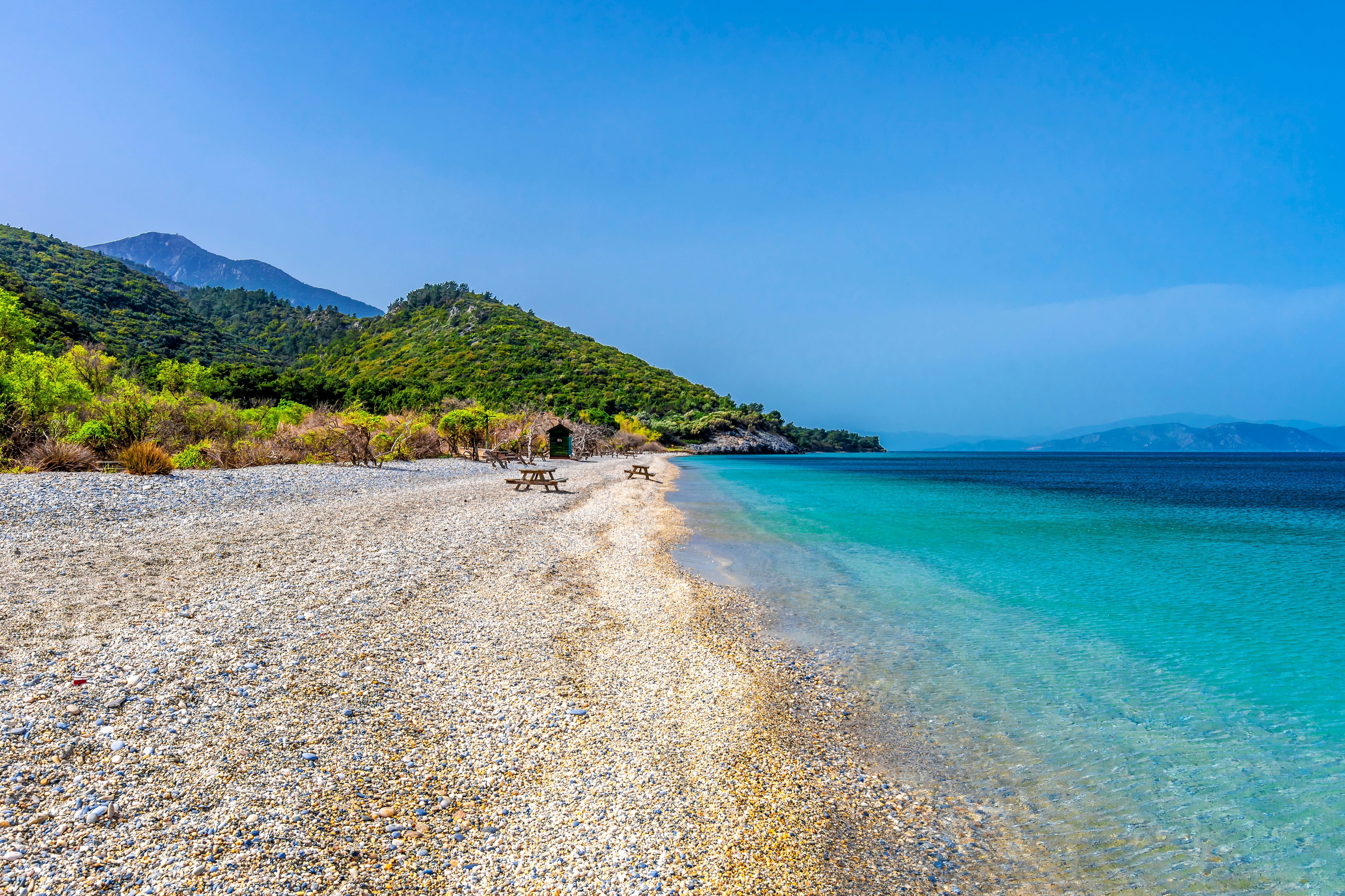
3. Dilek Peninsula National Park Botanic Tour, Kuşadası
Best hike for families
Distance: 2km (1.2 miles)
Estimated time to complete: 30 minutes
Level of difficulty: easy
This pretty little path gives visitors a taste of the beautiful nature inside Dilek Peninsula–Büyük Menderes National Park south of Kuşadası and it's a great starter for families. Some 801 different species of plants are found there, including 31 that are endemic to Türkiye. Notable species are identified on informative signs posted along the way.
Afterward, you can hit one of the unspoiled beaches within the park, which also contains longer marked trails for keen hikers, including the 15km (9 mile) trek through Olukludere Canyon to the village of Eski Doğanbey, with its historic collection of old Greek and Turkish homes.
Advertisement
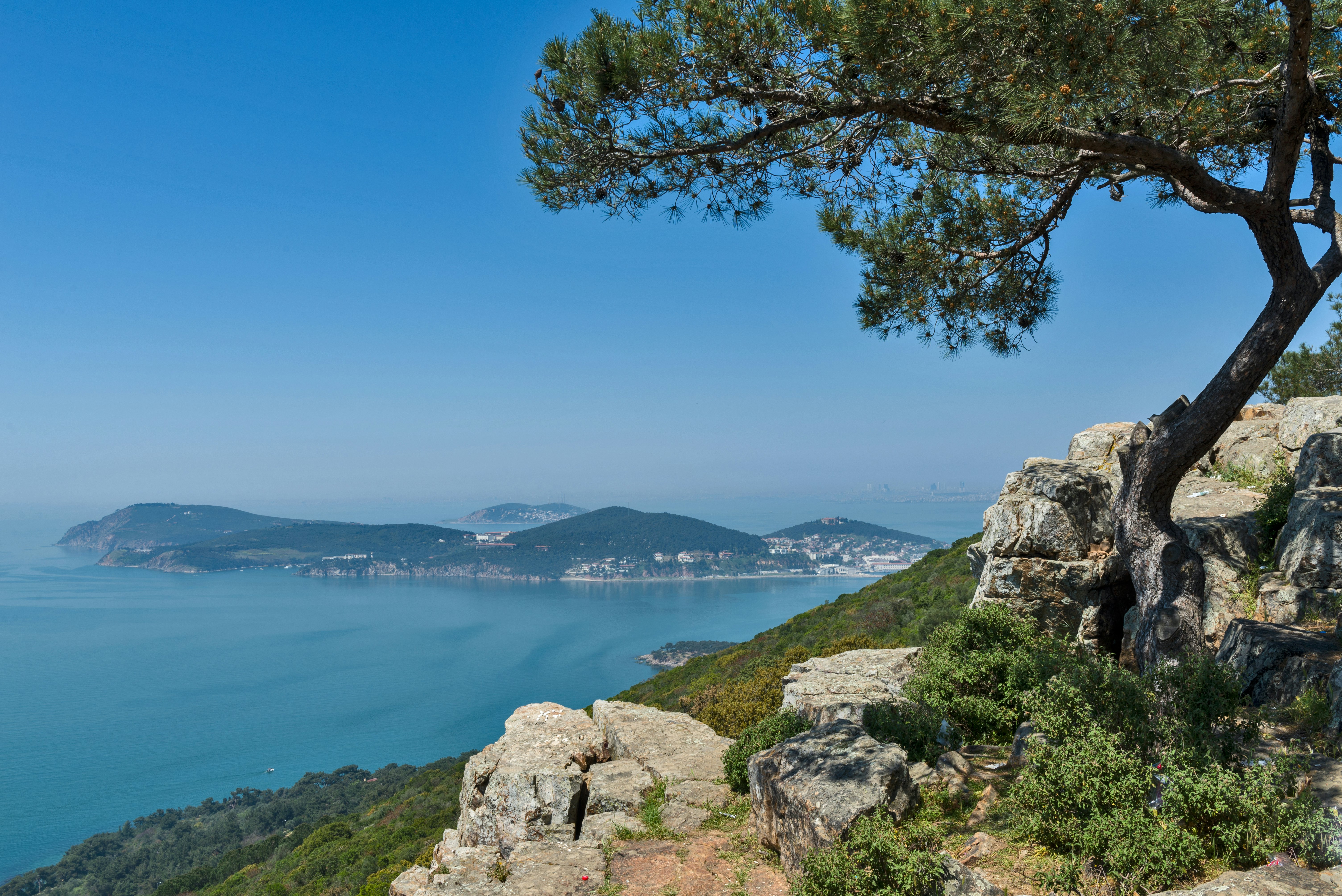
4. Büyükada Big Tour, İstanbul
Best hike near İstanbul
Distance: 12km (7.5 miles)
Estimated time to complete: 4 hours
Level of difficulty: moderate
This hilly walk around the largest of the Princes’ Islands off the coast of İstanbul takes you past stately mansions and a historic monastery complex, through fragrant pine woods and up to viewpoints with sweeping panoramas of the sprawling cityscape.
Follow the signs from the bustling Büyükada ferry dock for the “Büyük Tur” (Big Tour) – a paved road circling the island. Because cars are not allowed here, walkers will only have to share the road with bicycles and small electric carts. The center of the island has more trails passing through areas of greenery; they’re not well-marked, but it’s hard to get too lost.

5. Kaçkar Mountains Traverse
Best hike for rugged mountains
Distance: 63km (39 miles)
Estimated time to complete: 4 days
Level of difficulty: challenging
Sometimes stark and rocky, sometimes lush and green, the rugged mountains above Türkiye's Black Sea coast are ideal for trekking, despite the lack of signposted paths. One relatively well-traveled route takes you through the yayla (high pastures) of Pokut and Yukarı Kavron in Rize province, continuing to the small mountain village of Sırakonaklar on the southern side of the range. In between, if the weather is favorable, you can summit Mt Kaçkar, the highest peak in the area at 3937m (12,917ft).
6. Chimaera, Olympos
Best night hike
Distance: 12km (7.5 miles) round-trip from Olympos, 9km (5.5 miles) from Çıralı
Estimated time to complete: 4 hours
Level of difficulty: moderate
In the mountains above Olympos and Çıralı, natural gas seeping from the rocks combusts when it comes into contact with the air, creating eerie, inextinguishable flames that inspired stories of fire-breathing monsters in ancient myth.
The flames are most impressive at night, when you can really feel the legend of the Chimaera come alive. Flashlights or head torches are essential for this hike, which you can start from either Olympos or Çıralı, beginning late in the afternoon.
7. Mt Ararat
Best high-altitude hike
Distance: 48km (30 miles)
Estimated time to complete: 5 days
Level of difficulty: challenging
This picture-perfect peak near the Armenian border – a dormant volcano that stays snow-capped year-round – has huge mythological and religious significance to people from Türkiye and neighboring Armenia and Iran. The tough but non-technical ascent to the summit is popular with peak-baggers, though access is periodically restricted by the government.
Assuming the peak is open, climbing Mt Ararat requires a guide, who will sort out the permit process and set out a schedule that allows time to acclimate to the altitude en route to the 5137m (16,854ft) summit. During the ascent, there are epic views across a vast landscape stretching into Türkiye, Armenia and Iran.
8. Yazıköy–Kanyonüstü–Kent Forest, Yenice Forests
Best forest hike
Distance: 12km (7.5 miles) out-and-back
Estimated time to complete: 4 hours
Level of difficulty: moderate
The dense Yenice Forests outside of Safranbolu are crossed by more than two dozen routes, following a mix of trails and forest tracks. Walks here can take anything from one hour or two or more days. The hike from Yazıköy to Kanyonüstü and on to Kent Forest takes in small villages, vast valleys and the high rock walls of Şeker Canyon.
The route is particularly lovely in fall when the surrounding trees blaze with color. The local governor’s office has published an English-language hiking guide to the forest.
9. Lake Abant Nature Park track, Bolu
Best lakeside hike
Distance: 7km (4.5 miles)
Estimated time to complete: 2 hours
Level of difficulty: easy
Pretty Lake Abant in the mountains of Bolu province in northwestern Türkiye is encircled by a well-kept, slightly undulating path that offers beautiful views across the water, with a handful of cafe-restaurants to stop at along the way. At times the path becomes a wooden walkway crossing over sections of the lakeshore that are thick with reeds and wildflowers. Longer, more ambitious trails in the surrounding hills loop around the lake, offering views from above.
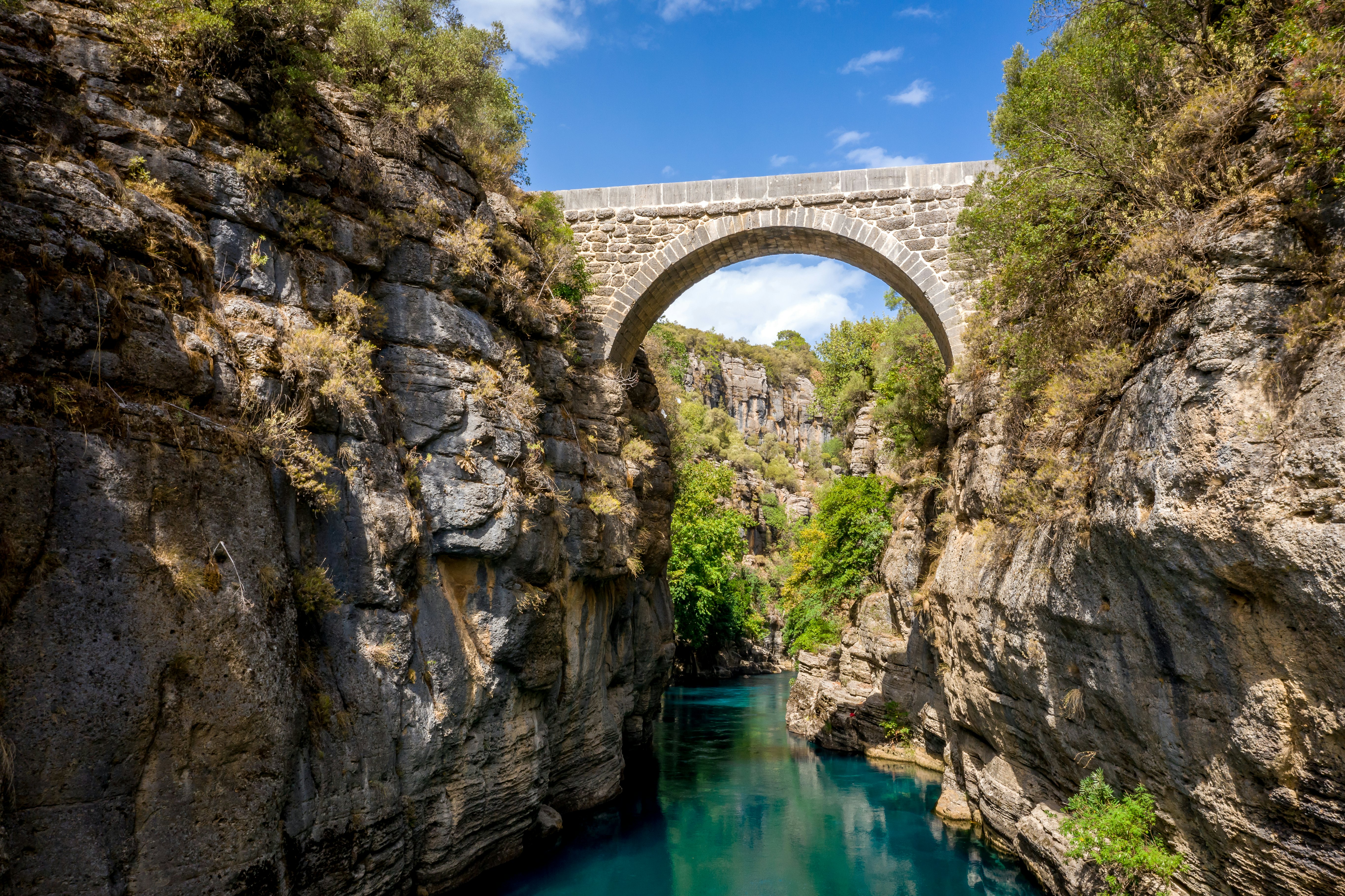
10. Köprülü Canyon–Tazı Canyon, Antalya
Best canyon hike
Distance: 17.5km (11 miles) out-and-back
Estimated time to complete: 4–5 hours
Level of difficulty: moderate
A popular destination for rafting tours, Köprülü Canyon National Park in the mountains northeast of Antalya also offers a wealth of hiking opportunities. The track from Köprülü Canyon to the Tazı Canyon traverses two of the deep gorges in the park, offering dramatic views of the tree-topped canyon walls.
If you’re lucky, you might spot eagles or vultures circling overhead. A shorter 4km (2.5 mile) out-and-back hike crosses between Oluklu Köprü and Büğrüm Köprü, two ancient Roman stone bridges within the national park.
Advertisement
Take your Turkey trip with Lonely Planet Journeys
Time to book that trip to Turkey
Lonely Planet Journeys takes you there with fully customizable trips to top destinations – all crafted by our local experts.


Explore related stories

Aug 2, 20235 min read
7 years walking the world: what the ultimate slow travel trip taught me about life


