10 essential hiking trails on Kauaʻi for exploring the Garden Island

Feb 15, 2022 • 10 min read

With treks like the Kalalau Trail, which traces the lush and stunning Na Pali Coast, Kauaʻi is a haven for hikers © maximkabb / Getty Images
About 90% of Kauaʻi is inaccessible by road, so one of the best – and only – ways to experience the natural beauty of the oldest and northernmost island in the Hawaiian chain is by foot.
The island features a range of hiking trails, from a casual coastal walk to a stroll through an alpine swamp to an epic 11-mile trek along the fabled Na Pali Coast. And no matter what trail you pick, you will be rewarded with unforgettable views – and memories – of Kauaʻi.
Awa’awapuhi
Best hike for panoramic views
6.5 miles round trip, moderately difficult
There are more than 50 miles of hiking trails in Kokeʻe State Park on Kauaʻi’s west end, and Awaʻawapuhi offers one of the best views on the island. (There are parking and entry fees to the park as of 2021.) This 6-mile trek meanders through rainforests and desert-like terrain and ends at a 2500ft perch above the fabled Na Pali Coast. Along the way you’ll see more than 50 different species of native rainforest and dryland plants, including ohia trees, koa with its sickle-shaped foliage, pūkiawe and ʻaʻaliʻi.
But don’t let the well-graded, relatively reasonable length of this hike fool you. It starts in the park at 4120ft elevation and descends to the lookout – meaning it’s all uphill on the way back. So take your time at the end and enjoy the sweeping vistas of Awaʻawapuhi and Nuʻalolo valleys, the sheer cliffs and narrow canyons. The grassy area here is great for picnics – and you’ll be happy you’ve lightened your load for the hard trek back.
Nuʻalolo Cliffs
Best day hike
11.4-mile loop, difficult
If you plan to spend an entire day at Kokeʻe State Park – and you’re an experienced hiker – consider this 11-mile loop trail, which combines the best of both Nuʻalolo and Awaʻawapuhi trails. This winding route offers a bird’s-eye view of the stunning Na Pali Coast with better and closer peeks into the verdant valleys along the coastline – with far fewer hikers.
Like Awaʻawapuhi, this trail starts downhill toward the coast, through a thick forest of ohia and koa trees with an understory of invasive waiawī (strawberry guava) trees. These small trees with smooth bark and tasty fruit were introduced to Hawaii in 1825 from Brazil and quickly invaded native forests. Feel free to eat the red and yellow guava if you find them.
Some parts of this trail are narrow, and it's sometimes muddy and often challenging, but you will be rewarded with views of cascading waterfalls, pristine valleys and the breathtaking coastline that Kauaʻi dreams are made of.

Pihea to Alakaʻi Swamp
Best hike for a unique landscape
8 miles round trip, moderate
For a truly unique experience, consider visiting the Alakaʻi Swamp, a roughly 8-mile hike that includes a climb to Pihea Summit and a walk along a boardwalk through a montane swamp – an ecosystem zone found nowhere else on Kauaʻi. (And only a couple other places in the state – there's one accessible bog like this on Oʻahu, and another on Molokaʻi.) This special wet forest is located on elevated flatlands near Mt Waiʻaleʻale, one of the wettest spots in the world. Because of the soggy soil and high winds here, the vegetation, which includes native ohia and ʻōlapa trees, are stunted.
The trek starts at the Pihea Summit trailhead, located in Kokeʻe State Park at the Puʻu o Kila Lookout. As you walk through a native ohia forest, you might glimpse a white-rumped ʻapapane (Hawaiian honeycreeper) or ʻiʻiwi (scarlet honeycreeper) flitting among the trees on your way to Pihea's 4284ft summit and its views of the Na Pali Coast. Follow the signs to the enchanting Alakaʻi Swamp, a place that has been revered by Native Hawaiians for centuries.
The less rainy summer months are the best times to visit the swamp, which can be dark, dank and eerie. Mist settles over the strange landscape, sitting 4500ft above sea level. At the end of this part of the trail – about 3.5 miles – you’ll reach a lookout on Kilohana facing picturesque Hanalei Bay, where you can picnic before the hike back.
Canyon Trail to Waipoʻo Falls
Best hike to view Waimea Canyon
3 miles round trip, easy to moderate
Most visitors stop at the lookout at Waimea Canyon State Park to take in panoramic views of what’s commonly called the Grand Canyon of the Pacific. (There are parking and entry fees to the park as of 2021.) Waimea Canyon stretches an impressive 14 miles long, 1 mile wide and more than 3600ft deep, with crested buttes, rugged crags and deep valley gorges that are spectacular from this vantage point. In the distance you’ll see the 800ft Waipoʻo Falls.
But if you hike along Canyon Trail to Waipoʻo Falls, you can actually stand at the top of the waterfall and get a completely new view of the canyon from the opposite end of the lookout. The 3-mile round-trip trek is well-worn and well-marked, easy for novice hikers. After a few up-and-down sections, the trail opens up to gorgeous views of the deep, colorful gorge and its reddish lava beds. (Waimea means “reddish water” in Hawaiian.) From here you can see Poʻomau Canyon, Kohua Ridge and ʻĀwini Falls.
A short walk further and you’ll reach the top of the twin cascades of Waipoʻo Falls. Don’t get too excited: You won’t get an epic view of the waterfall – just the stream that leads to it.
Kalalau
Best hike for adventurous backpackers
22 miles round trip, difficult
Hiking to the remote Kalalau Valley is a bucket-list experience – people actually train for this. It’s a challenging 11 miles along the Na Pali Coast, zigzagging through five lush valleys, across streams and past dramatic mountains to the pristine and isolated Kalalau Beach.
Many hikers make the arduous trek in a single day, opting to camp at Kalalau Beach for a night or two before turning around to head back. (You'll need permits to camp.) That way you can reap the rewards of your journey – exhausting switchbacks, harrowing narrow sections and the terrifying Crawler’s Ledge, where you walk a narrow ledge with sheer cliffs to one side. It’s not for the faint of heart.
The best time to hike the trail is during the summer months, when the weather is typically dry and the ocean is calm. Once you’re at Kalalau Beach, you can explore the surrounding area – seaside caves, swimming holes – or just relax and unwind, at least until you have to hike out again.

Hanakapi‘ai Falls
Best waterfall hike
8 miles round trip, moderately difficult
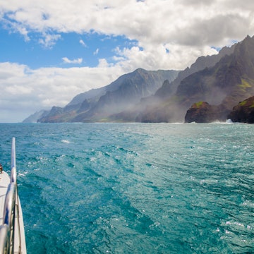
Spanning 17 miles along Kauaʻi’s north shore, the Na Pali Coast is one of the most spectacular vistas in Hawaii. And while you can check it out by boat or helicopter, hiking offers a way to experience its rugged natural beauty up close. One of the most popular hikes – which includes a stop at a 300ft waterfall – is the Hanakapi‘ai Falls Trail, which starts at Kēʻē Beach on Kauaʻi’s north end.
This 8-mile trek is tough – not for beginners – and follows the famed Kalalau Trail along the coast to Hanakapi‘ai Beach. Summer is best for this hike, as Hanakapi‘ai Stream, which you need to cross, is lower and easier to ford, and the beach is a stretch of gorgeous white sand. The beach is not for swimming, however. Dangerous rip-currents make it a beach fit only for looking.
Many stop at the beach – and rightfully so – before turning around. But the rest of the trail into the canyon will reward you with a cascading waterfall and an emerald swimming hole below. There are parking and entry fees to enter Haʻena State Park as of 2021, and advance reservations are required.
Nounou Mountain (aka Sleeping Giant)
Best hike with views of East Kauaʻi
3.8 miles round trip, moderately easy
From anywhere in Kapaʻa, you can see Nounou Mountain, more famously known as Sleeping Giant, thanks to its emerald ridgeline resembling a large human figure lying on his back, facing the sky. Hawaiian legend says this giant was tricked by villagers into eating a vast amount of rocks hidden in fish and poi; after such a heavy meal, he fell asleep – and never woke up.
There are three trails snaking up Nounou, the East Trail being the most popular. It climbs 1000ft of elevation via switchbacks and well-graded paths, through groves of invasive waiawī trees, ironwoods and kī (ti) plants, ending at a grassy meadow with picnic tables – right on the giant’s chest.
From there you'll have a stellar view of Waiʻaleʻale and the Wailua River, though more experienced hikers can trek on to the summit to see much more of the eastern coastline. Get an early start because the trail can get hot in the mid-day sun.
Kuilau Ridge
Best easy hike
4.3 miles round trip, easy
If you’re short on time but still want to hit the outdoors, this 4.3-mile trail is perfect, especially for families. It’s a short, scenic trek that follows a wide and well-graded old road, and you’re starting at an elevation of about 1200ft, so the views of Nounou and Waiʻaleʻale are great right from the start.
The climb along the ridge in the foothills of the Makaleha Mountains is gradual, with switchbacks on steeper sections. The trail is dotted with native ohia trees and ends under a canopy of ironwood, complete with picnic tables. Watch the weather; there’s a reason (rain) this area is so lush.
Okolehao
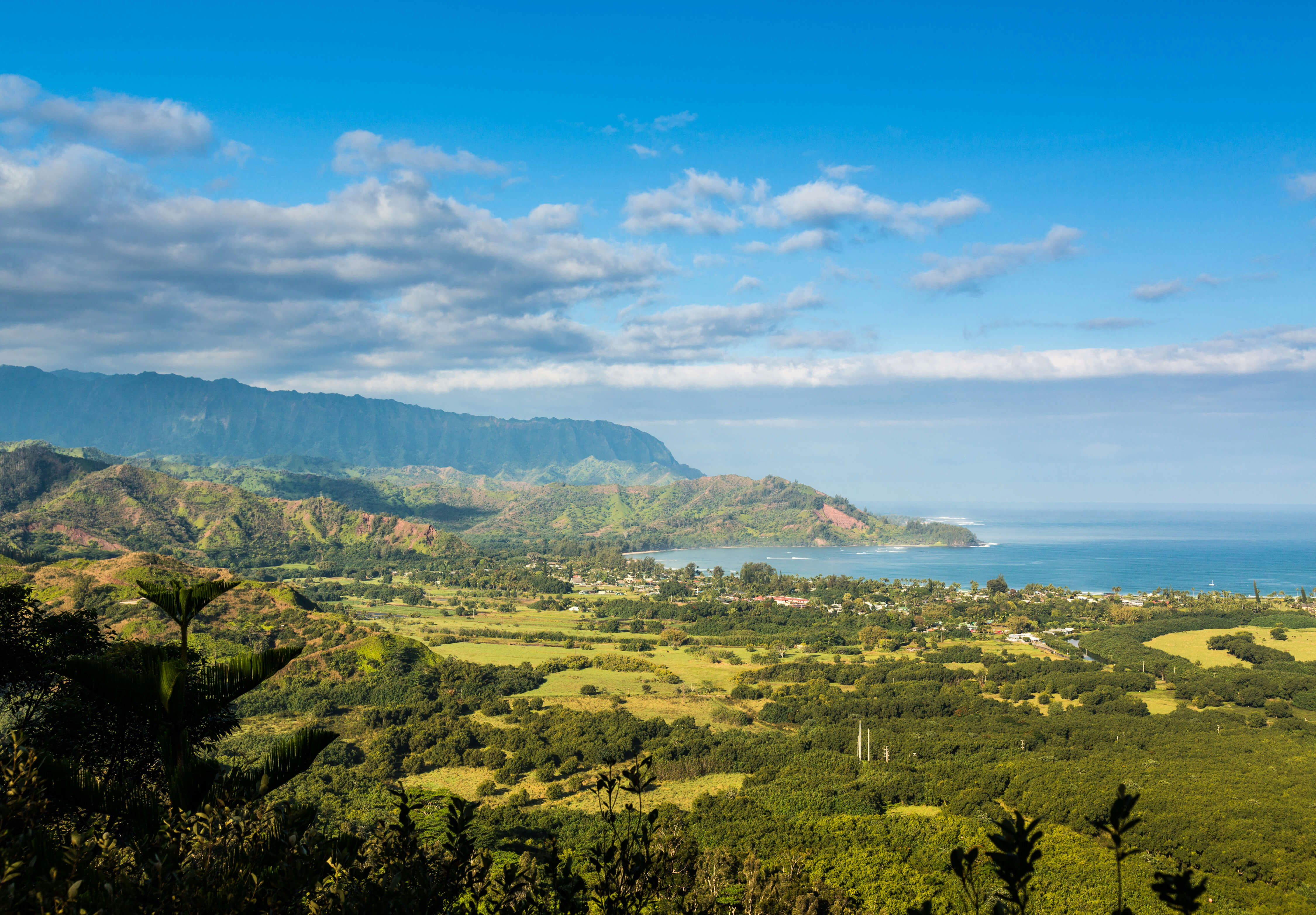
Best hike with views of Hanalei Bay
3.6 miles round trip, moderate
For one of the best views of magical Hanalei Bay, take this trail – established by bootleggers during prohibition – to the top of 1232ft Hihimanu Ridge. (Okolehao is a liquor distilled from the roots of ti plants, which were cultivated and harvested along this trail.)
The 3.6-mile hike ascends a scenic ridge that separates Hanalei and Waiʻoli valleys, and it’s best in the summer, when rainfall is less, as the path can get muddy and slick. Once on the trail, you can take a short side trip to a heiau (religious site) that overlooks loʻi (irrigated terraces) for growing taro, a staple crop in Hawaii. You’ll walk past native koa and invasive strawberry guava trees, along with an abundance of ti plants that were likely planted by local moonshiners in the 1920s. At the top you’ll be rewarded with 180-degree views from Kilauea Point to the Na Pali Coast.
Mahaʻulepu Heritage
Best family-friendly hike
4 miles round trip, easy
This coastal trail runs about 4 miles along Kauaʻi’s rugged southern shore, dotted with limestone cliffs, tide pools, sand dunes and Pacific Ocean views. During the winter months, you might even spot honu (Hawaiian green sea turtles), endangered monk seals and migrating humpback whales.
Start at the popular Keoneloa Beach, nicknamed Shipwreck Beach after a fishing vessel ran aground here decades ago, so the story goes. (Parents, there are restrooms and showers here.) The hike isn’t strenuous – it's mostly flat, so great for those of all ages and skill levels – but it can get very hot, and the terrain is a mix of jagged rocks and tree roots, so wear sunscreen and sturdy shoes.
On the trail, there’s a detour – highly recommended – to Makauwahi Cave, the state’s largest open-ceiling limestone cave, managed by paleo-archaeologists and conservationists. You have to crawl through a 3ft hole to enter the cave, but once you’re through, the space opens up into an amphitheater, formerly an underground sinkhole that caved in thousands of years ago. Take a free guided tour – they run from 10am to 4pm daily – to learn more about this special place, home to native flora, ancient rock formations and other well-preserved artifacts.
You might also like:
How to choose the best Hawaiian island for your trip
The best things to do in Hawaii you probably didn't know about
17 best places to visit in Hawaii


