Advertisement
Hiking Greece – discover the top trails, from Crete to the Peloponnese

Alexis Averbuck
Jan 15, 2026 • 13 min read
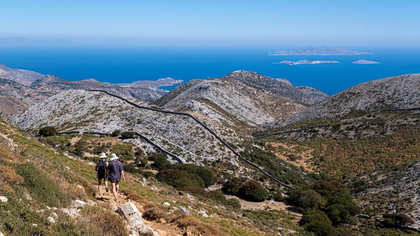
Hiking in the Cyclades in Greece. Marc Bruxelle/Shutterstock
Hiking Greece is a dream, with stunning scenery, well-maintained trails and picturesque villages where you can pause to recharge along the way. And the best hikes in Greece offer something for every kind of walker, too.
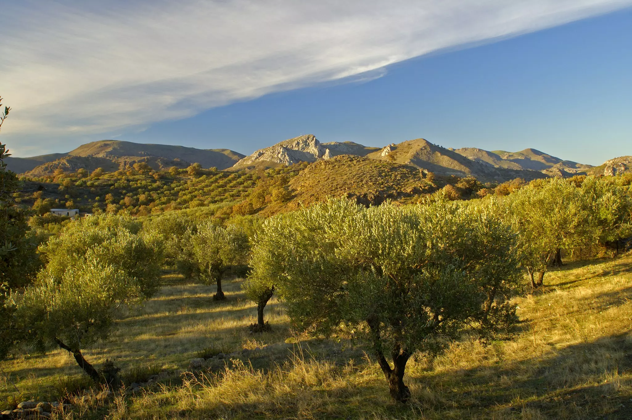
The Greek mainland boasts well-maintained routes that meander through olive groves and follow dramatic gorges, while on the country’s islands, you’ll find ancient kalderimia (cobbled or flagstone paths dating back to Byzantine times) connecting sleepy villages with beautiful sandy coves.
Encompassing routes that are great for both seasoned strollers and rookie ramblers (plus everything in between!), here’s our pick of Greece’s best hiking trails.
Hiking in Greece: an overview
While many visitors head to Greece relax on its sun-kissed beaches, the country’s balmy climate and diverse terrain make it a top destination for hikers, with scenic coastlines fringed by cobalt seas and thyme-scented mountains calling out for exploration.
Much of Greece is a hiker’s paradise, with well-marked trails and excellent maps available to help with route finding. As well as popular long-distance routes and classic day-hikes such as the Samaria Gorge trek in Crete, most islands and villages offer plenty of easy local walks and rambles.
In northern Greece, the best hiking is around Mt Olympus, the Vikos Gorge in the Pindus Mountains, and on the hill trails that weave around the Prespes Lakes. Beyond the famous Samaria Gorge, western Crete has many other gorges that are perfect for hikers of all different skill levels.
Advertisement
Experienced hikers can tackle sections of the E4 Trans-European Hiking Route, which passes through northern Greece, the Peloponnese and Crete. And the organisation Paths of Greece is forging new hiking routes across the country, so new options are appearing every year.
Popular routes are well maintained, but less-trodden paths – for example, the trails through the Taÿgetos Mountains on the Mani Peninsula in the Peloponnese – can be overgrown and poorly marked. If you don't feel confident about the route, you can always hire a local mountain guide or arrange a trek through an agency such as Trekking Hellas.
Which are the best maps for hiking Greece?
The maps and apps produced by Terrain and Anavasi are invaluable resources if you want to get off the beaten track in the Greek Islands or the northern mountains and do some exploring on foot or with your own wheels. Other locally available print maps can be of varying quality, but Greek Paths of Culture produces some useful downloadable hiking maps.
If you're using a digital device to navigate, note that the mobile signal can be spotty outside of towns and larger villages. Google Maps can mistake private orchard paths for trails, and without an offline or hard-copy map, it’s easy to get lost on dusty, unmarked back roads and tracks.
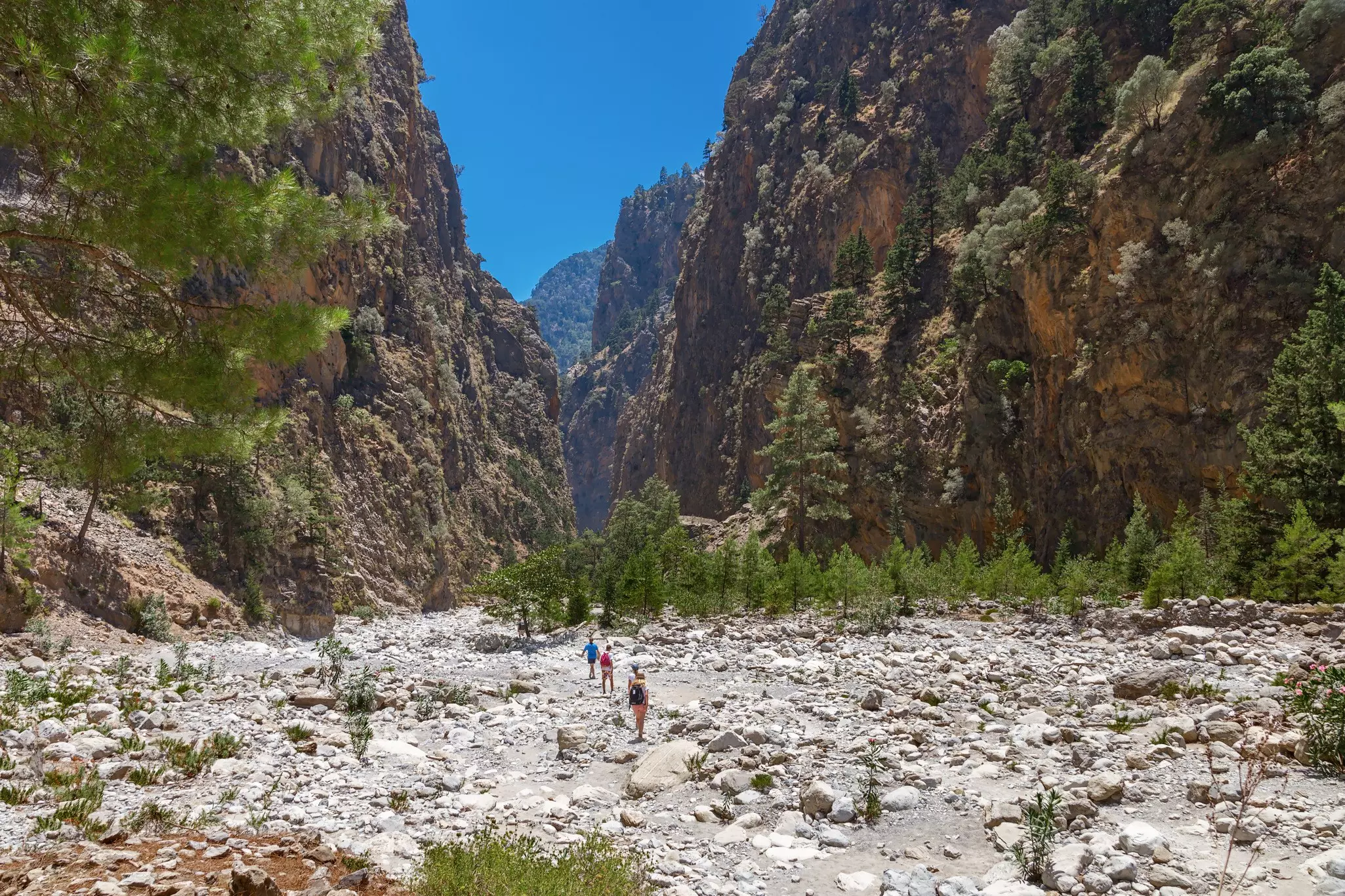
1. Samaria Gorge, Crete
Best descent from the mountains to the sea
Distance: 16km
Estimated time to complete: 4 hours
Level of difficulty: moderate
Hiking the 16km-long Samaria Gorge is one of Crete's must-do experiences, which is why you'll rarely be without company on the trail. Nevertheless, there’s an undeniable, raw beauty to Samaria, where vertical walls soar up to 500m, and the gorge walls are just 3.5m apart at the narrowest point and 150m at the broadest.
The hike begins at 1230m at Xyloskalo just south of the village of Omalos, and ends in the coastal village of Agia Roumeli, a short ferry ride from Sougia or Hora Sfakion. The first segment is a steep, serpentine stone path that drops 600m into the canyon and then levels out and broadens.
Sturdy shoes are a must – just see the sad faces of those trying to hike in flip-flops! All along the route, keep alert for kri-kri, a species of mountain goat native to Crete, and enjoy the wildflowers blooming in profusion in April and May.
Planning tip: Day trips to the gorge are heavily marketed across Crete, and the route can get crowded in summer. Start as early in the morning as you can to get ahead of the crowds. Day trips start at the park entrance and include a pick-up from either Sougia or Hora Sfakion, after a ferry ride from Agia Roumeli.
2. Melinda–Paleohori trail, Lesvos
Best easy walk through olive groves
Distance: 1.2km
Estimated time to complete: 30 minutes
Level of difficulty: easy
Lesvos has the best-organized network of hiking and cycling trails in the Northeastern Aegean Islands. A particular highlight is walking along the olive trails of southern Lesvos. A series of paths and old local roads thread across the island, linking olive groves, oak forests and pretty villages.
One short but particularly scenic stretch is the Melinda–Paleohori trail, which leaves from Melinda Beach and follows the Selandas River before ascending to finish at the olive press in the village of Paleohori, passing a spring with potable water along the way.
Planning tip: Trekking Trails Network of Lesvos maps outline many more hiking routes on the island.
3. Tsagarada to Damouhari, Pelion Peninsula
Best forest hike
Distance: 5.5km
Estimated time to complete: 1–2 hours
Level of difficulty: moderate
The lushly forested Pelion Peninsula, the mythical home of the centaurs, spills along the eastern edge of the Greek mainland near the city of Volos, and it’s a hiking hot spot. A centuries-old network of kalderimia pathways weaves through the tree, connecting quaint mountain hamlets to seaside villages.
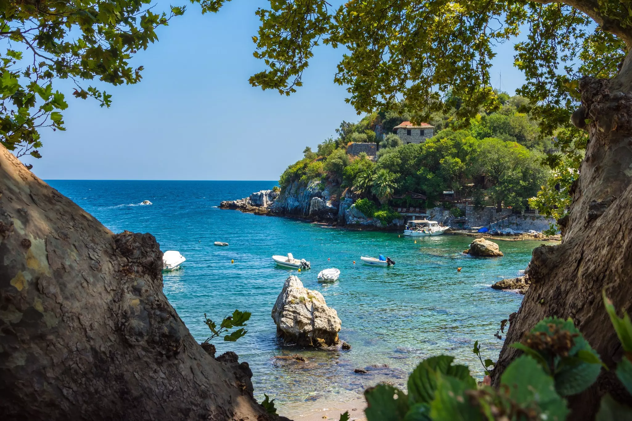
In the north, a particularly lovely hike begins near the village of Tsagarada. From the square at Agia Paraskevi, it’s a two-hour hike down to the small bay at Damouhari, blessed with a stretch of golden sand and crystal-clear turquoise waters – scenes from the cliché-affirming movie Mamma Mia! (2008) were filmed here.
Planning tip: Another great forest hike begins above the road at nearby Fakistra Beach and follows the coast to Plaka Beach.
Advertisement
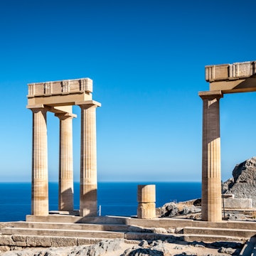
4. Hike to the Tomb of Kleobolus, Rhodes
Best round-trip walking trail for families
Distance: 5km
Estimated time to complete: 2 hours
Level of difficulty: easy
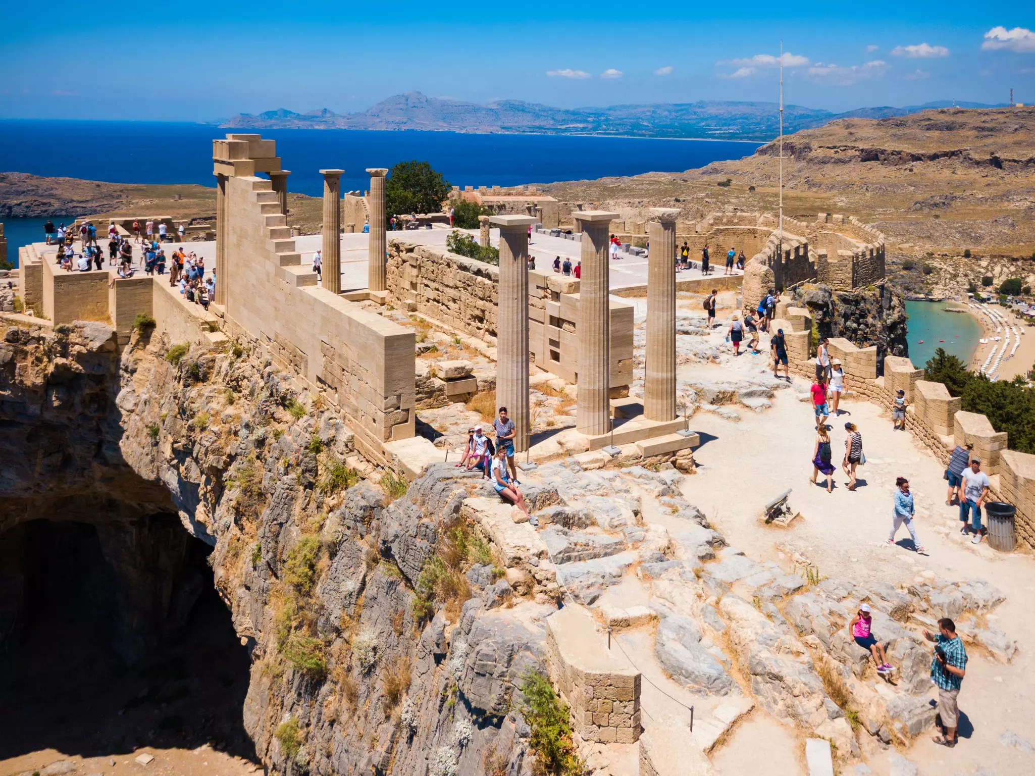
An easy, enjoyable 5km (two-hour) round-trip hike departs from the village by the ruins of Lindos on Rhodes, running northeast to the so-called Tomb of Kleobolus, set at the tip of a bare, flat-topped promontory. Serving up sweeping coastal views as well as historical monuments, this hike is best attempted in the late afternoon, when you can enjoy sunset views of the Acropolis across the bay.
Starting alongside Car Park 1 above the main beach at Lindos, the trail ends at a rocky hillock topped by the circular tomb, now thought to be the burial place of a wealthy local family rather than the actual burial place of Kleobolus – the Greek poet who ruled Rhodes in the 6th century BCE.
5. Stefanos Crater, Nisyros
Best for lunar landscapes
Distance: 8km
Estimated time to complete: 2–3 hours
Level of difficulty: moderate
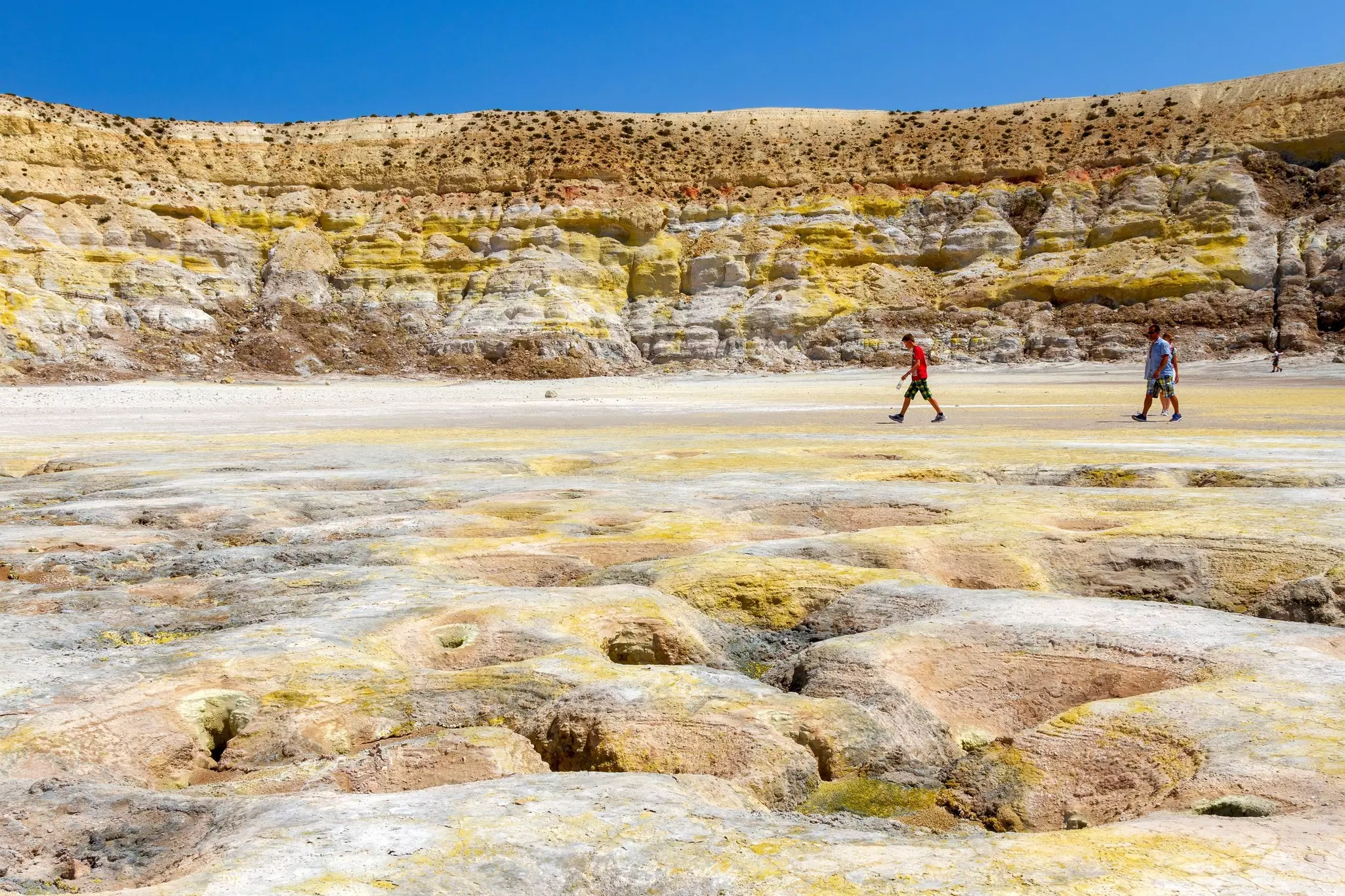
Little Nisyros in the Dodecanese has become a major destination for hikers, with the island’s calderas (craters formed by collapsing volcanoes) being a particular draw. You can walk to the heart of the largest crater, Stefanos, in around two and a half hours from Mandraki, either by hiking directly up the switchback footpath that crosses the rim beyond the Evangelistrias monastery, or by following the longer track that circles round to its shallower southern side.
Inside the caldera, you can examine a series of multicolored fumaroles, which bubble at 100°C (212°F), and sometimes hear the vents hissing and smell their sulfurous vapors. Take care here – there’s no fencing and the ground is unstable, so don’t stray far off the path and be sure to wear sturdy shoes.
Planning tip: A visit to the moon-like landscape of the caldera can feel like stepping into a science fiction movie, but aim to get here before 11am to avoid the busloads of day trippers arriving from nearby Kos.
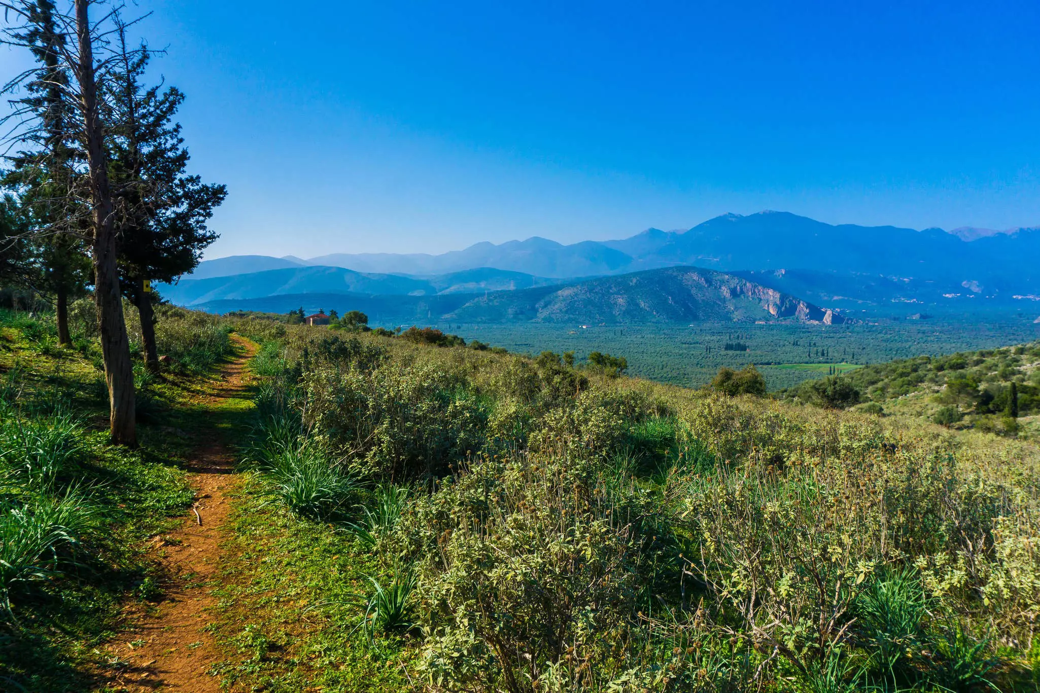
6. Delphi to Kirra Walk, Central Greece
Best for ancient monuments with views
Distance: 14km
Estimated time to complete: 3–4 hours
Level of difficulty: easy
This 14km downhill hike follows a centuries-old pathway from the magnificent, UNESCO-listed ruins of Delphi, the mythical center of the world in Greek legend, to the ancient port of Kirra, just east of modern Itea on the southern coast of mainland Greece.
The route, which forms part of the European E4 long-distance trail, starts from the E4 trailhead, about 100m east of Delphi's Hotel Acropole. The trail descends quickly, skirting the village of Chryso and zigzagging down the mountainside, delivering ever-more spectacular views until it meanders to the gulf through Greece’s largest olive grove.
Planning tip: At the end of your hike, have lunch and a swim at Kirra if time permits, before you return to Delphi by bus (around €2).
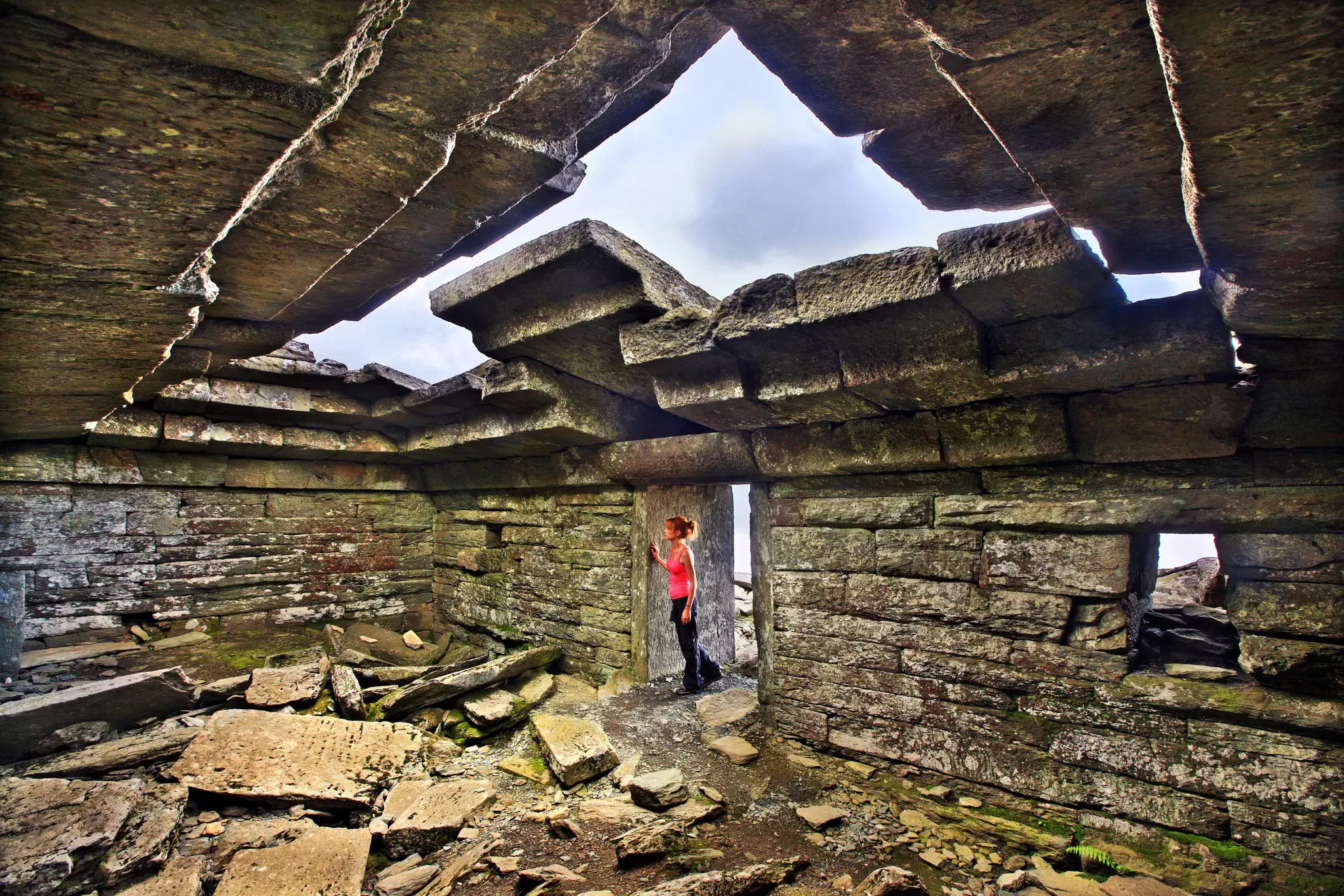
7. Mt Ohi (Profitis Ilias) summit hike, Evia
Best for sunrise views
Distance: 8km
Estimated time to complete: 3–4 hours
Level of difficulty: challenging
For breathtaking views, tackle the thigh-burning trail to the summit of Mt Ohi (1398m), Evia's third-highest peak. The mountain is crowned by mysterious drakospita ("dragon houses") – ancient dwellings hewn from rocks weighing several tonnes, joined together without mortar.
The hike starts from the nearest village, Myli, and you can stay overnight at the Mt Ohi refuge at 1000m, then make the 30-minute hike up the summit to catch the sunrise, which makes for a magical experience.
Planning tip: Evia Adventure Tours in Eretria is a good source for information on hiking in Evia and staff can arrange organized group hikes and other outdoor adventures.
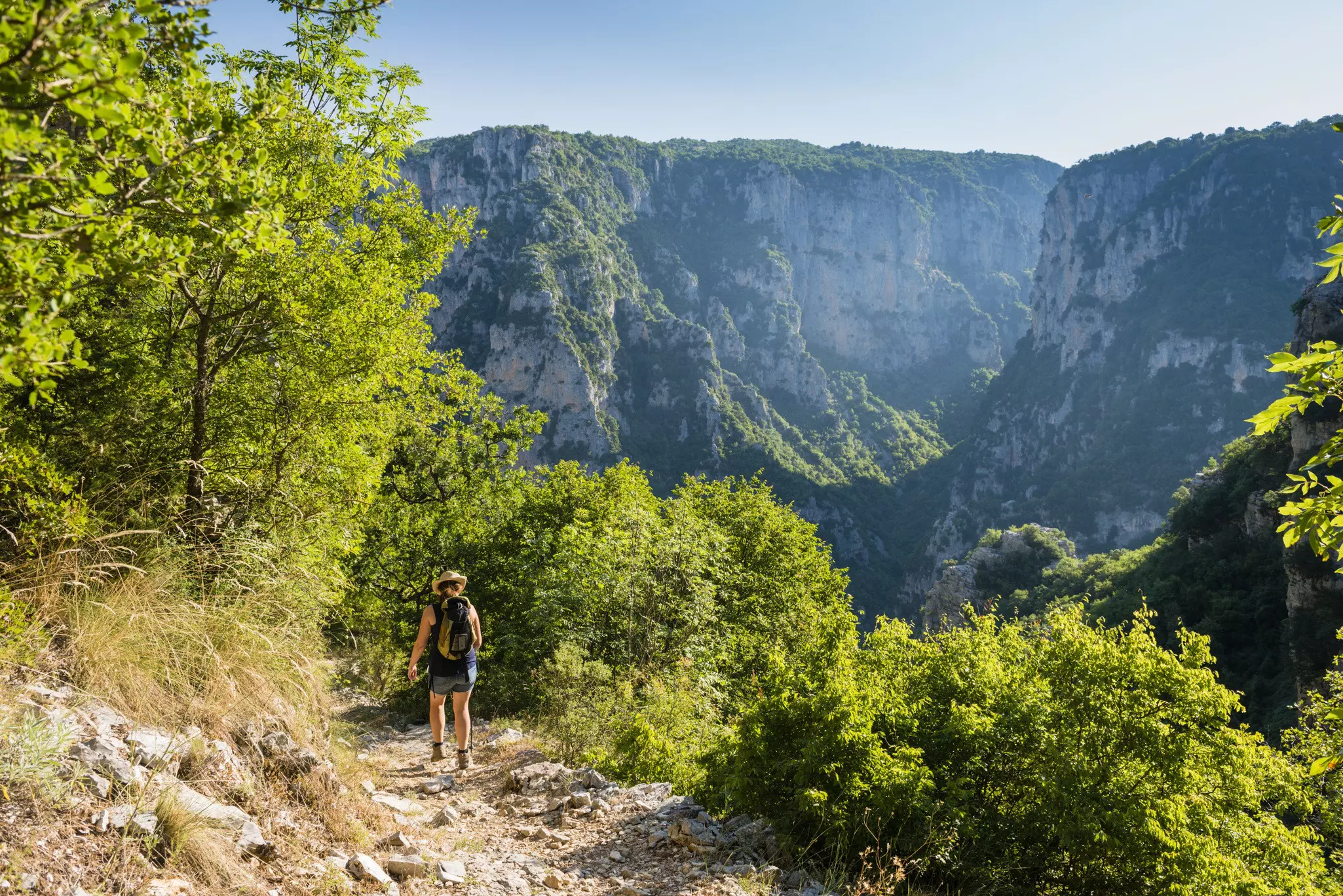
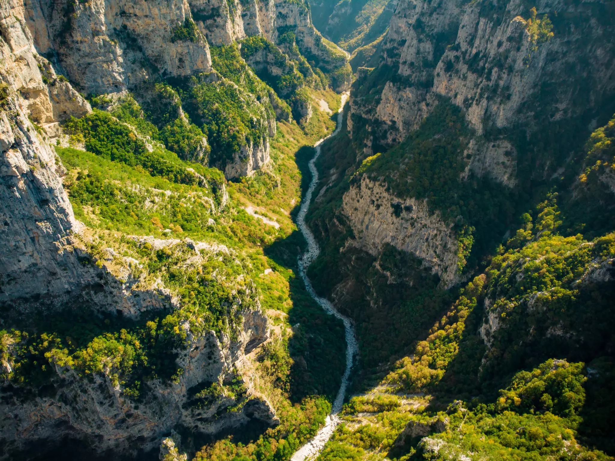
8. Vikos Gorge, Epirus
Best for raw nature
Distance: 12km
Estimated time to complete: 6–7 hours
Level of difficulty: moderate
In the northwest of mainland Greece, the Zagorohoria area takes in 46 traditional stone-and-slate villages, tucked into the Pindos mountain range north of the city of Ioannina. Linked together by a series of stone paths, bridges and staircases, the villages make wonderful hiking destinations, with accommodations available in historic buildings.
The highlight here, however, is the dramatic, 12km-long, 900m-deep Vikos Gorge, which bisects the Zagorohoria region. The most popular, though still quite challenging, route starts in Monodendri, where a steep path heads down into the chasm. At the canyon’s end, a trail leads right to Mikro Papingo.
The sections of the O3 National Trail that follow the gorge are mostly well-tended and clearly marked. However, the only water is at Klima Spring, halfway along the gorge, so come prepared with snacks and drinking water.
Planning tip: Budget extra days to hike between the villages of the Zagorohoria surrounding the Vikos Gorge, following traditional monopatia (walking trails) that have been used by local people for centuries.
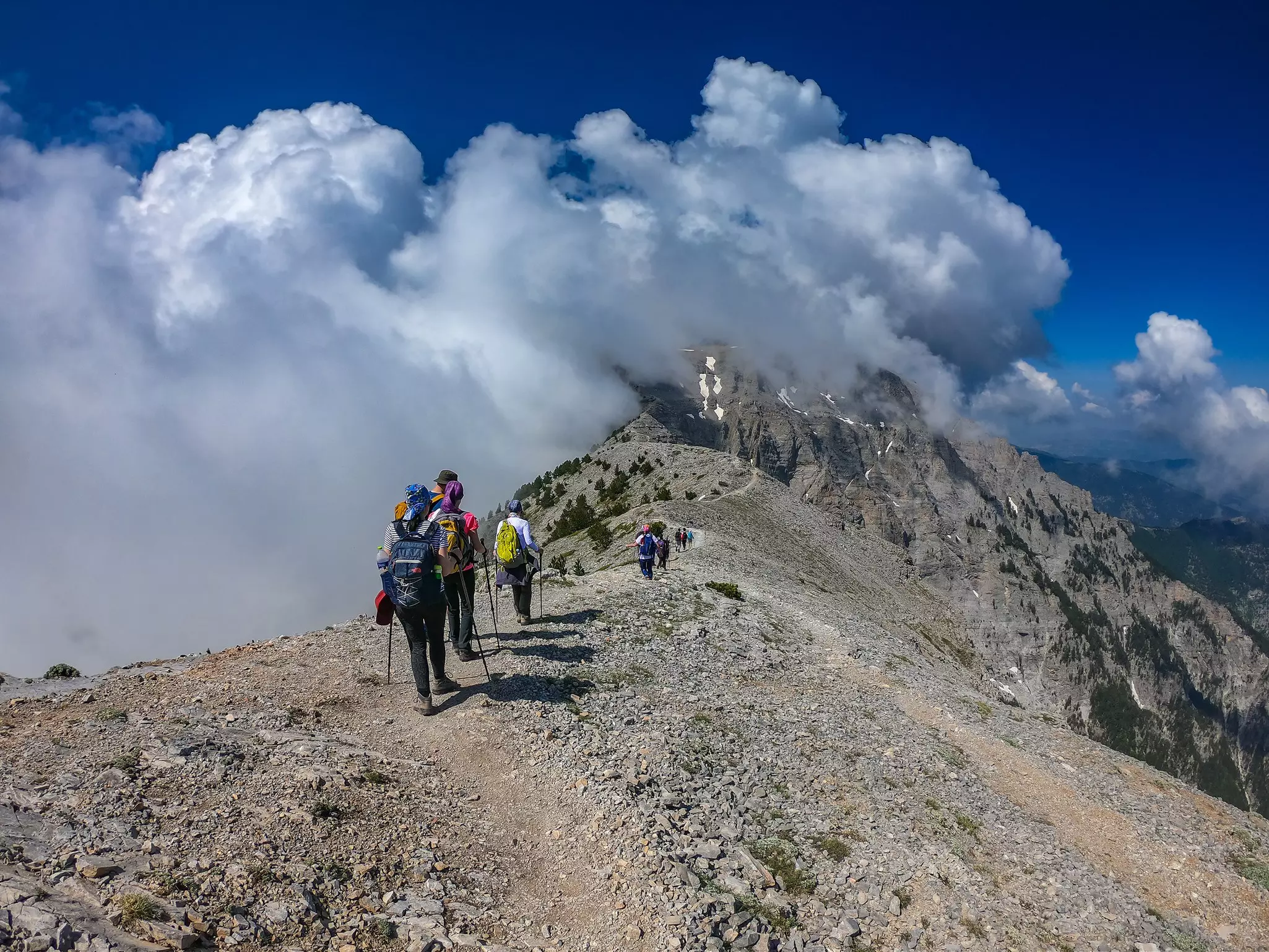
9. Mt Olympus
Best for mythology and drama
Distance: 20km
Estimated time to complete: day hikes, or 2–3-days for the full ascent
Difficulty: challenging
Crowned by three dramatic summits – Mytikas, Skolio and Stefani – Mt Olympus is Greece’s highest mountain, rising to 2918m at its highest point. Protected by a UNESCO Biosphere Reserve, its lush, virgin slopes are home to more than 1700 plant species, some rare and endemic, as well as wolves, jackals, deer and more than 100 bird species.
The air here is crisp and cool, even in the hottest summer months, and the sweet smell of pine trees, the sound of chirping birds and roaring water, and the way the light filters through the trees all combine to give Olympus an otherworldly atmosphere. Hiking here – or even better, camping overnight – feels truly mythical.
One of the most popular routes is the E4 Prionia Trail, a challenging full-day route which starts near Litohoro and ends at Mytikas, taking hikers past Agios Dionysus Monastery and the Spilios Agapitos Refuge. Climbing to the true summit of Mt Olympus will take two to three days, with overnight stays in the mountain huts that dot the landscape.
Planning tip: Mt Olympus’ biggest village, located just at the edge of the Enipeas Gorge, is Litohoro. The Olympus National Park Information Center in Litohoro has information on the hikes you can do in the area, including some easy day hikes for those just seeking a taste of the scenery.
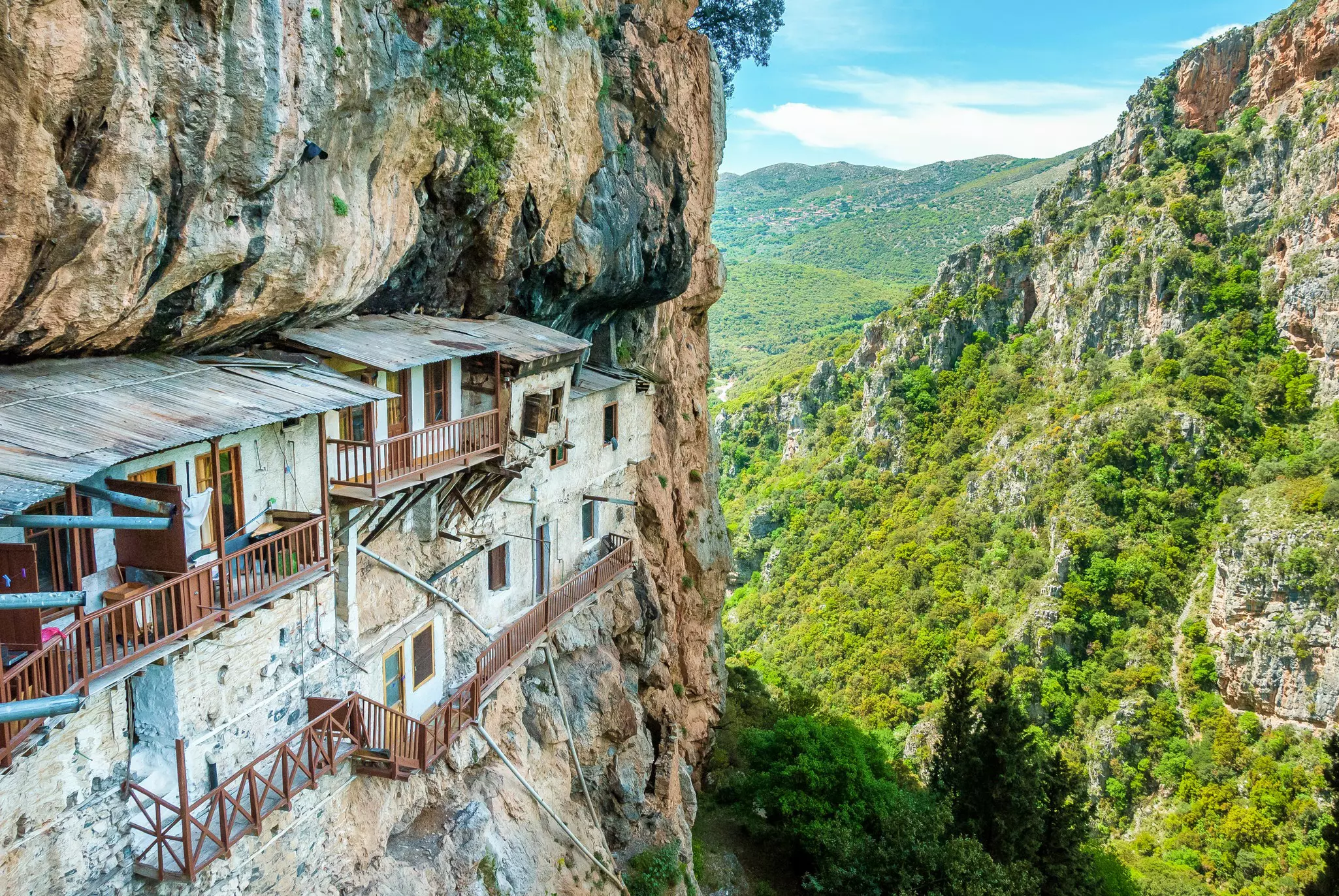
10. Menalon Trail, Peloponnese
Best for long-haul adventures
Distance: 75km
Estimated time to complete: 5–8 days
Level of difficulty: difficult
The well-signposted, 75km-long Menalon Trail stretches from Stemnitsa to Lagkadia on the Peloponnese peninsula, taking in the dramatic scenery of the Lousios Gorge, the western slopes of Mt Menalon, the Mylaon River valley and the Gortynian Mountains.
The trail is divided into eight sections of varying difficulty, each involving a day of hiking; the Stemnitsa–Dimitsana section is the most popular for a day hike. In winter, snow can hit high-altitude sections, and there’s decent shade for hot-weather hiking.
Planning tip: Download a trail outline and maps from the Menalon Trail website. The villages of Stemnitsa, Dimitsana, Elati, Vytina, Valtesiniko and Lagkadia all have places to stay and eat, and you can pick up provisions at Vytina, Nymphasia and Magouliana.
Hiking Greece – what do I need to know?
Spring (April to May) is the best time for hiking; the countryside is green and fresh from the winter rains, and carpeted with wildflowers. Autumn (September to October) is also a good time. Be careful of hiking in the heat of summer (June to August) – temperatures can rise above 35°C (95°F), bringing a risk of dehydration and heatstroke, and forest fires are becoming an annual hazard.
Here are some more tips to consider.
If you are a less confident hiker, consider joining an organized hike in Greece; the biggest and most reliable operator is Trekking Hellas.
When venturing off the beaten track, a good map is essential. Online maps are often wrong, and the phone signal can be patchy in the countryside. Most tourist maps are inadequate; the best hiking maps are produced by the Greek companies Anavasi and Terrain.
Be realistic about your abilities and stick to routes you can complete comfortably in the time available. Start off with shorter routes before attempting multiday hikes.
Before you set out, always inform your guesthouse or the local hiking association of your planned route and when you plan to return.
Most of Greece's trails are not suitable for wheelchairs. For travelers with mobility issues, harbor boardwalks and pedestrianized streets in the country's historic cities are the best bet.
Advertisement
Take your Greece trip with Lonely Planet Journeys
Time to book that trip to Greece
Lonely Planet Journeys takes you there with fully customizable trips to top destinations – all crafted by our local experts.