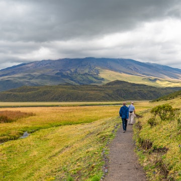

Hikers take a break outside of Riobamba, Ecuador. Heath Korvola/Getty Images
Take a look at any topographical map of Ecuador and you’ll immediately notice the Andean spine that cuts through the country from north to south. It’s these mountains and volcanoes that offer the most adventure, and it's where travelers often head first for the best hikes in Ecuador.
For trekkers and serious climbers alike, the high sierra is packed with paths that climb their way up to high altitude. Others wind across lower elevations, through and around alpine scenery.
There are trails for all fitness levels, and while hiking and climbing are possible throughout much of the year, the most popular seasons are November to February and June to August. Book with a guide if you want to climb higher, trek solo or travel off-season.
Situated on the equator where adjacent tectonic plates have forced the ground upward, Ecuador’s Avenue of the Volcanoes is, quite rightly, one of its top draws and best places for trekking in the high country. The route from Quito to Cuenca passes through breathtaking scenery, where snow-tipped, perfectly conical or rugged mountains punctuate the sky.
The Central Highlands are dotted with pueblos rich in Indigenous Andean heritage, and hiking is also a perfect way to immerse yourself in the culture here.
Walking at altitude brings you to water-filled calderas surrounded by grasses and flowers, and guides can help you descend further into canyons, or upward to secluded lodges and eco-retreats that sit above the cloud line, offering a condor’s eye view of the valleys below.
Here are our picks for the six best hikes in Ecuador.

1. Cotopaxi National Park
Best hike for nature and wildlife
Distance: 2.2 miles (3.5km)
Estimated time: 2 hours
Level of difficulty: Easy
The second-highest peak in Ecuador (19,347ft) and one of the world’s highest active volcanoes, Volcán Cotopaxi offers a serious guided climb for those with the motivation to walk for two days to see the views from the summit.
For others who prefer to stay closer to the base, the 83,000-acre Parque Nacional Cotopaxi’s trails provide a benign, grassy natural sanctuary, with the volcano’s peak as stunning backdrop and central focal point.
Walk around Lake Limpiopungo if you only have a couple of hours to spare – it’s flat, and the gentle terrain will suit all fitness levels. There’s nature in abundance here, from white-tailed deer to Andean fox (or colpeo) roaming the grasslands. The keen-eyed traveler may see soaring condors or even the rare spectacled bear on the volcano’s eastern slopes.
Try horseback riding and stay at one of the park’s traditional haciendas, taking a guided trek to find out more about the flora, fauna and geology of this most beautiful national park, arguably Ecuador’s best.
2. Chimborazo
Best high-altitude hike
Distance: 23.9 miles (38.4km)
Estimated time: 2 to 3 days
Level of difficulty: Difficult

Meet your new travel partner
Unlimited data while you travel with Holafly eSIM. Use code LONELYPLANET for an exclusive discount.
Heading south to Riobamba, there’s no escaping the shadow of Chimborazo, Ecuador’s highest peak and a staggeringly monumental structure.
Allow time in the area to take the Devil’s Nose, a marvelous feat of railway engineering where the track follows a series of switchbacks as the train cuts its way down and through the Andes. Passing villages en route, you’ll also be greeted with a brilliant view of Chimborazo from the windows early on.
If you’ve become acclimatized to Ecuador's altitude, you may want to add an ascent of Chimborazo to your itinerary, but only if you're ready for a challenge. At around 20,700ft, the equatorial summit is the closest point to the sun on Earth, and it's covered in glacial ice that requires you to hire a certified guide, donning crampons and other serious kit.
Be prepared for an evening at a high-altitude refugio before the final ascent. Preparation and a high level of fitness are absolutely vital for the climb.
Day-trekkers and mountain bikers will love the Reserva de Producción de Fauna Chimborazo, a natural habitat for vicuña, llama and alpaca, with any number of shorter trails out of the park.
From Riobamba, take in nearby views of Altar and Tungurahua volcanoes, Parque Nacional Sangay or Colta Lagoon, the latter of which has some of the loveliest reflections of Chimborazo for those keen on photography or quiet contemplation during a gentle stroll.

3. The Quilotoa Loop
Best hike for highland culture
Distance: 25 miles (40km):
Estimated time: 3 to 5 days
Level of difficulty: Moderate
One of Ecuador’s most beautiful locations, the scenic Quilotoa crater can be trekked to, through or around, depending on how much energy and time you've got. Stay overnight at one of the area’s eco-lodges, then enjoy a leisurely ramble to the lookout points or a more strenuous hike down to the lakeshore the next day.
However you get there, the crater rim is probably the best selfie spot in all of Ecuador, as teal and emerald water, rugged rock and atmospheric low clouds compete for attention in the background.
The longer Quilotoa Loop takes up to five days and allows for a real dive into nearby villages, rainforest vegetation and highland culture, where you can pick up phrases in the local Kichwa language.
A number of markets take place on the loop, from Zumbahua on Saturday to Saquisilí on Thursday. Indigenous markets are one of the highlights of any visit to the Ecuadorian Andes, so be sure to plan your itinerary around them.
Everything is accessible with local transport, and it’s definitely worth spending a few days in the region to explore on foot. Tour operators in Quito can take the pain out of organizing every step of your schedule.
4. Lake Cuicocha
Best day hike
Distance: 7.5 miles (12km)
Estimated time: 4 to 5 hours
Level of difficulty: Easy
If you’re headed to the colorful market town of Otavalo, one of the Andes’ most important Indigenous trading places, Lake Cuicocha is an easy add-on day hike. This flooded, extinct volcano is surrounded by vegetation, making for a beautiful four- or five-hour walk around the rim.
Two small lava islands poke their way out of the center of the laguna, their mounds resembling the guinea pigs from which the lake gets its Kichwa name.
Since Cuicocha Lake is one of the lesser-known caldera hikes in Ecuador (losing out to the more renowned Quilotoa), you’ll encounter fewer people on the trail and really get to experience the serenity of nature as you stroll.
The Otavalo area has much to offer, should you choose to base yourself there. The impressive 59ft Peguche waterfalls, enhanced by the wall of lush vegetation that covers the surrounding rock face, are easily reached by foot or bike from Otavalo.
What’s more, an Indigenous water-purification ceremony takes place at the site during the sun festival of Inti Raymi in June, when visitors are welcome. Check in with the local tourist office for details.

5. Ingapirca and the Inca Trail
Best multi-day hike
Distance: 25 miles (40km)
Estimated time: 3 days
Level of difficulty: Moderate-to-difficult
The Ecuadorian section of the Inca Trail that once connected Quito with Cusco is less known than the Peruvian path to Machu Picchu, yet it is certainly worth a visit. The hike takes three days total; though much of Ecuador’s royal road was destroyed by Spanish conquistadors, you can see the impressive remains of the Temple of the Sun at Ingapirca.
Reaching a maximum elevation of 13,800ft, the Ecuadorian Inca Trail matches the highest point on the Peruvian section (at Dead Woman’s Pass). The journey to Ingapirca sweeps through cloud-height peaks with views of canyons, lagoons and mountainous scenery.
Take a hiking tour with a local guide and hear the stories of the Inca, as well as the later Indigenous groups’ struggles for independence from their colonial overlords.
6. Condor Trek
Best trek in Ecuador
Distance: 31.5 miles (51km)
Estimated time: 5 days
Level of difficulty: Difficult
Renowned as one of the best treks in Ecuador, the Trek of the Condor is not for the faint of heart, as the five-day trail passes 10,000ft of altitude in many places, often in cold and intense weather.
However, it’s not a very technical mountain climb, making it accessible to those who’ve acclimatized and gained a level of fitness through previous training. Walk amid Indigenous pueblos and see wildlife grazing on the páramo (grassland).
Starting the trip from Papallacta means you can soak your muscles in one of the many beautiful outdoor thermal pools as you prepare your legs for the intense but worthwhile pounding to come.


