Advertisement
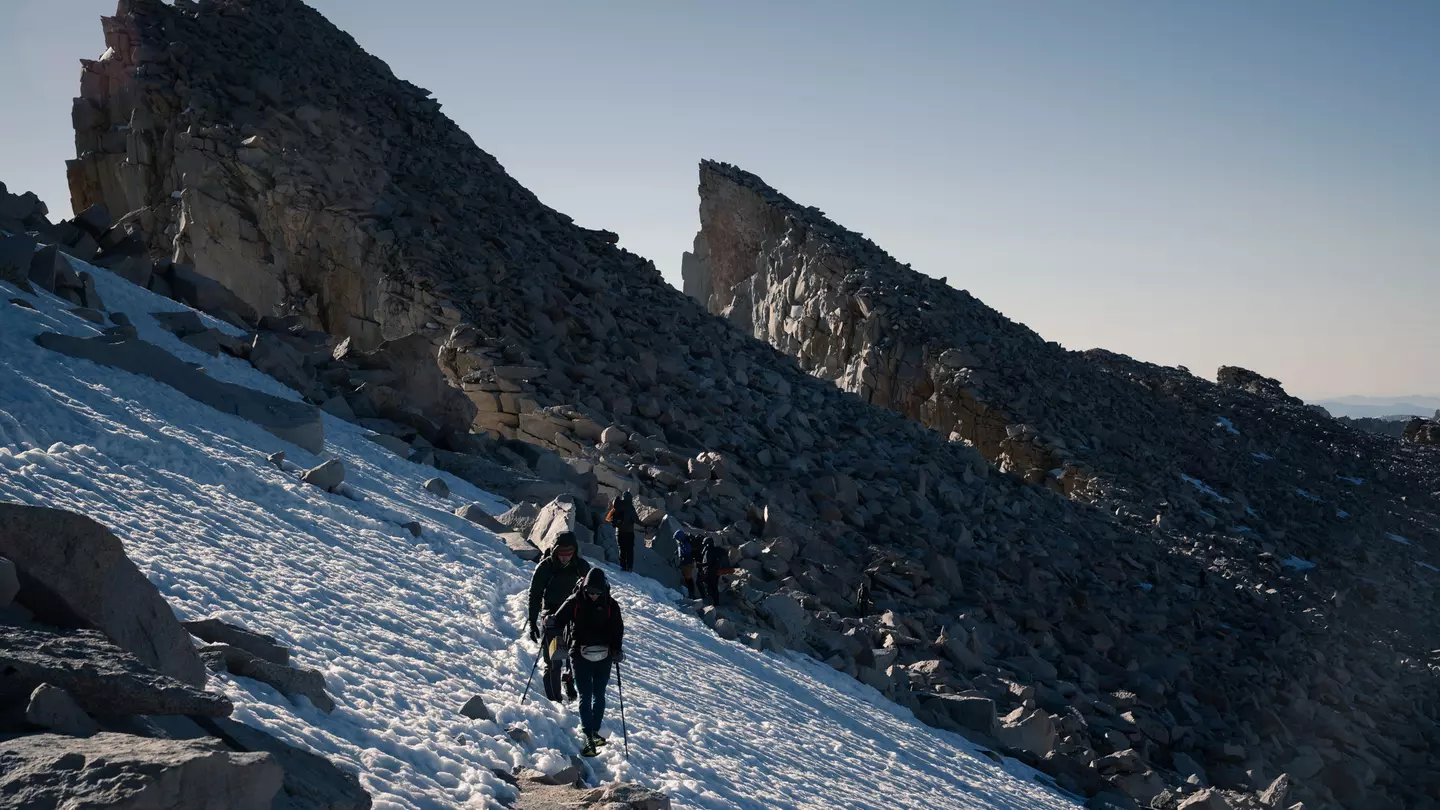
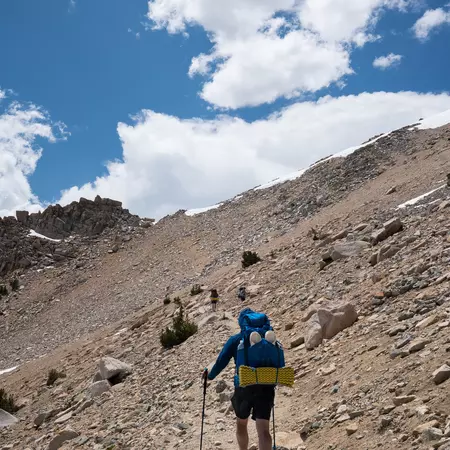
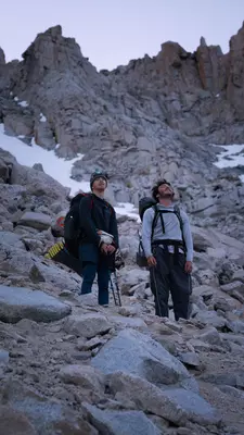
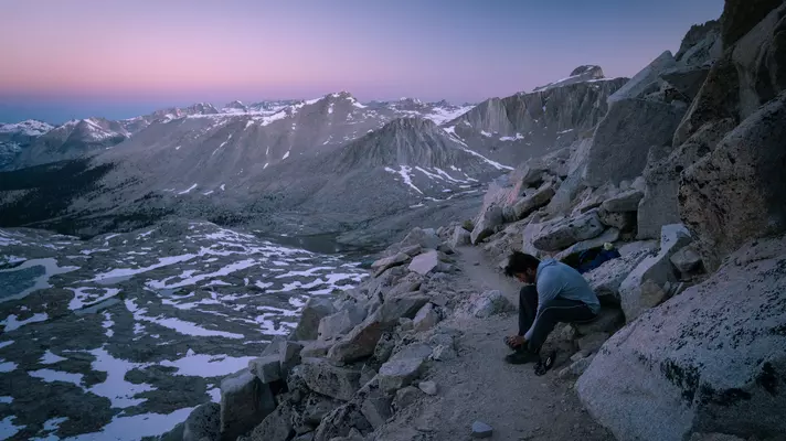
The author, Jack, and his friends approaching Mt Whitney's summit. Nicolas Galvis
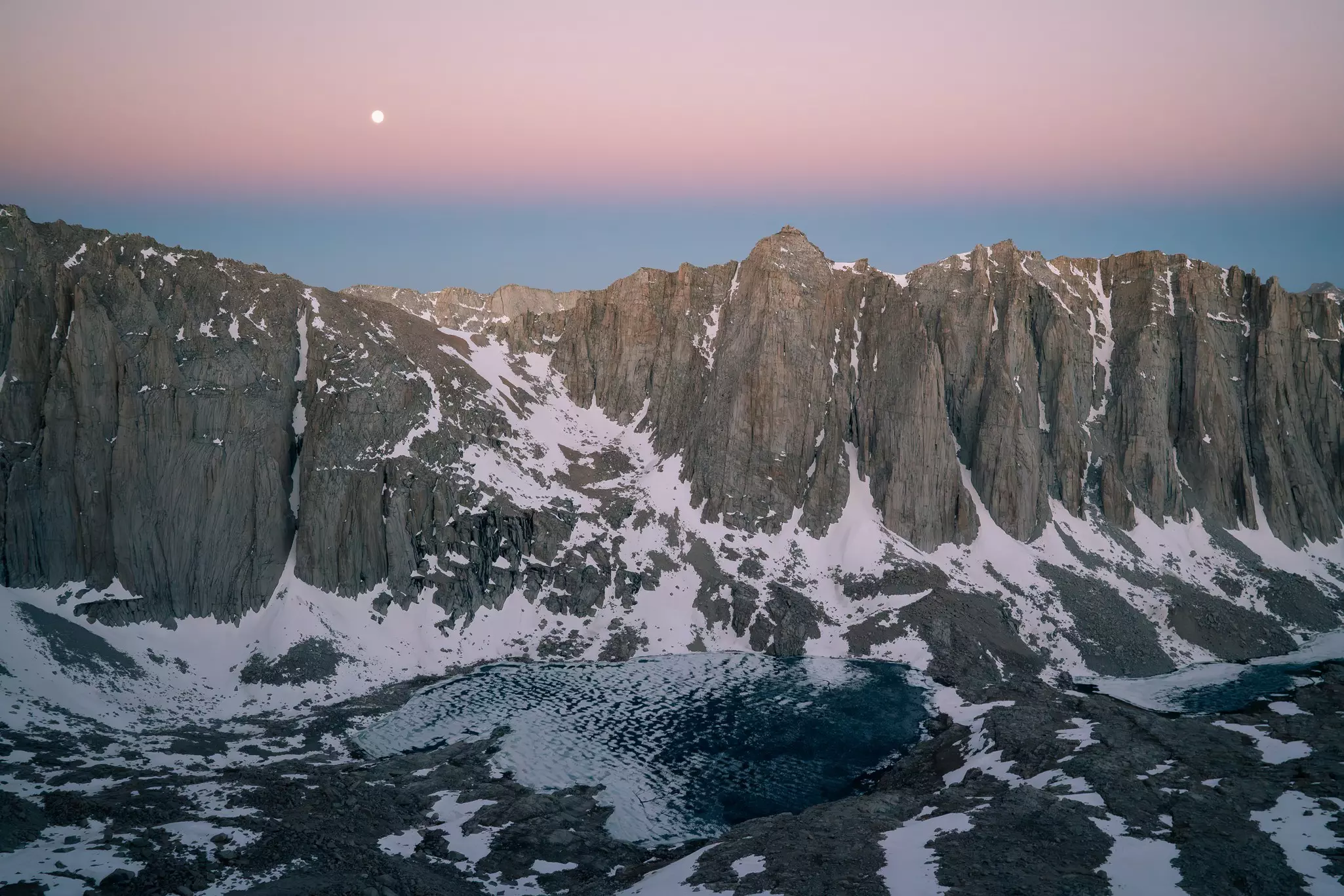
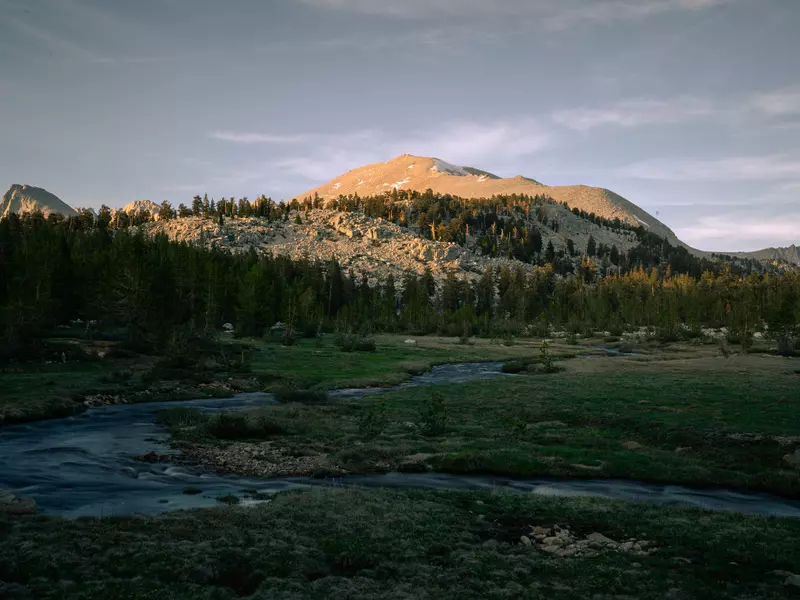
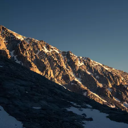
As soon as you near the small town of Lone Pine along Hwy 395 in Southern California, the jagged peaks rising straight out of the desert to the West will give you goosebumps. These are the ruggedly beautiful High Sierras. The spike along the serrated knife's edge is Mt Whitney, the highest point in the contiguous United States at 14,505 ft (4421m). The peak is situated between the Inyo National Forest, the Sequoia and Kings Canyon National Parks, and the John Muir Wilderness.
My own father has summited Mt Whitney six times, taking my sister and me up when we were 16 years old as an unusual and memorable birthday gift. My sister was even given the middle name Whitney after the mountain itself. I just returned to the trail with my dad and two school friends to experience a new route and complete my second summit. So, what about this trek is so special, and how would one go about it?
Here’s everything you need to know about hiking Mt Whitney, including route options, seasonal differences, how to get permits, what gear you’ll need and more.
Advertisement
Why hike Mt Whitney?
Why do we go to these hallowed High Sierra trails? As my dad always says, everyone has their own hike. Most will attempt an ambitious one-day hike. Others will take their time, enjoying the sights, sounds and smells of the remote Sierras. Others don mountaineering gear to conquer snowy peaks. I’m somewhere in the middle, though I certainly don’t mind the feeling of standing atop the world.
Whatever your motivations, Mt Whitney and the surrounding trails can provide. For physically fit mountain lovers, the experience should be a beautiful getaway and a thrilling challenge.
How long does it take to hike Mt Whitney?
How long your hike will take largely depends on which route you choose to follow. For the front side of the mountain, the hike is 1–2 days. Going in through the back side can be anywhere from 5–8 days, with many possibilities to extend or shorten the hike along the way.
What’s the best trail to take on Mt Whitney?
The most mainstream way to summit Mt Whitney is from the east – it’s also the most difficult and dangerous. These trails starting at the Whitney Portal Parking Lot are scenic, but this could not be called an easy route by any means. It is 8.3 miles from the Whitney Portal parking lot to the Trail Crest (where the trails intersect), and then an additional 1.9 miles to the summit of Whitney. Be warned that this makes for a grueling 10.2-mile ascent only to turn around and do it all downhill.
Hikers will either start around midnight to try to finish the summit in one day with a light daypack, or opt to get a one-night backpacking permit and split the ascent in two. This route can be incredibly dangerous, especially if it’s a snowy year, and the sharp rise in altitude can lead to severe and sometimes fatal altitude sickness. If you are aware of the difficulties and dangers involved with this route and are an experienced hiker/mountaineer, best of luck to you!
But if you’re open to a more immersive backpacking trip, consider the advantages of approaching Whitney from the western backside as a 5-day trip.
Kearsarge Pass, accessible from the Onion Valley Campsite parking lot, just a half-hour drive north from Lone Pine on Hwy 395, is a great entry point. You can do a thru-hike, which follows the trail 35.7 miles south to the peak of Mt Whitney, and then continues over and down the Portal, making for a long summit day, but a much easier overall trip with plenty of time each day to reach the next campsite (hiking around 10 miles per day on average).
Advertisement
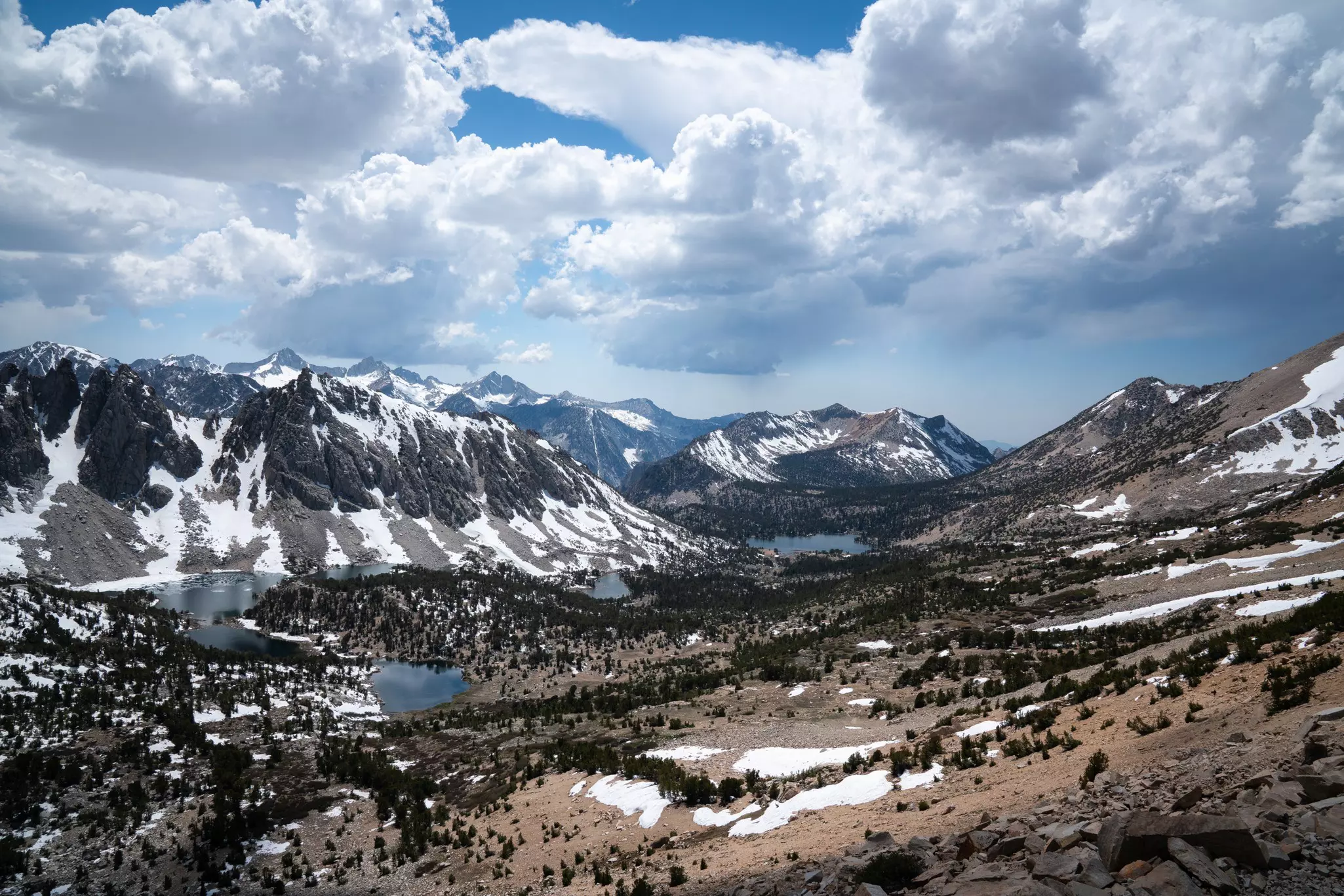
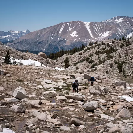
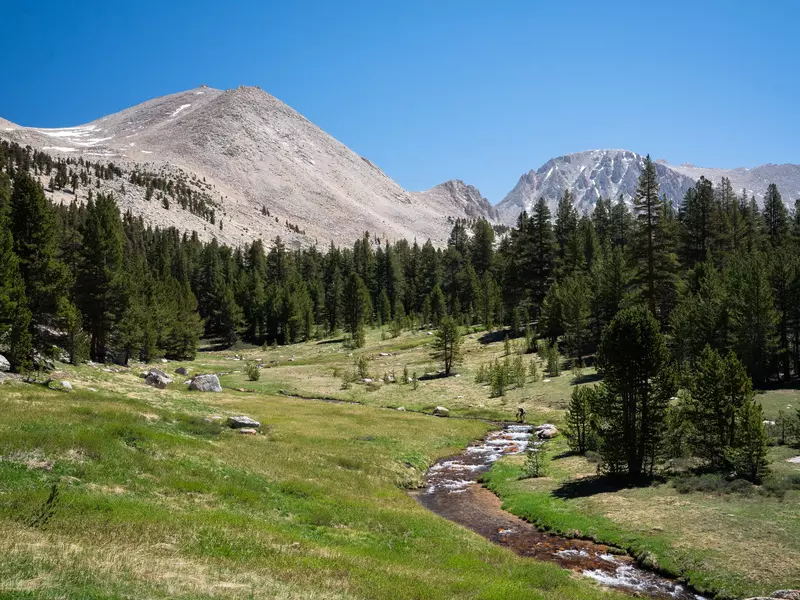
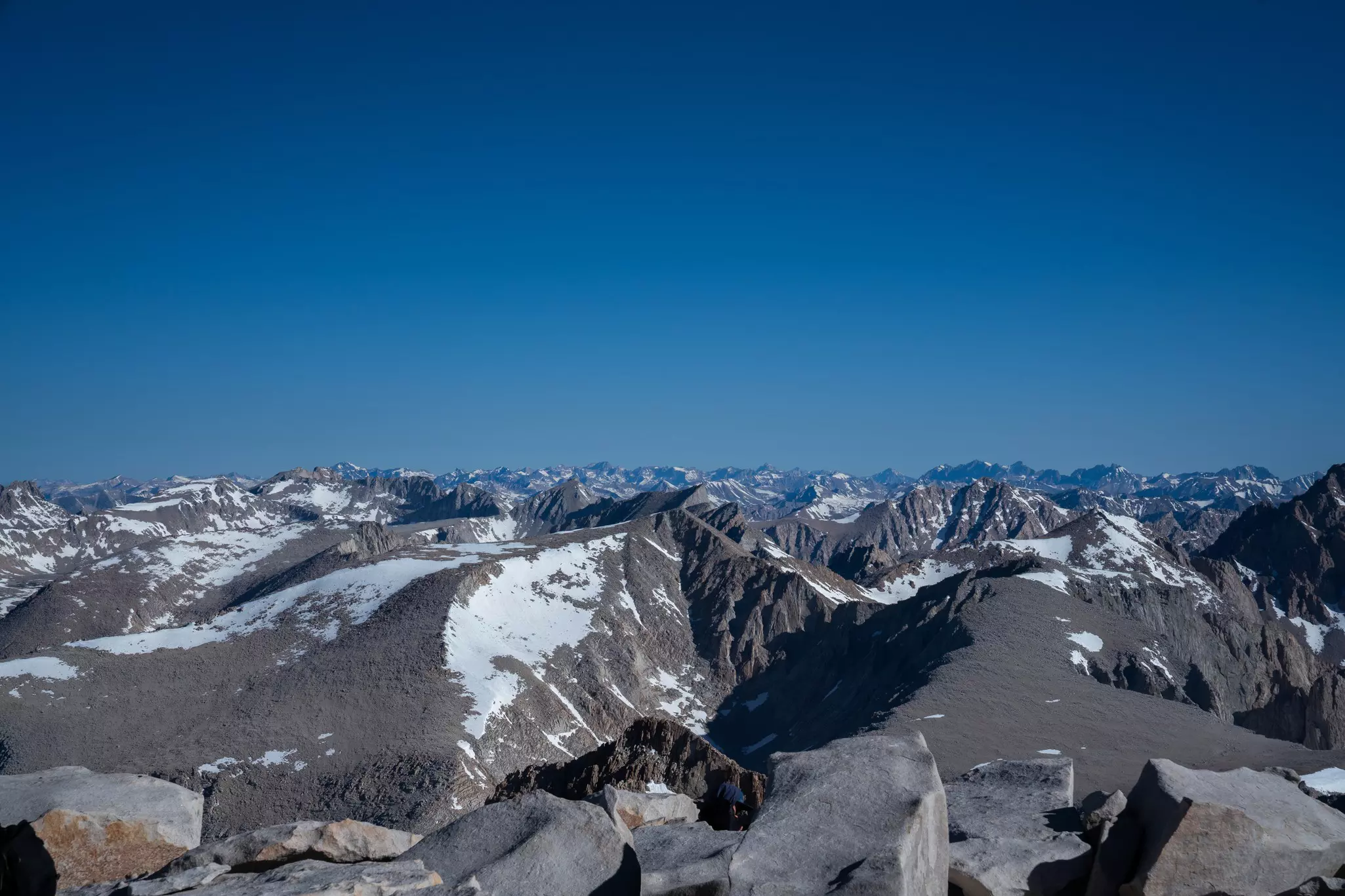
Another option, and my personal recommendation, is an out-and-back from Kearsarge Pass to the summit of Mt Whitney and back, coming out at a total of 71.5 winding miles (115km) through pristine wilderness. The beauty of the trail is unparalleled, climbing up above the tree line into snowy, glacial basins only to fall back down into verdant meadows crisscrossed by rushing streams and glittering birdsong. The trail is quiet, well-maintained and clear, aside from snow patches, and the campsites are well established.
Another potential entry point is Cottonwood Pass, which is south of Mt Whitney. To continue through to Kearsarge Pass would come out to 55.3 miles, and to do an out-and-back would be 47.6 miles. For any route, be sure to select campsites for each night that are a reasonable distance apart – a list of which is available on the permit selection website in a drop-down menu.
There are many advantages to these back side routes to the Mt Whitney Summit, including:
Avoiding the busy Whitney Portal area altogether, including its many restrictions, like required Sag Bags for human waste and a special permit.
Four nights of altitude adjustment before you climb Mt Whitney itself.
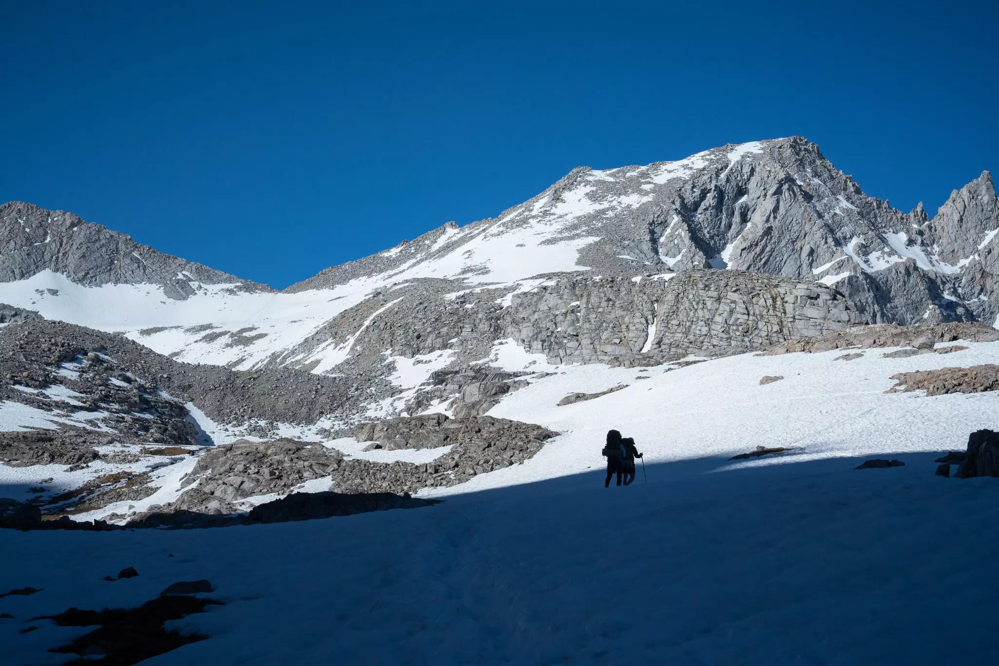
A much shorter summit climb of approximately 2 hours and 30 minutes. (We started at 4am in the dark with headlamps and summited by 7am.)
Enjoyment of a fantastic southern section of the John Muir Trail.
When completing a longer trek to Mt Whitney from the back side, the summit itself will become just the cherry on top of a larger backpacking experience.
When is the best time to hike Mt Whitney?
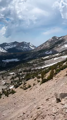
The limiting factor is snow: either snowpack or snowfall. July to September are peak hiking season and are generally the safest bets for good conditions and easy summery weather through these trails. May, June and October could be considered shoulder months and, depending on the year, they may be easily doable or completely snowed out. There can be late snowfall in May, or early snowfall in October, which can be dangerous to trek through. The trails could be covered in snowpack until mid-June, or could be safely accessible by late May.
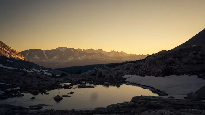
If you’re heading out earlier in the season, such as in June, expect there to be sections with plentiful snow, notably on Forester Pass, which lies around the midpoint between Kearsarge and Whitney. Note that the photos in this article are from early June of a "regular" snow year.
Check online community boards, such as the "Whitney Portal Message Board, " to verify the snow conditions. A particularly useful app is FarOut, where Pacific Crest Trail (PCT) hikers post updates daily. Bring microspikes and trekking poles to help you navigate snow-covered sections of the trail.
What health and safety considerations are there?
Hiking Mt Whitney along longer routes is certainly an authentic taste of high-altitude backpacking, complete with steep passes, days with 13+ miles of walking, and thin mountain air. That being said, this is certainly a hike that is accessible to anyone who is active, comfortable walking long distances and equipped with adequate gear. It’s not uncommon to see teenagers or more senior hikers doing just fine along the trail. The last time I went out was with two of my friends who had never backpacked before, and they both fared well. After completing the hike, one of those friends gave the advice: “Know your limits. Rest is important and necessary. Take it one step at a time, it’s not a competition.”
Depending on whether you camp at Crabtree Meadow or Guitar Lake the night before, the summit itself is a few miles longer, but not necessarily steeper, than other passes along the trail. The footing is loose and the air is thin near the peak, so make sure to do what’s called power breathing, with sharp, hard exhales to ensure you’re getting enough oxygen.
If you’re planning to hike up the Whitney Portal in 1–2 days, be prepared for a more intense experience. This route is essentially straight up and then straight down the eastern side of Whitney, and it can be dangerous due to the high altitude.
As mentioned, trekking poles and microspikes are invaluable when dealing with snow on the trail. Also, leaving the campsite earlier, sometimes even before sunrise, can ensure that the snow will be firmer and thus easier to walk on.
How do you get a permit to hike Mt Whitney?
To hike Mt Whitney, you will need a coveted permit. These are distributed using a quota system on Recreation. gov, under "Inyo National Forest wilderness permits." If you want to exit at the Whitney Portal, you’ll need a special permit, which can be challenging to acquire in this highly trafficked area.
Where is the best place to stay near the trails?
Mt Whitney is located halfway between Los Angeles and Las Vegas. Lone Pine, Bishop and Independence are the nearest small towns in the Owens Valley, just east of the Sierras and west of Death Valley. These are the best places to lodge before or after hiking, with stores selling gear for any last-minute needs, as well as plenty of cowboy iconography.
What's the best way to access the trailheads?
It is important to consider how you will get to and from the trailheads. If you’re with a group and have two cars, you can plan to leave a car at the exit point, or you can arrange a ride from a private shuttle service. If you hire a shuttle, be sure to have it drop you off at your entry point so you can exit with your car awaiting you at the exit point. That way, you can exit sooner or later than you had planned, and you won’t risk missing an awaiting shuttle driver. Contacts of locals who work as shuttle drivers are easily findable online, and can be booked ahead of time.
What essential gear do I need to pack?
Optimizing backpacking gear is a science in itself, and ideally, your target pack weight is closer to 20lbs (not 35) so you can “go light, ” but here are some must-haves:
A warm, puffy jacket
Trekking poles
Microspikes, if there is any possibility of snow travel
A bear canister
Trail runners instead of heavy hiking boots
Water filtration or iodine tablets
Rain jacket and pants
A three-season tent
A fanny pack
Sunglasses and sun protection
Stove and cookpot
Down sleeping bag rated to 15°F
A toilet kit, with a titanium shovel and toilet paper (which you must pack out)
Sleeping pad like Thermarest Z-lite Lite
Advertisement