Advertisement
The 11 best hikes in Scotland’s Highlands & Islands

Lonely Planet Editors
May 26, 2025 • 13 min read
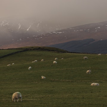
The Highlands and Islands offer some of Scotland's most thrilling hikes. Duncan Andison/Shutterstock
From gentle strolls around silent lochs to challenging scrambles through the craggy mountains of the Cairngorms and Cuillin Hills, the north of Scotland was made for hiking. Indeed, with their mix of untamed scenery, abundant wildlife and rich history, walks in Scotland’s Highlands and Islands rank up there with some of the top hikes in Europe.
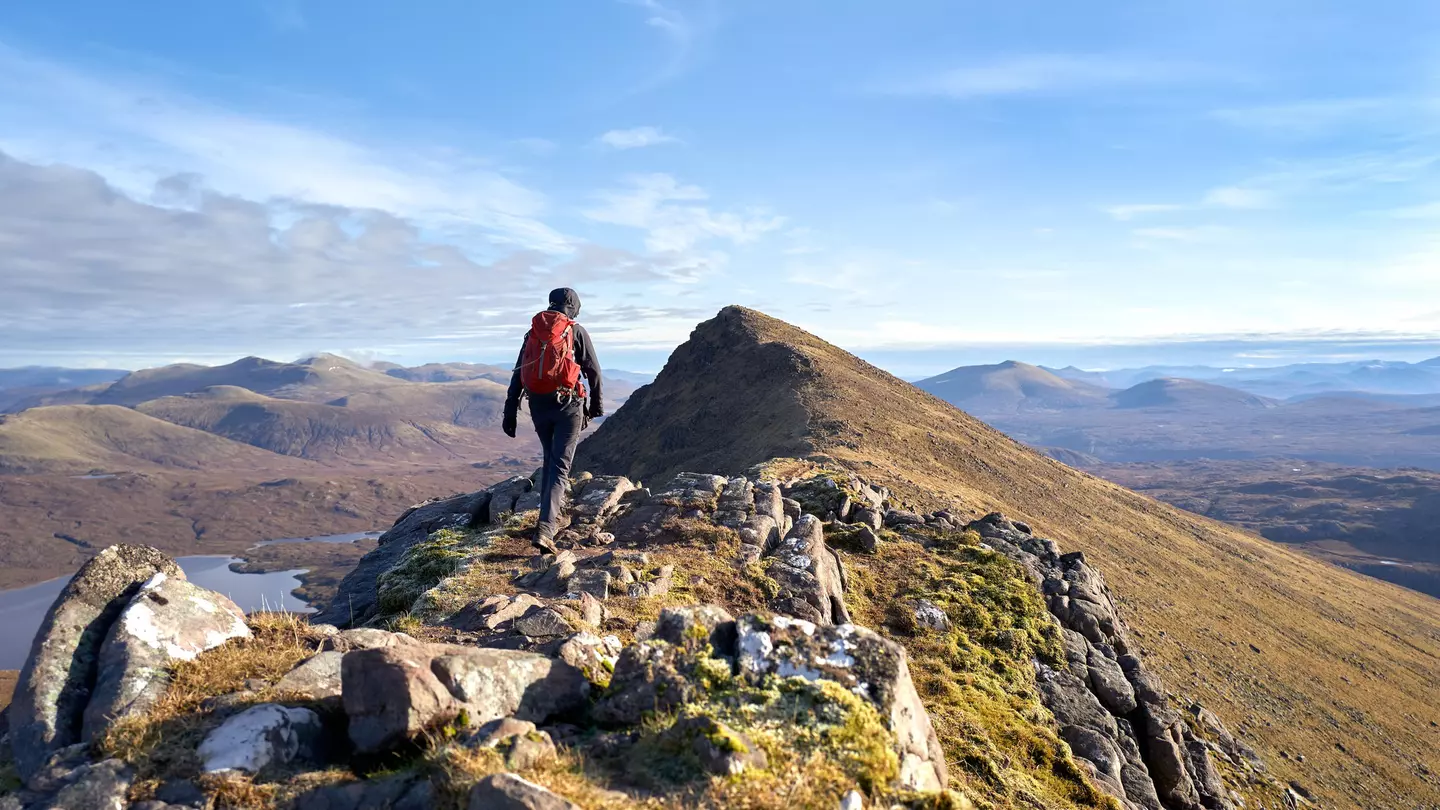
Many of the best walks start from small fishing and crofting villages with cozy hotels and B&Bs, or from roadside car parks and public bus stops on the winding roads that meander along the indented coastline and loop around the ankles of mighty Munros – peaks over 914m (3000ft), as defined by the Scottish Mountaineering Club.
The typical Highlands walk starts close to sea level, climbing up sharply to some of the highest points in the British Isles. This rapid change in elevation means epic views are almost guaranteed – providing the weather plays ball. For less ambitious hikers, there are lowland walks to remote lighthouses and sea cliffs thronged by squawking colonies of seabirds.
So grab your hiking boots and rainproofs and check out our list of the top hikes in Scotland’s Highlands and Islands.
1. Ben Nevis
Best for a sense of conquest
8 miles (12km), 6–7 hours; moderate to challenging
Advertisement
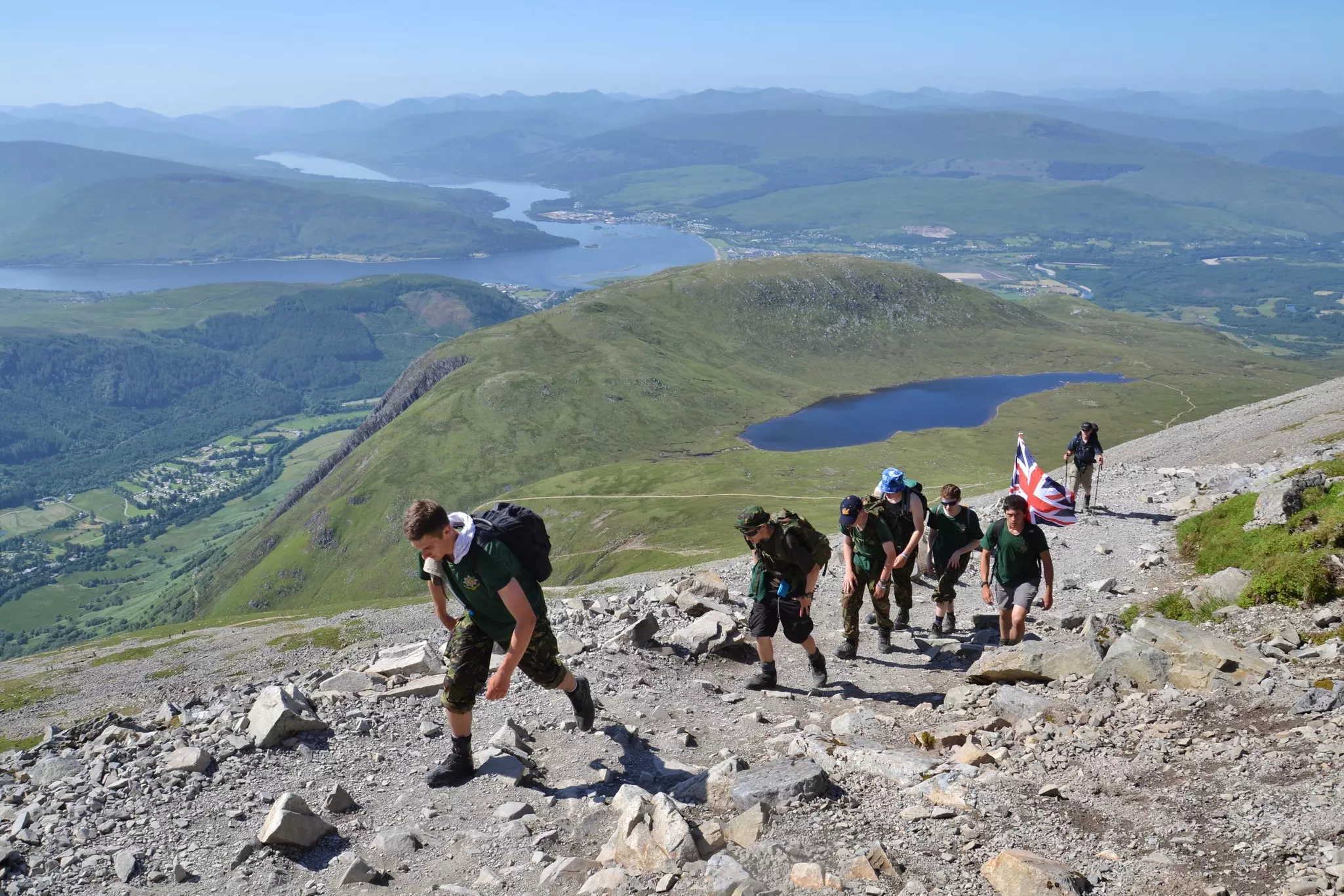
As the highest peak in the British Isles, 1345m (4413ft) Ben Nevis near Fort William calls out to hikers like a siren. A staggering (often literally) 130,000 people reach the summit each year, and anyone reasonably fit should have no problem conquering the peak in summer.
The most popular starting point is the car park at Glen Nevis Visitor Centre, from where a path climbs gradually to Lochan Meall an t-Suidhe and then zigzags steeply up beside the Red Burn to the summit plateau. The highest point of Ben Nevis is marked by a huge cairn beside the ruins of a 19th-century observatory.
Planning tip: For an even bigger challenge, see if you can secure a spot on the annual Ben Nevis Hill Race in September; the record time for the return trip to the summit is a remarkable 85 minutes.
2. The West Highland Way
Best long-distance trail
96 miles (154km); 7 days; challenging
Scotland’s spectacular West Highland Way carries hikers north from Milngavie to Fort William through rugged glens, past fast-flowing streams and wild moorland where magnificent mountains are never out of sight. Steeped in history, this multi-day epic follows footpaths, old cattle trails and former railway lines and military roads as it cuts a swathe across the western Highlands.
You can commit to the full seven-day distance or choose a shorter stretch to enjoy on a day walk or an overnight camping hike. The early stages through Loch Lomond & the Trossachs National Park are easily accessible from Glasgow, while the north end of the trail can be hiked from Fort William.
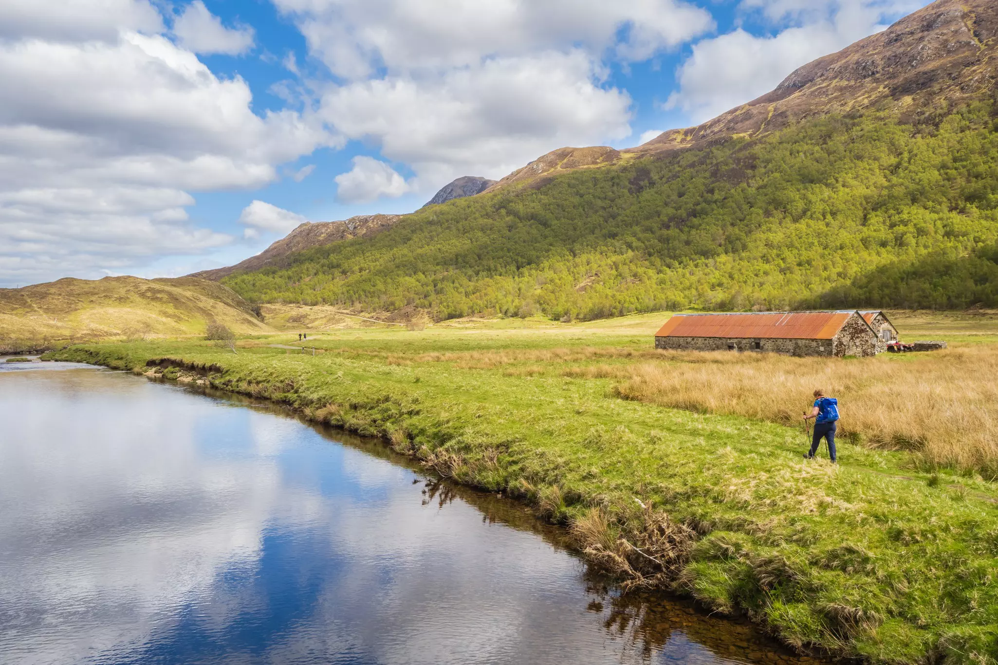
3. Glen Affric
Best for escaping the Loch Ness crowds
12 miles (19km); 4–6 hours; moderate
Between Fort William and Inverness, Glen Affric is a world away from the crowds of day-trippers and monster hunters thronging Loch Ness. Passing through a forest of Caledonian pines southwest of Cannich, you’ll enter a brilliant realm of adventure for hikers, mountain bikers, paddlers and anglers.
This national nature reserve is a scenic wonderland of shimmering lochs, wild woodlands and rugged mountains, home to pine martens, wildcats, otters, red squirrels and golden eagles. Experienced hikers should try the 12-mile (19km) circuit of Loch Affric, or the 35-mile (56km), two-day trek from Cannich to Glen Shiel on the west coast.
4. Stac Pollaidh
Best for West Highlands views
2.8 miles (4.5km); 2–4 hours, moderate
The name Stac Pollaidh (a combination of Gaelic and Norse words meaning “pool river pinnacle”) tells you exactly what to expect from this rewarding hike – a rugged mountain peak by the water. Stac Pollaidh isn’t the highest point near Ullapool, but hikers can reach the summit and return in less than three hours, enjoying incredible views from the summit.
Begin at the car park located halfway along the northern shore of glittering Loch Lurgainn, around half an hour north of Ullapool by car. A well-trodden footpath leads up through shrubland and arcs around to the rocky crest of Stac Pollaidh, where views of moody mountain peaks, languid silvery lochs and undulating islands await.
Planning tip: Reaching the true summit of Stac Pollaidh involves a precarious scramble over rocky outcrops and loose scree slopes. McKenzie Mountaineering arranges multi-day hikes up Stac Pollaidh and other peaks in the area.
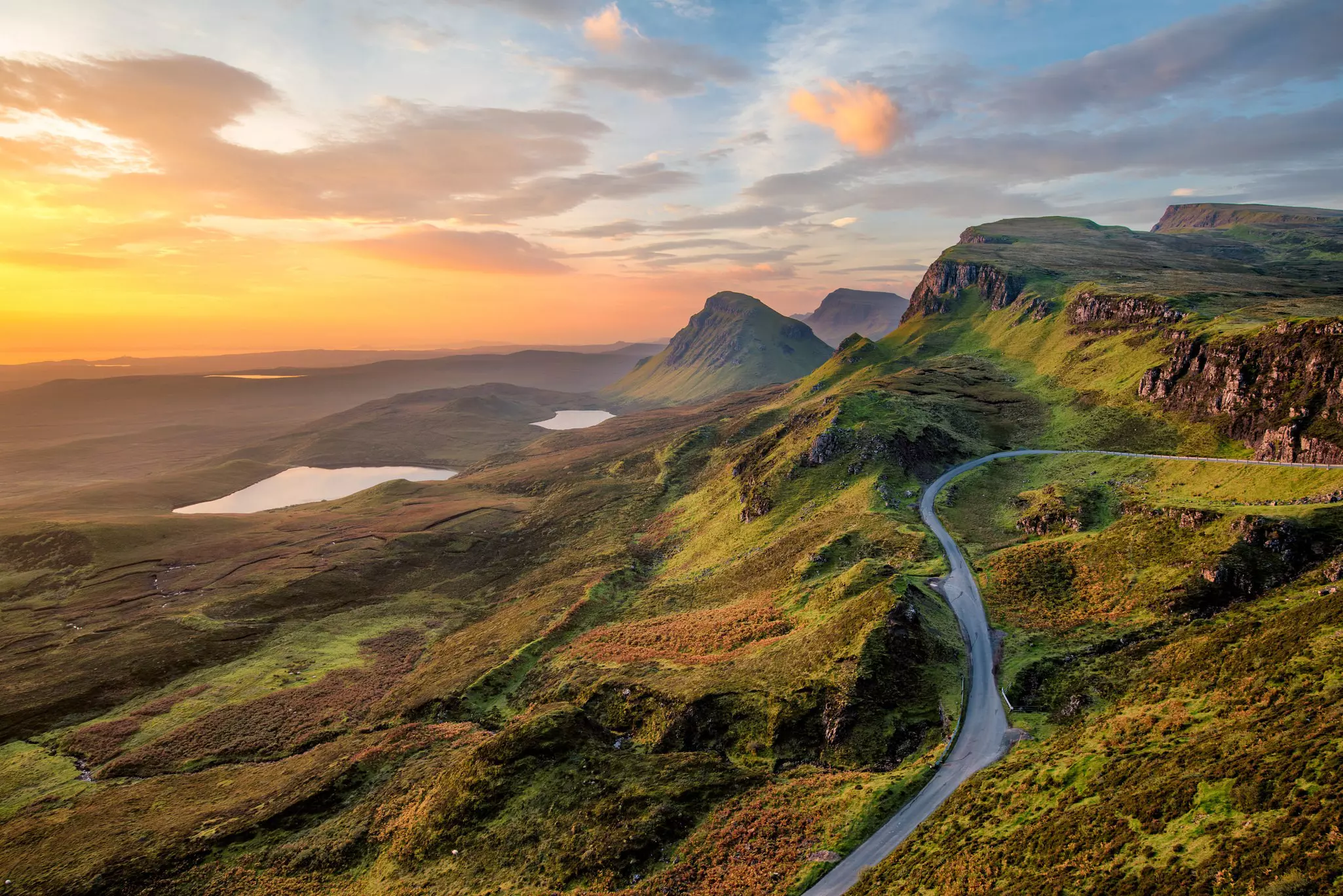
5. The Quiraing, Isle of Skye
Best for legendary landscapes
4.5 miles (7.2km); 2–3 hours; easy
Looming high above Skye’s Trotternish Peninsula, the Quiraing has near-legendary status among walkers, thanks partly to its cameos in Hollywood movies such as Stardust (2007) and Macbeth (2015). The curious name comes from the Old Norse term kví rand (meaning “round fold”), a reference to the lofty plateau known as the Table where herders hid their livestock from Viking raiders.
Set off early in the morning from Portree for the Quiraing car park, then head off on foot into this unique landslip landscape. A busy but scenic trail heads up to the jagged cluster of rocks known as the Prison, which offers views over a sweep of glacial valleys and the Needle, an isolated 37m-high (121ft) column of basalt rock.
The cliff-hugging path then winds down and back up to the Table, which offers panoramic views over Trotternish and the nearby islands of Rona and Raasay. You’ll feel uplifted by the scenery as you follow the steep and usually muddy path back to the car park.
Advertisement
Planning tip: For a quieter hike, try the 8.5-mile (13km) hike from the medieval Trumpan Church to the handsome Waternish Lighthouse, gazing north toward the Isle of Harris in the Outer Hebrides.
6. Goatfell, Isle of Arran
Best island hike
6 miles (9.5km); 5–6 hours; moderate
On a clear day, there is no better vantage point for taking in the Isle of Arran’s glorious good looks than mighty Goatfell (874m/2867ft), the highest peak on the island. The most popular path, beginning in the grounds of Brodick Castle, is easy to follow and well maintained by the Arran Ranger Service.
Allow two to four hours to reach the summit and return via the same route; bring plenty of water and a good head for heights if you plan to tackle the rough trails running north from the summit. From Goatfell’s exposed crown, you may be able to see as far as the River Clyde, or even Ireland on a clear day.
Planning tip: If dizzying heights don’t appeal, stay by the sea and follow the Arran Coastal Way on a 65-mile (104km) circuit of the island; highlights of the route include Lochranza Castle, the King’s Cave, Kildonan Beach and Glenashdale Falls.
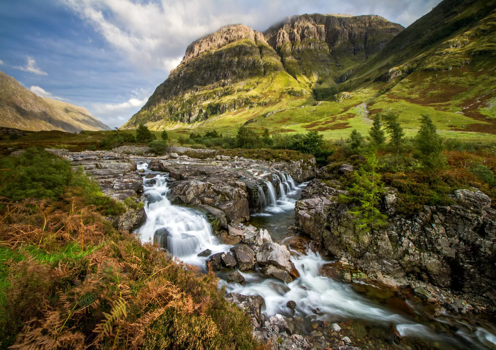
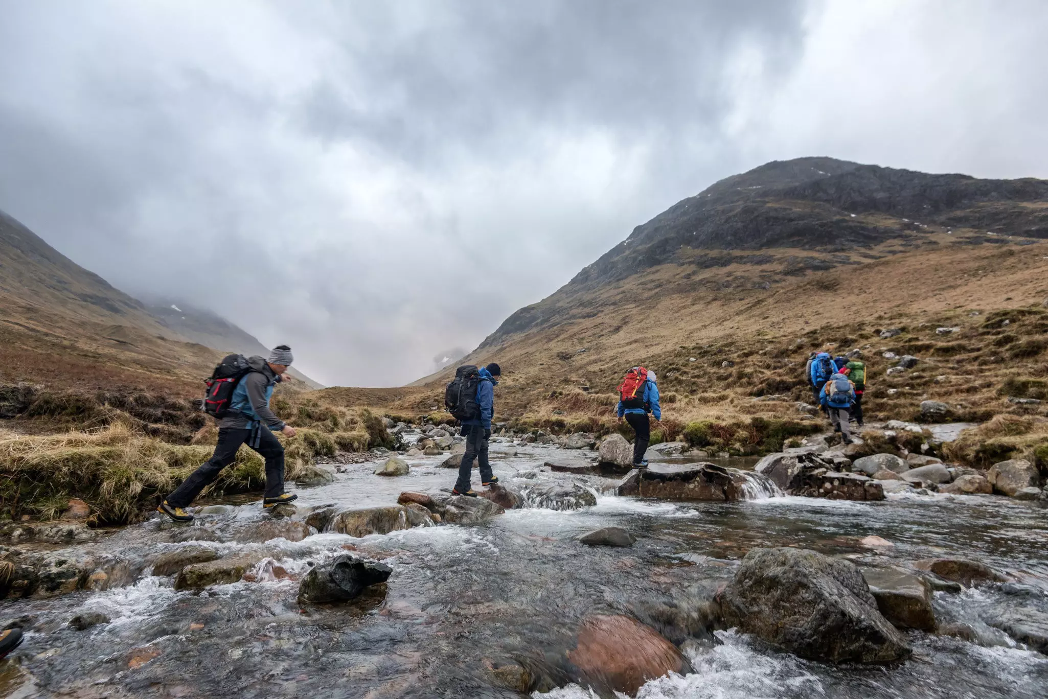
7: Glen Coe
Best for Highlands history
2.5 miles (4km); 3 hours; moderate
Scotland’s most famous glen is also one of its grandest. The approach from the east is guarded by the rocky pyramid of 1021m (3351ft) Buachaille Etive Mor, creating a natural playground for hikers, climbers and skiers. The West Highland Way long-distance walking trail threads through Glen Coe’s eastern end but you can get a feel for the terrain on many shorter hikes.
For a journey back into Highland history, follow the footsteps of past cattle rustlers to the Lost Valley – a mountain sanctuary haunted by the ghosts of murdered MacDonalds. A strenuous 2.5-mile (4km) walk from the Three Sisters car park rises through a maze of jumbled, moss-coated boulders before emerging – quite unexpectedly – onto a broad flat meadow, where stolen cattle were once secreted away.
8. The Cuillin Hills, Isle of Skye
Best for a mountain challenge
Distances and times vary; challenging
With 11 mighty Munros lined up along its rocky spine, the Cuillin Ridge on the Isle of Skye is one of Scotland’s top hiking challenges. This is no casual walk in the park – these serious and exposed ascents are best attempted with a guide, or on an organized expedition arranged through an operator such as Rock n Ridge.
The Cuillin Hills take their name from the Old Norse word kjöllen, meaning “keel-shaped, ” and they’re almost alpine in character, despite topping out at just 993m (3258ft). Expect thrilling, occasionally hair-raising walks along knife-edge ridges, loops around jagged pinnacles, and descents along scree-filled gullies.
Planning tip: There are plenty of rewarding low-level hikes around the edges of the Cuillin, accessible from Sligachan to the north or Glenbrittle to the south. Try the steep but dramatic six-hour climb from Glenbrittle campsite to Coire Lagan as a taster for more ambitious Cuillin hikes.
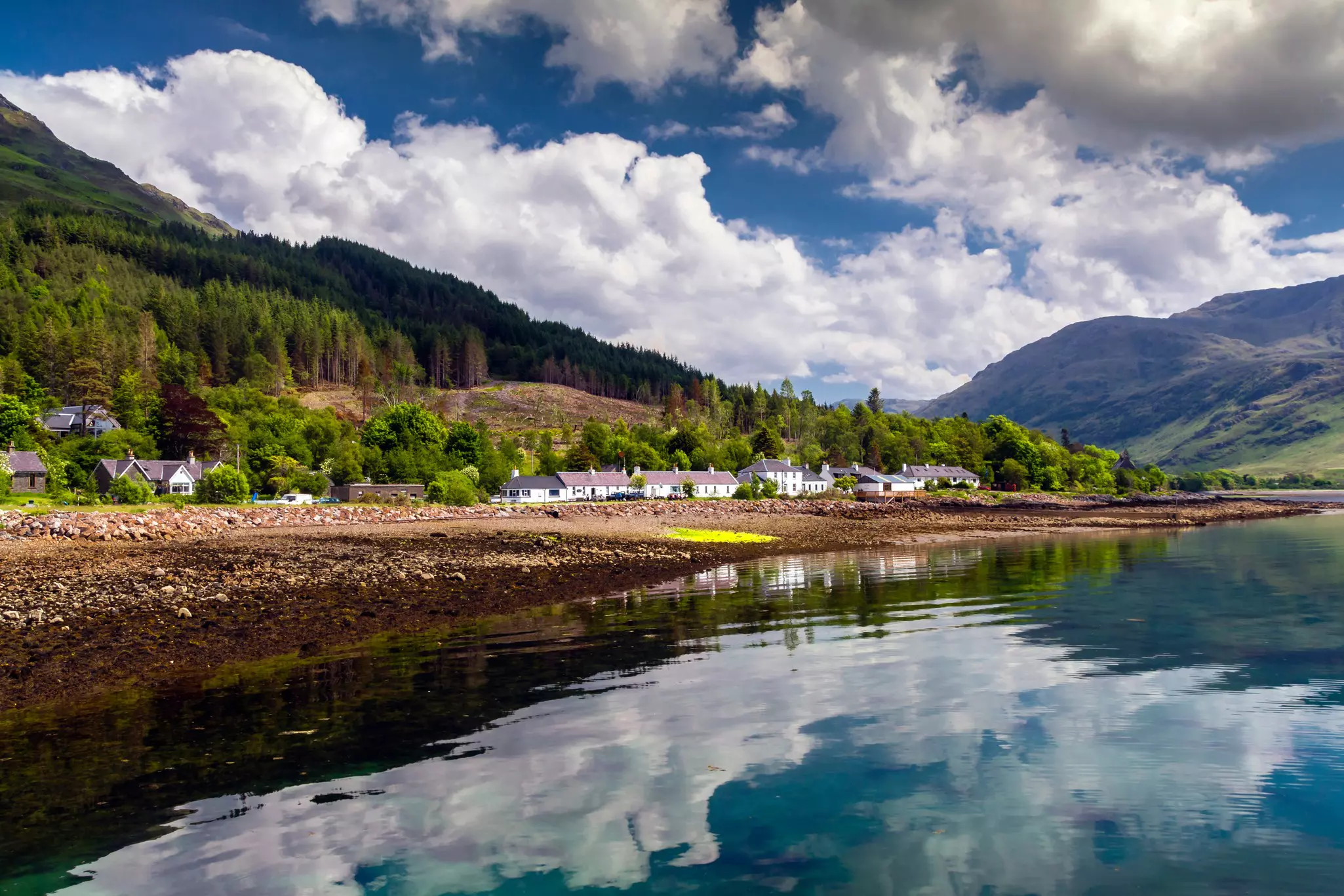
9. Knoydart Peninsula
Best walk with a reward at the end
16 miles (26km); 8 hours; challenging
The Knoydart Peninsula is the only part of the UK that cannot be reached by car. The only way to get to Inverie, its sole village, is on the ferry from Mallaig, or on foot from remote Kinloch Hourn – a tough 16-mile (26km) hike that will look good on any hiker’s list of conquests. Plan for a full day of walking through remote, glacier-carved scenery.
Visiting is a taste of off-grid living, Scottish style. On arrival, make for the Old Forge, listed in Guinness World Records as Britain’s most remote pub. It’s surprisingly sophisticated, with real ale on tap, as well as an Italian coffee machine and good food.
Planning tip: If you just fancy a day trip, you can join a Knoydart Ranger for a half-day walk around the peninsula from Inverie, delving into local history, ecology and foraging.
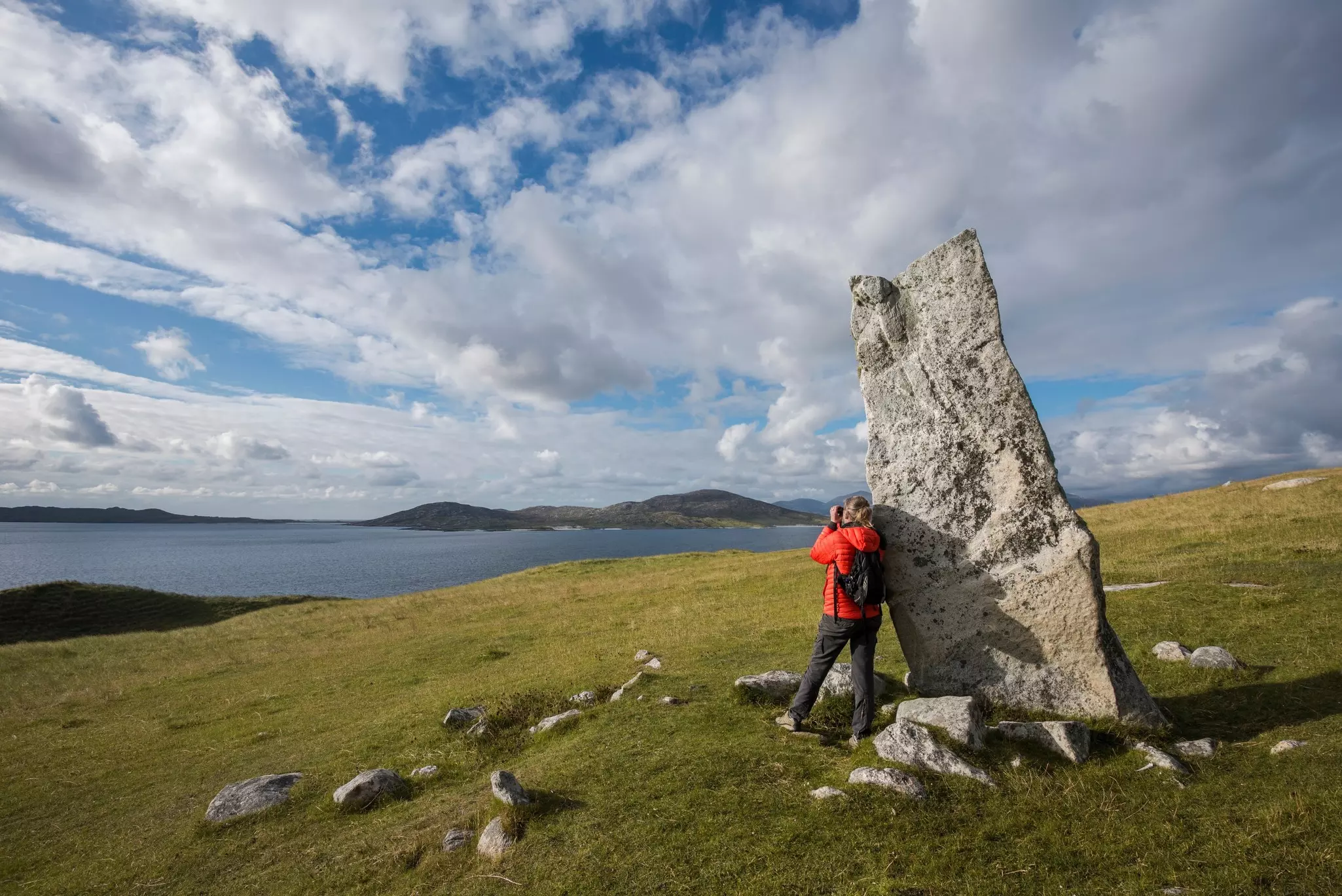
10. Neolithic Orkney
Best for ancient history
8 miles (13km); 3–4 hours; easy
The low-lying, windswept Orkney Islands are studded with Neolithic stone circles, tombs and ancient stone settlements. For an informal but deeply immersive walk, follow quiet roads and shortcuts across moors and meadows from the impressive chambered tomb of Maeshowe to Skara Brae, Britain’s best-preserved Neolithic site.
En route, you’ll pass the timeless standing stones of the Ring of Brodgar and the Stones of Stenness, raised in the third millennium BCE as part of an ancient ceremonial complex. From the beach at Skara Brae, you can extend the walk south to the towering cliffs at Yesnaby for views out over the steely-grey Atlantic.
Detour: For bonus drama, add the walk to the picturesque sea stack known as the Old Man of Hoy to your itinerary. Starting from Hoy’s picturesque Rackwick Bay, a 5.5-mile (9km) round-trip hike will deliver you to soaring cliffs that buzz with great skuas, overlooking the landmark rock formation.
11. Hebridean Way, Outer Hebrides: Best for a sense of mission
156 miles (251km); 8–13 days; challenging
For a walk with a genuine sense of purpose, the long-distance Hebridean Way path weaves across 10 islands on its way from Barra in the south to the rocky Isle of Lewis in the north, taking in the full sweep of the Outer Hebrides.
These wave-lashed islands are lined with picturesque white-sand beaches and rolling machair that provides a refuge for rare birds and flowers, with a Gaelic heritage spanning millennia. While you hike, you can scan the coastline for seals and golden eagles soaring overhead, and drop in on Calanais (Callanish) – Scotland’s most evocative stone circle.
Planning tip: For a slightly easier trip through the Outer Hebrides, consider following the 197-mile (317km) Hebridean Way cycle route. By bike or on foot, most people travel from south to north because of the prevailing winds.
Tips for hiking in Scotland’s Highlands and Islands
You’ll have an better hiking experience if you follow these tips.
What should I pack for a hike in Scotland’s Highlands and Islands?
Warm layers are essential, as wind and rain at elevation can drive down temperatures. Bring waterproofs and a windproof layer – the weather does not lend itself to the use of umbrellas. You’ll need waterproof hiking boots and spare socks, as your feet will definitely get wet at some point.
For remote hikes, carry a map and compass and let someone know where you are going and when you plan to return – Scottish Mountain Rescue are called out regularly to hikers and climbers who get into trouble in the hills, particularly in winter.
Bring a pair of compact binoculars or a camera with a long lens – you never know when you’ll spot a soaring eagle or the black shape of a whale out in the bay. A headtorch, water purification tablets, and a mobile phone for emergencies also belong in your pack.
When is the best time to go hiking in Scotland’s Highlands and Islands?
With the northerly latitude, you’ll need to be prepared for the weather. It can rain in the Highlands and Islands at any time of year, and marshy ground and strong winds can make progress slow and tiring. On the flip side, the warming effect of the Gulf Stream keeps temperatures milder than you might expect from spring to fall.
The best time to go hiking in Scotland’s Highlands and Islands is from May to September, but bring insect repellent for the small biting flies known as midges from June to August. Spring and fall see damper weather but quieter trails and fewer bugs. In winter, you’ll need to be equipped for serious snow conditions.
Do I need a guide?
Many hikes are easy to follow if you have a decent map or an app such as AllTrails on your phone. Even by just following signs marking the route of public footpaths, you can navigate many trails without a guide. However, this doesn’t apply to every trail.
When exploring mountainous areas such as Cairngorm National Park or the Black Cuillin on the Isle of Skye, an experienced guide is a definite asset, and they’re easy to find through local tourist offices. Always carry a map and compass as a backup, even if you’ll mainly be navigating using electronic devices.
Where should I stay when hiking the Highlands and Islands?
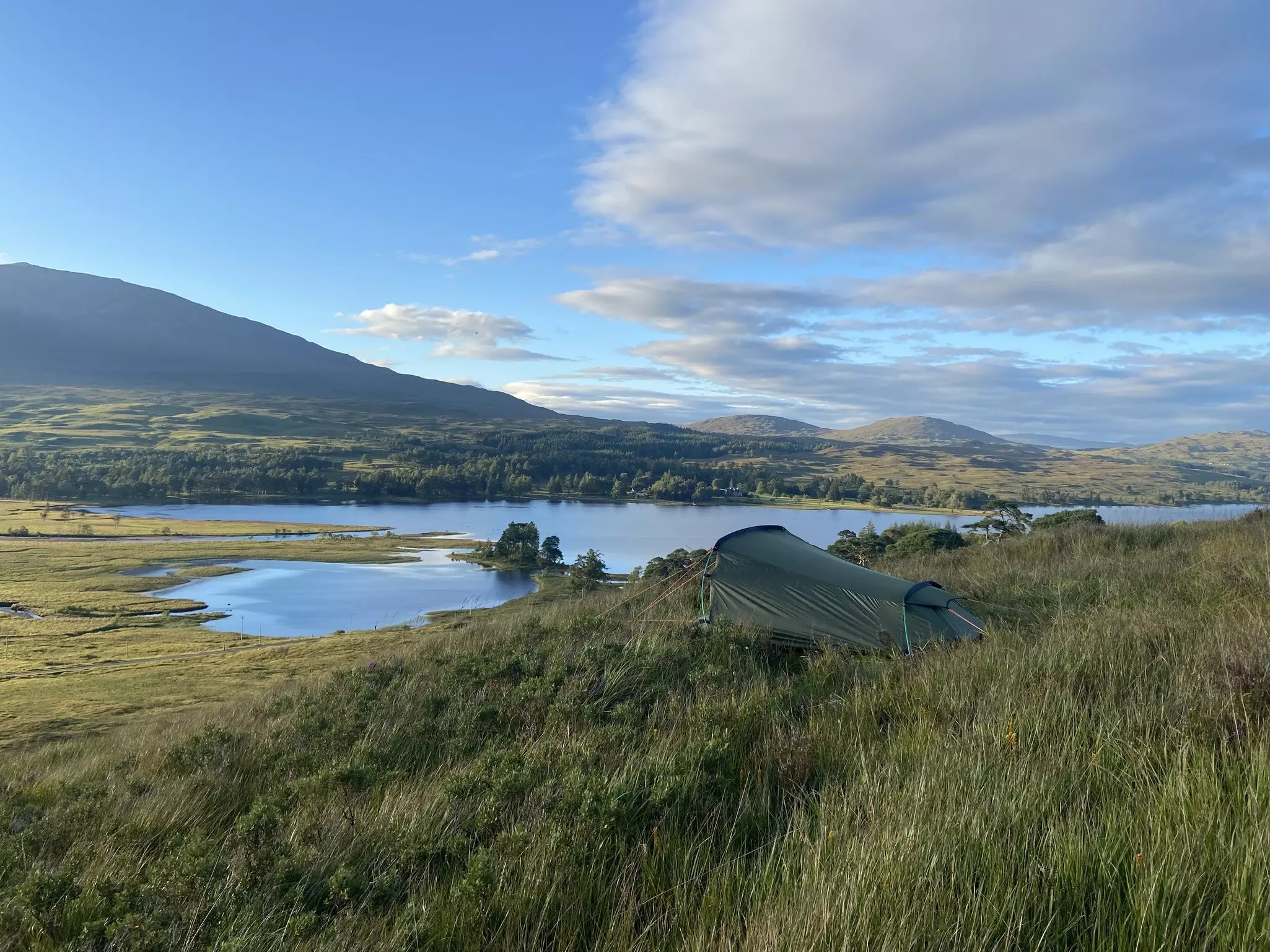
Wild camping is permitted on unenclosed land, so long as you follow the Scottish Outdoor Access Code. In the Scottish Islands, it can be hard to tell if land is in use – try asking if it’s okay to camp at the nearest farmhouse. Otherwise, official campsites are easy to find.
If you prefer a solid roof overhead, there are hotels and B&Bs all over the Highlands and Islands, alongside rustic bothies – simple huts where you can take shelter in remote areas. They’re left unlocked for visitors to use, but follow the advice of the Mountain Bothies Association.
Don’t expect The Ritz – there may be a fireplace but running water and electricity are rare, and the toilet facilities may consist of a spade and an invitation to walk a certain distance from the building. Leave bothies as you found them and always carry out any rubbish from your stay.
Are there any handy resources for hikers?
Research routes and amenities along the trails online using websites such as Scotland’s Great Trails, Walkhighlands, and AllTrails.
This article was adapted from Lonely Planet’s Scottish Highlands & Islands guidebook, published in June 2025.
Advertisement
Explore related stories

Jan 22, 20267 min read
The best time to visit Scotland for festivals, stunning landscapes and winter nights
Oct 16, 20247 min read
5 of the most spectacular road trips in Scotland, from the Highlands to the islands