Advertisement
Parque Nacional Cerro Castillo, Chile. Guaxinim/Shutterstock
No matter where you go in Chile, an epic hike isn’t far away. Indeed, with the rugged Andes as its 4000km backbone and all the gorgeous terrain that comes along with it, Chile is a hiker’s paradise, and ambitious walks in nature are some of the country’s top draws.
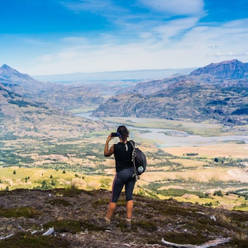
Stand at the geographic heart of the country near Santiago and the tallest mountains in the Americas snake along the horizon to your east. Out west, over another mountain range, you’ll hit the pounding surf of the Pacific Ocean.
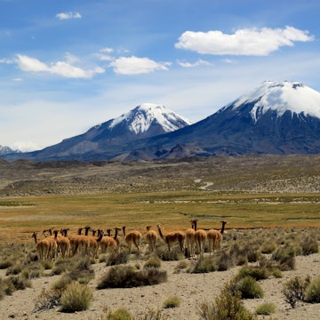
Down south, beyond a few dozen lakes and volcanoes, you’ll reach the temperate rainforests, crackling glaciers and foggy fjords of Patagonia. Up north, past an array of verdant wine valleys, you’ll discover the desiccated salt flats, steaming geysers and soaring sand dunes of the Atacama Desert.
From multiday circuit treks on remote islands to half-day hikes up Andean volcanoes, the hardest decision will be choosing which route to tackle. Here are 11 of the best hikes in Chile to choose from.
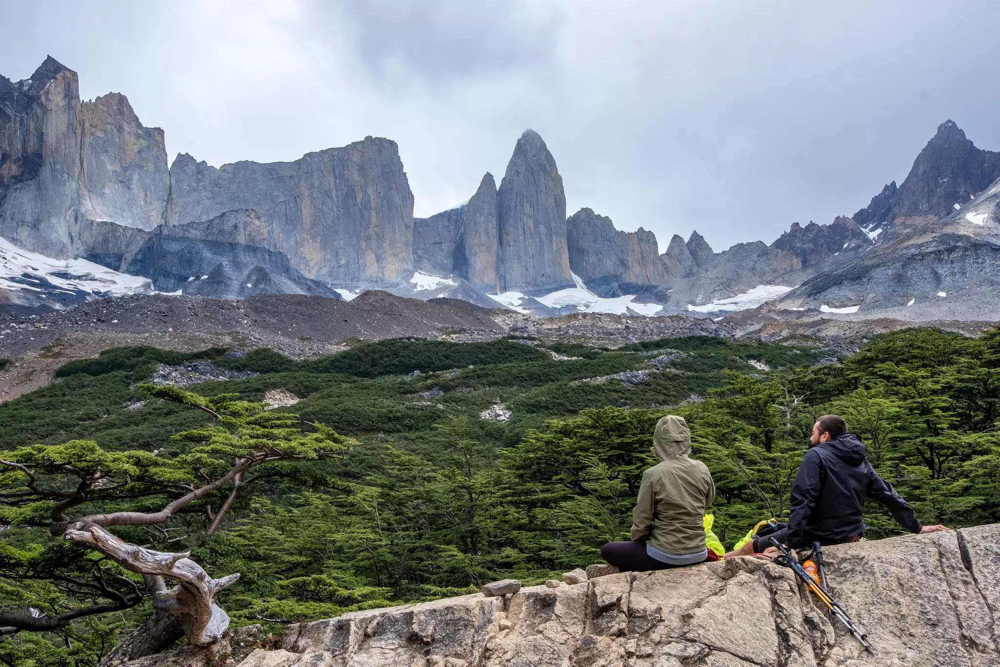
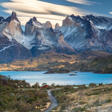
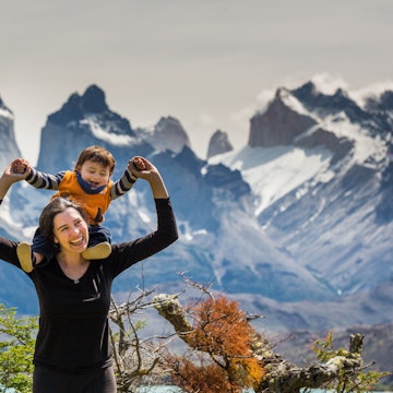
1. W Trek, Parque Nacional Torres del Paine
Best for stunning Patagonian scenery
Distance: 80km one way
Time commitment: 5 days
Difficulty: moderate
If Chile were known for just one hike, it would be the W Trek, one of the most popular routes in all of South America. Taking its name from the shape it traces on a map, this 5-day path through Parque Nacional Torres del Paine showcases its incredible scenery to the fullest. Expect soaring granite spires, milky green moraine lakes and views of the gargantuan Patagonian ice field.
Advertisement
When hiking from west to east, the first leg is from Guardería Paine Grande to Refugio Lago Grey (13km; 4 hours one way) – a relatively easy trail with some challenging uphill sections and a dramatic Lago Grey glacier lookout along the way. From Refugio Grey, you can opt to hike further along the trail to a series of hanging bridges, giving you truly magnificent glacier views.
You then backtrack to Paine Grande before a long day hiking to the beautiful Valle Francés (9.5km; 5 hours) and onto Refugios Francés (20km; 9 hours) or Los Cuernos (22.5km; 10 hours). This section skirts Lago Skottsberg, with the famous Cuernos (Horns) looming above. Drop your heavy pack at Campamento Italiano (closed through at least the 2026 season) to travel up lightly from Valle Francés. Mirador Británico, the middle of the W shape, affords sweeping views of the valley and Cordillera Paine.
The next day, you’ll have a shorter, gentler, though often fiercely windy hike to Refugio Chileno (11–14.5km; 5–7 hours) with some elevation and the very blustery Paso de los Vientos along the Río Ascencio as you approach Chileno.
The final leg, to Mirador Las Torres (10km; 4 hours), is a moderate hike up to a treeless tarn below the eastern face of the Torres del Paine before a final stretch across a scree field of giant boulders for glorious close-up views of the towers. You then retrace your route to Chileno and continue down to Las Torres sector (7km; 2 hours).
While this area is incredibly remote, you can actually make the trip as rustic or cushy as you like. That’s because in addition to a string of well-run campsites along the way, hikers can also stay at well-appointed mountain lodges (known as refugios), sleeping in a bunk and dining on three-course meals washed down with Austral craft beer.
Planning tip: The W trail is absolutely overrun with domestic tourists at the height of summer (in January and February), so it’s best to book in the shoulder seasons on either end.
2. O Circuit (Paine Circuit), Parque Nacional Torres del Paine
Best for epic Patagonian adventure
Distance: 112km
Time commitment: 7–9 days
Difficulty: moderate
To immerse yourself in the scenery of Torres del Paine with more solitude, set off on the 112km Paine Circuit trek. Also known as the O Circuit, it links the W Trek with the backside between Refugio Grey and Refugio Las Torres. The circuit typically takes 7–9 days; since fewer visitors hike the entire route, the northern section is quieter than the W.
Most hikers begin and complete the circuit at Las Torres sector, but other starting points head east from Grey and Paine Grande. (You may only hike the O Circuit counterclockwise.) As you enter the park from the east, views from Laguna Amarga (Bitter Lake, a reference to its salinity) hint at dramatic vistas to come. The 15km hike to Campamento Serón takes around 4 hours.
On this 18.5km, 6–7 hour stage, expect strong winds as the spectacular route from rustic Campamento Serón campsite follows Río Paine through grassland before a climb ahead of Lago Paine. The trail then curls around the shores of the shimmering lake for several kilometers, with one more uphill push at the end.
In a peaceful spot beside Lago Dickson in the north of the park, the same-named campsite is the jumping-off point for the walk southwest to Campamento Los Perros, which passes by the Perros Lagoon and hanging glacier. You can take a detour to the glacier mirador (viewpoint) to drink in the view before continuing on to Campamento Los Perros. Covering 10.5km, this leg is a fairly simple but windy section of the route and takes around 5 hours.
The high point – in all senses of the term – of the next 8.6km stretch is the 1241m Paso John Gardner. Often covered with knee-deep mud or sometimes snow, it’s the most extreme part of the whole Paine Circuit but brings rewards in the form of its stellar vistas. You’ll want to get an early start for this long day. Note that the descent of this section is physically challenging, especially in winter.
You’ll close this half of the loop by taking in stunning glacier views. From Campamento Paso, you head steeply downhill, focusing on your footsteps and trekking poles while also marveling at the views of Glacier Grey alongside. You’ll continue to descend, crossing a series of three hanging bridges over narrow gullies, until you reach Refugio Lago Grey and reconnect with the W.
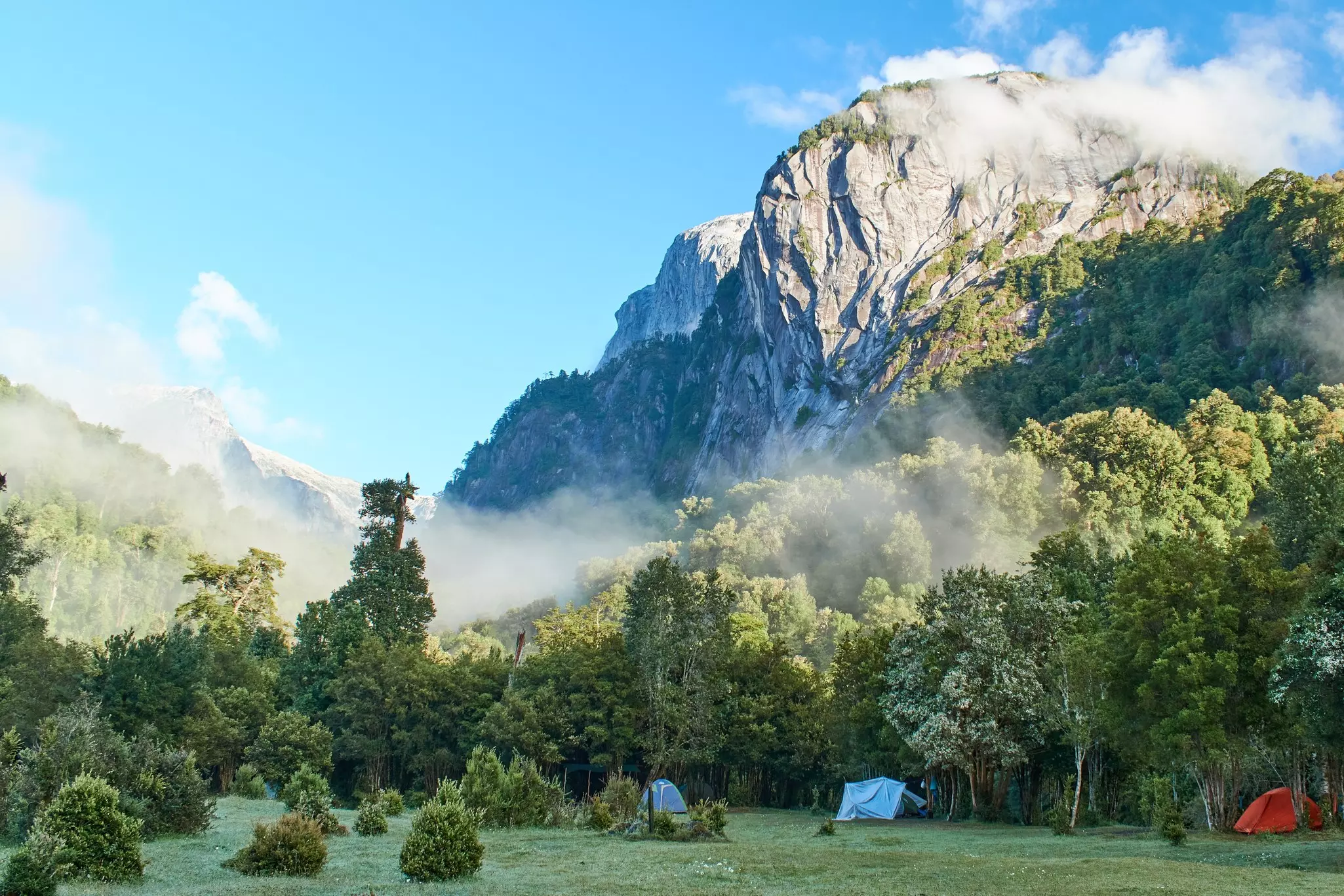
3. Cochamó Valley Trail
Best for rock climbers
Distance: 12km one way
Time commitment: 2 days
Difficulty: moderate
Follow in the footsteps of Butch Cassidy and the Sundance Kid, who drove their cattle over the Andes from Argentina to Chile on the Cochamó Valley Trail more than a century ago. Not much has changed since the famed American outlaws escaped to Northern Patagonia, though the trail they used is fast emerging as a hub for mountain climbers, many of whom compare its imposing granite domes to the famous ones at Yosemite.
Most visitors hike in along the muddy horse trail to the outpost of La Junta, a spectacular valley that almost feels under threat from the looming granite domes and towering mountain surroundings.
Planning tip: Either Camping La Junta or the comfier Refugio Cochamó serve as solid bases for several days of walks and climbs in the surrounding mountains.
4. Dientes de Navarino Circuit
Best for hardcore adventurers
Distance: 54km
Time commitment: 4 days
Difficulty: challenging
Advertisement
How’s this for bragging rights: if you tackle the remote and little-visited Dientes de Navarino Circuit, you can tell your friends back home that you’ve completed the southernmost hiking route in the world. Of course, to do so you’ll have to brave thundering winds, frigid nights and weather that can (and usually does) span four seasons in one day.
This challenging circuit trail on Isla Navarino begins in the tiny hamlet of Puerto Williams, which claims the title of southernmost city in the world; the hike up Cerro Bandera is the first stage. Taking 4–5 days in total through spectacular Tierra del Fuego wilderness, the route winds past a series of glorious lakes and truly awesome views of the appropriately fanglike peaks of the dientes (teeth).
Planning tips: The number of people hiking the circuit has increased in recent years, though this trip is not suitable for casual hikers. Because it requires solid navigational skills and backcountry experience, you must be completely self-sufficient (including experience with GPS and topographical maps) to undertake the trek. Most visitors hire a trained guide.
5. Mirador de Los Cóndores, Parque Nacional Glaciares de Santiago
Best near Santiago
Distance: 11km
Time commitment: 4–5 hours
Difficulty: moderate
Any ascent to this Andean lookout in the Cajón del Maipo valley near Santiago makes the Chilean capital – and its 7 million residents – feel worlds away. Yet the trailhead is only about an hour’s drive from the city limits.
A moderate ascent up arid Andean foothills, the hike offers dazzling valley views, as well as a chance to try some nutty goat cheese sold at a mule driver’s house less than a mile before the summit. The namesake condors, which encircle the cliff at the trail’s end, are the undisputed highlight, wowing hikers with their massive 3m wingspan.
Planning tip: Other wildlife in and around the Parque Nacional Glaciares de Santiago – created in 2022 to protect the glaciers closest to the capital – include black-chested buzzard eagles, colocolo wildcats and pumas.
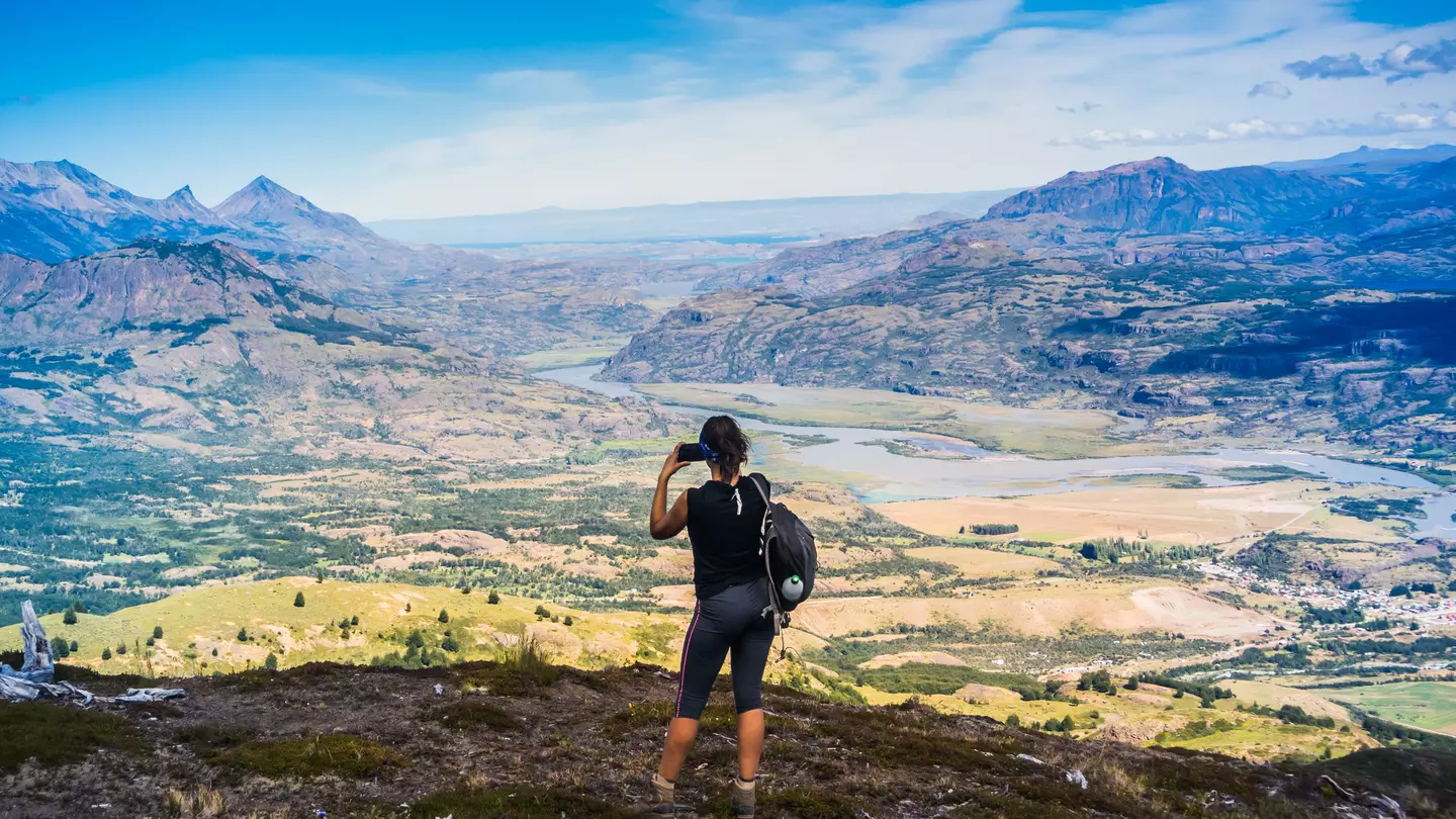
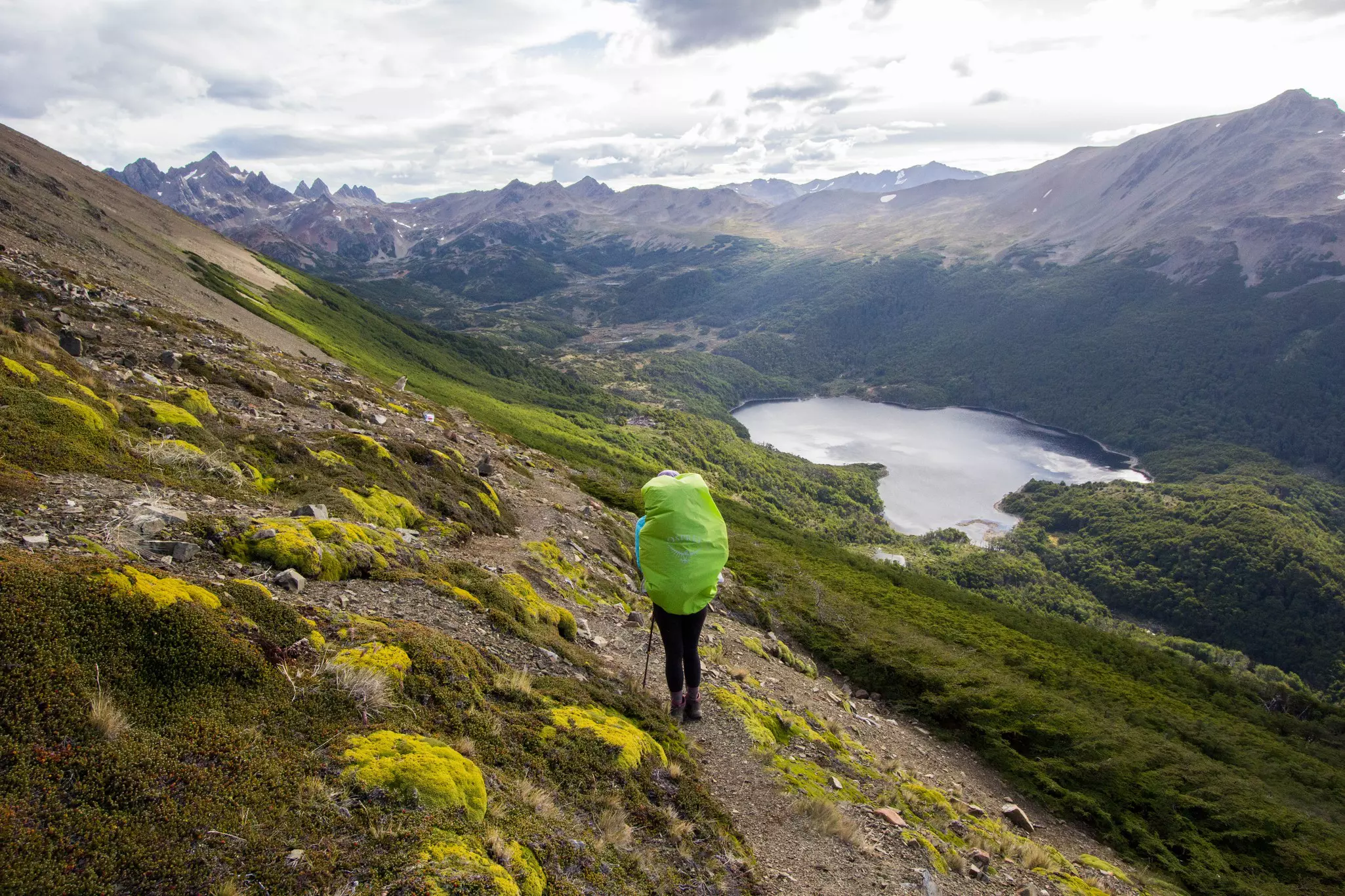
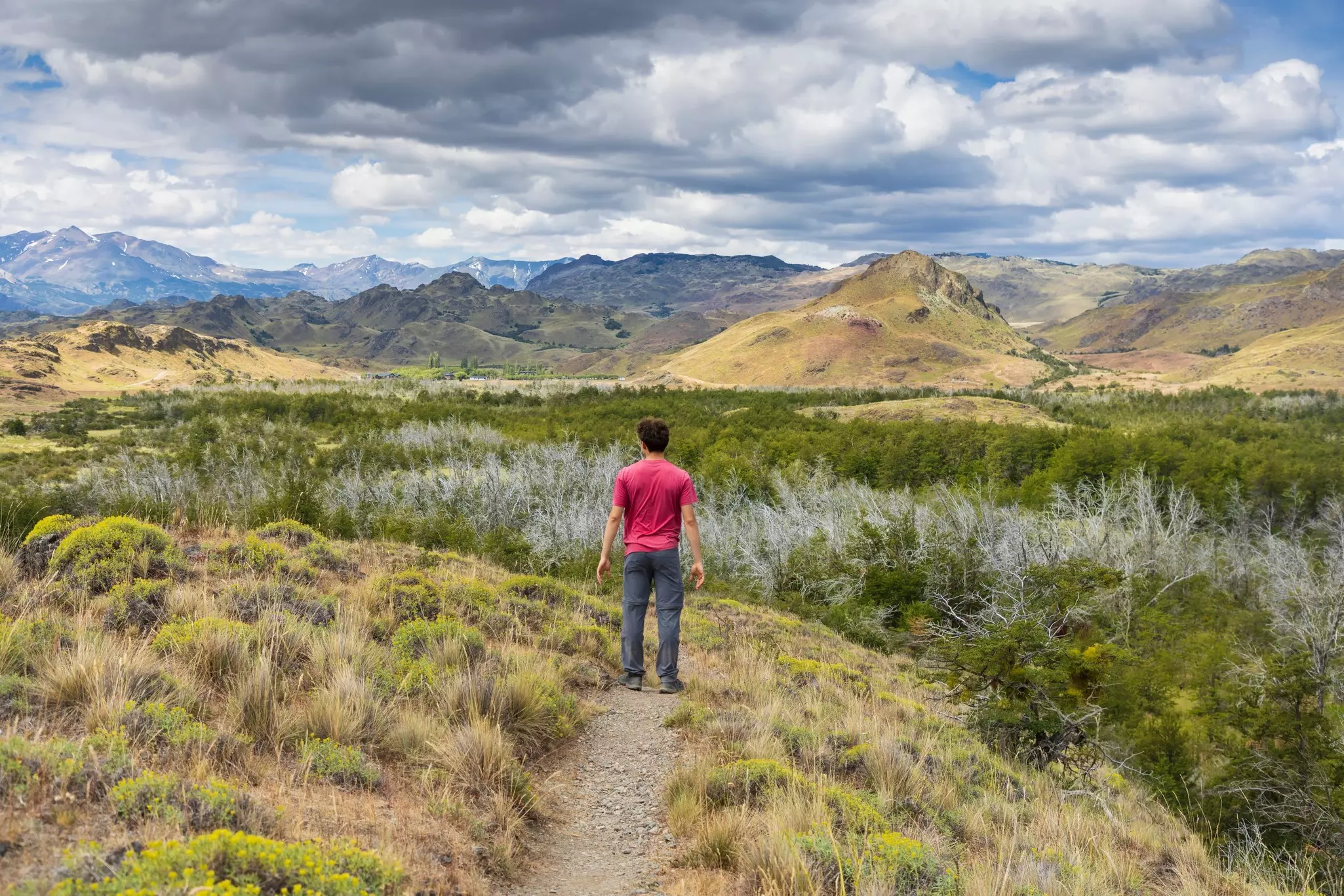
6. Cerro Castillo Circuit
Best for a less-crowded Patagonia experience
Distance: 50km one way
Time commitment: 4–5 days
Difficulty: challenging
Hikers with concerns about overtourism should consider the Cerro Castillo Circuit as an alternative to Torres del Paine’s W Trek. Cerro Castillo became a national park in 2018, its namesake peak appearing along the edge of the Carretera Austral (Southern Highway) like an imposing castle of rock and ice.
Several day trails crisscross the park; our favorite is the Sendero Laguna Cerro Castillo, a 15km trek that leads to a sapphire lagoon at the base of the triple-tiered, glacier-flanked Cerro Castillo. But it’s the epic transverse trail (often called Las Horquetas Circuit) that offers the most immersive experience.
Over the span of 4 or 5 days, you’ll cross montane streams, picnic next to turquoise lagoons, photograph hanging glaciers and camp in Andean beech forests, all while keeping an eye out for endangered huemul deer. Since this is seriously remote backcountry, share your plans with others before you set out, and check in with the ranger to avoid seasonal hazards.
Planning tip: Given the park’s newness, its infrastructure has yet to catch up with Patagonia’s better-known preserves. Also, since the access points traverse private property, entrance fees are relatively steep, at 5000 Chilean pesos (CH$) per day for a multiday hike.
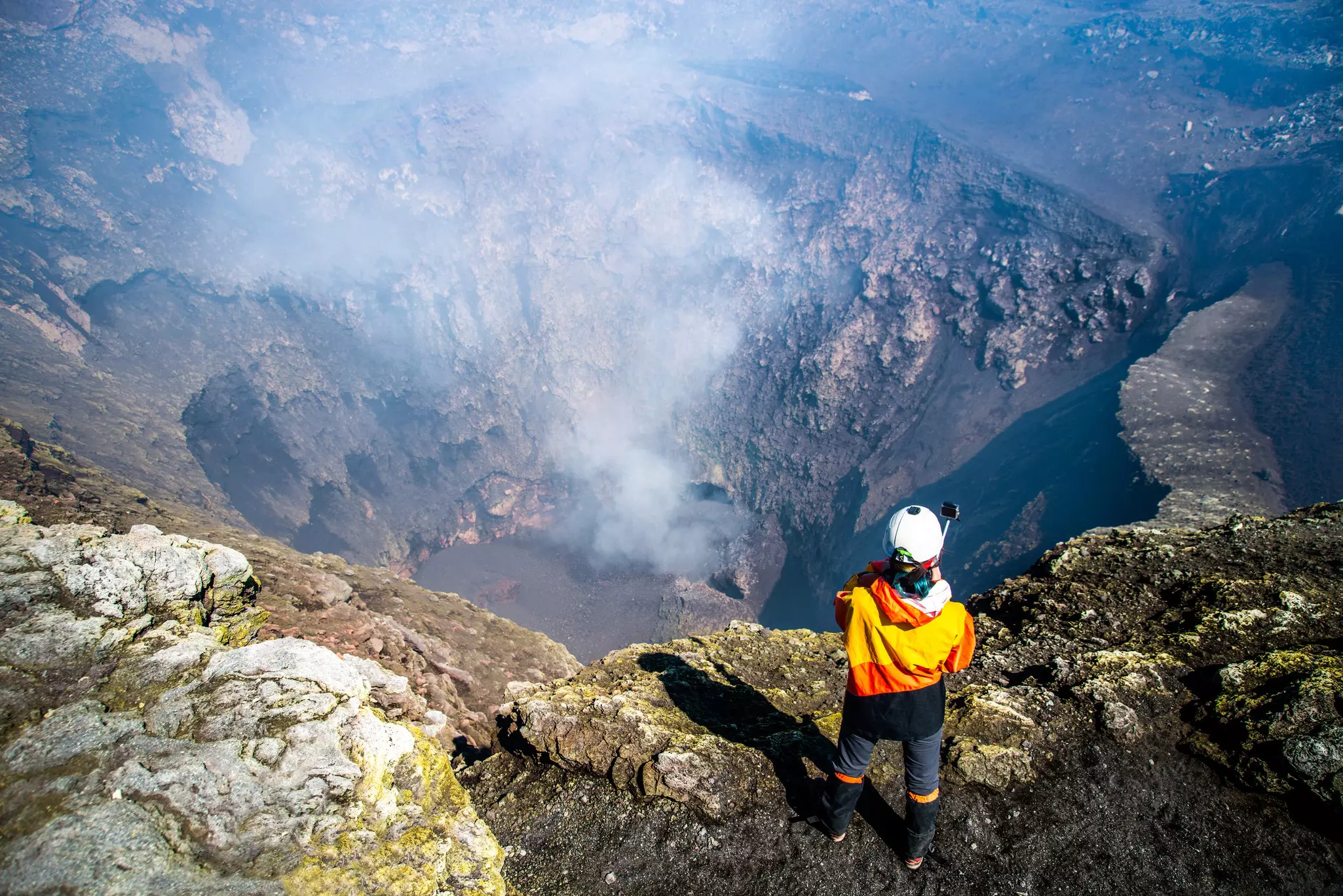
7. Volcán Villarrica
Best for fans of volcanoes and ice climbing
Distance: 10km
Time commitment: 7–9 hours
Difficulty: moderate
Volcán Villarrica is one of the most active volcanoes in the Americas – so it may come as a surprise that climbing to its top to view its smoke-spewing crater and permanent magma lake is one of the most popular activities in Chile’s Lakes District.
At 2847m, the volcano’s perfectly conical peak towers above the resort town of Pucón, where several tour companies offer guided trips that include crampons and ice picks for the snow-capped summit.
Planning tip: To speed up the journey by more than an hour, opt for the chairlift (CH$10,000), which will whisk you up the first 400m of the ascent.
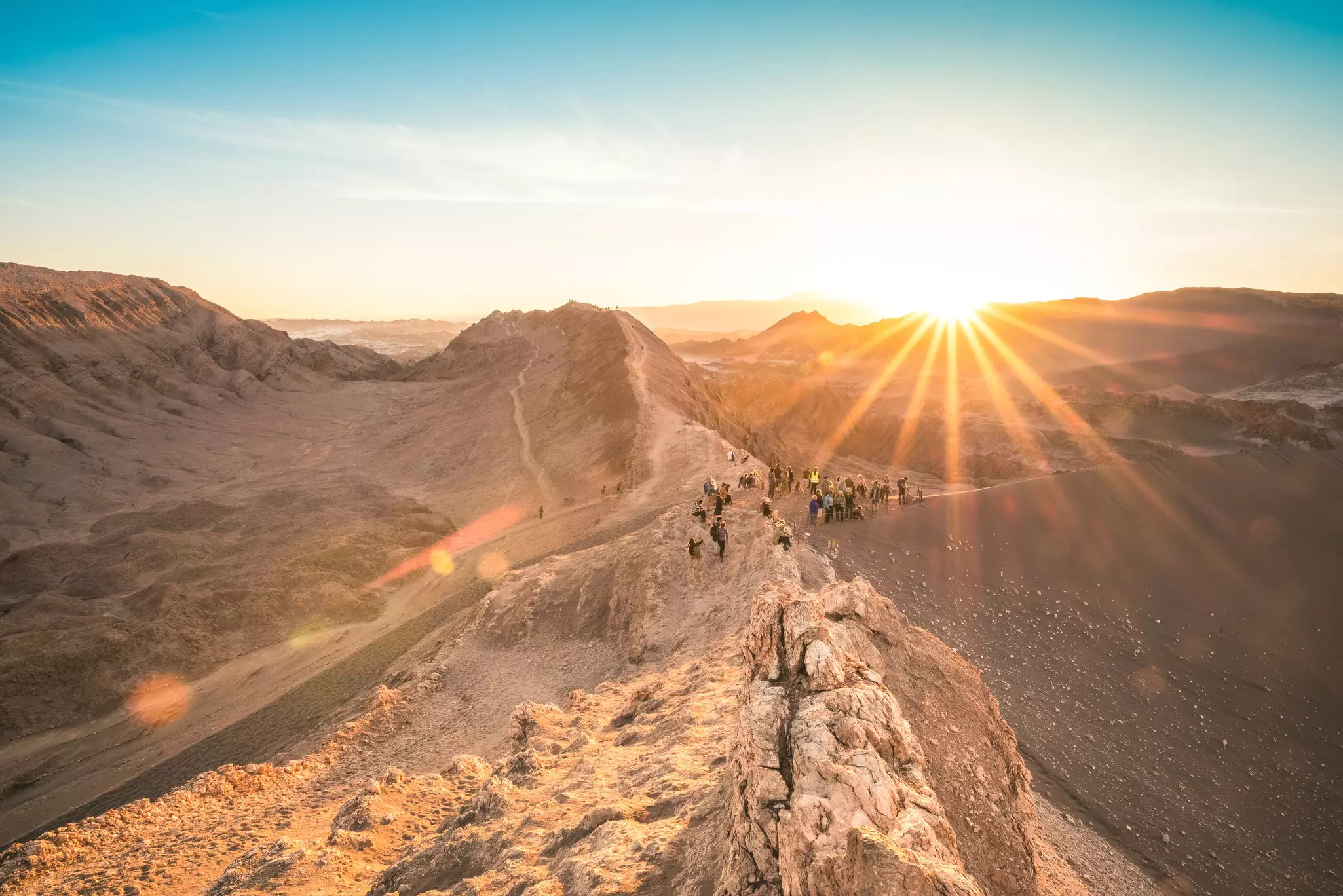
8. Duna Mayor, Valle de la Luna
Best for desert vistas
Distance: 1.6km
Time commitment: 1 hour
Difficulty: easy
Near the desert oasis of San Pedro de Atacama, the Valle de la Luna is famous for its sunsets. Yet this landscape is just as evocative in the heat of the day. (Just be sure to bring a hat, SPF and lots of water.) You can escape into the desert’s earthen caverns, climb towering dunes or get lost amid the bizarre rocks that pop up around every turn.
The short Duna Mayor trail offers an appealing intro to this ethereal, moonlike landscape. Its principal viewpoint takes in the valley’s unusual geological formations, which are the result of millennia of erosion.
Planning tip: Many visitors arrive on an organized tour from San Pedro, with most trips usually departing around 4pm and including a sunset cocktail. To avoid the crowds, visit in the morning, even if you’ll miss out on the sunset colors.
9. Isla Robinson Crusoe Trail
Best for sheer remoteness
Distance: 19km
Time commitment: 7–10 hours
Difficulty: moderate
After your propeller plane lands at the remote airstrip on remote Isla Robinson Crusoe, 670km off the coast of Valparaíso, you have two ways to get to your lodging in San Juan Bautista. While most visitors opt for the 90-minute boat taxi to the far side of the island, we recommend sending just your luggage via the boat and hiking to the island’s sole town through its spectacularly bizarre interior.
Some 62% of the flora are found nowhere else on earth, with much of the vegetation – including perky tree ferns and giant rhubarbs – as similar to that of New Zealand as mainland Chile. On this nearly 19km hike, you’ll also get the chance to walk in the footsteps of Scottish privateer Alexander Selkirk, whose experience as a castaway here in the early 1700s inspired Daniel Defoe’s classic adventure novel Robinson Crusoe.
Planning tip: Most flights allow only 10kg of luggage, so you’ll need to pack smart. Most essential on this wet, wind-whipped island are a waterproof jacket, quick-dry pants and layers of windproof clothing, as well as SPF.
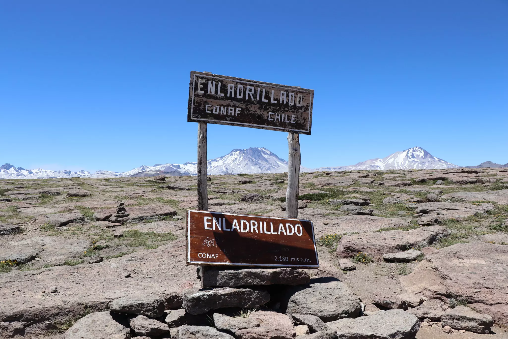
10. Sendero Enladrillado
Best for leveling off
Distance: 19km
Time commitment: 7–9 hours
Difficulty: challenging
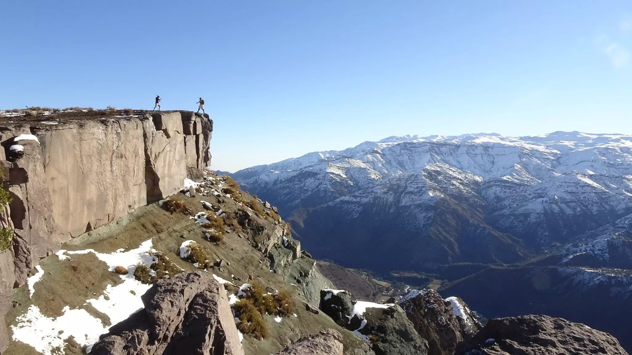
The range of challenging hikes at the well-organized and easily accessible Reserva Nacional Altos de Lircay, 180km southeast of Santa Cruz, will leave you (quite literally) short of breath. The park’s star trail is Sendero Enladrillado, which takes you to the top of a 2300m basalt plateau – arguably the best day hike in the whole of Middle Chile.
The trail starts with a 2-hour stretch east along the Sendero de Chile; a signposted right-hand fork then climbs steeply through dense forest for about an hour before leveling off. You eventually emerge onto the dead-flat platform of Enladrillado. (It’s so strange that some think it must be a UFO landing ground.) To the west, you can see the flat-topped crater of Volcán Descabezado (Headless Volcano) and next to it the sharp peak of Cerro Azul. The 10km one-way trek takes about 4 hours up and 3 down.
Consult park maps for how to link this trail with the Sendero Laguna del Alto, which leads to a mountain-ringed lagoon at 2000m. Trekking Chile, based out of the superb Lodge Casa Chueca in nearby Talca, sells topographic maps and can arrange guides for day hikes or longer excursions like Circuito los Cóndores, a 6-day high-Andean circuit.
Planning tip: When you finish exploring the park, don’t forget about the turquoise Lago Colbún down below. Encased in the Andean foothills, it’s a serene spot for kayaking or paddleboarding, with several lodging options right on its shores.
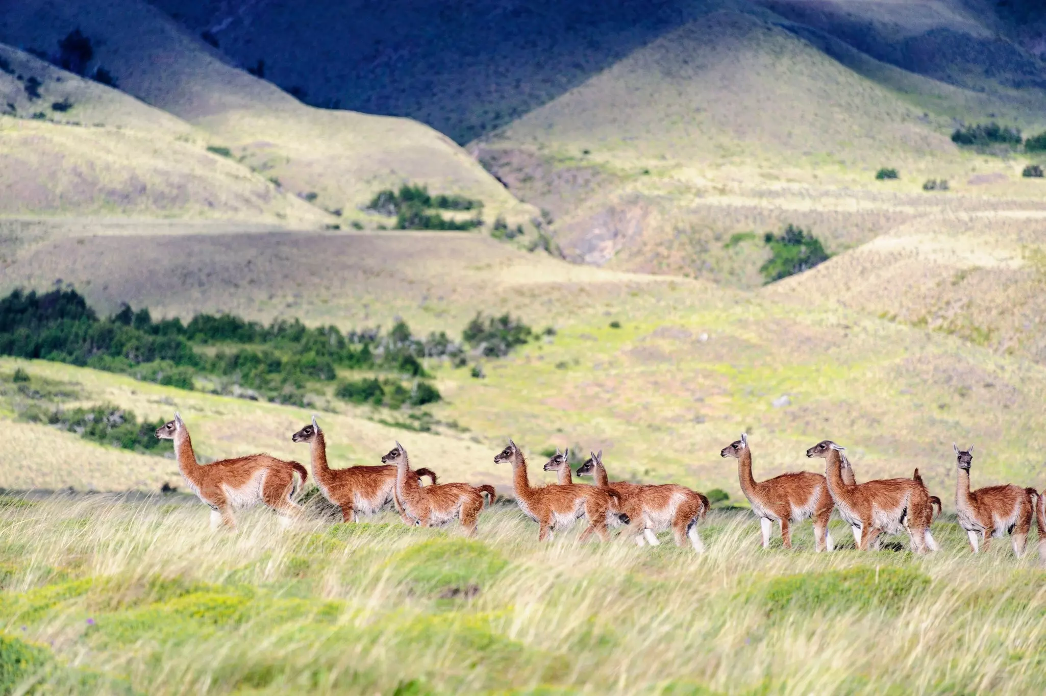
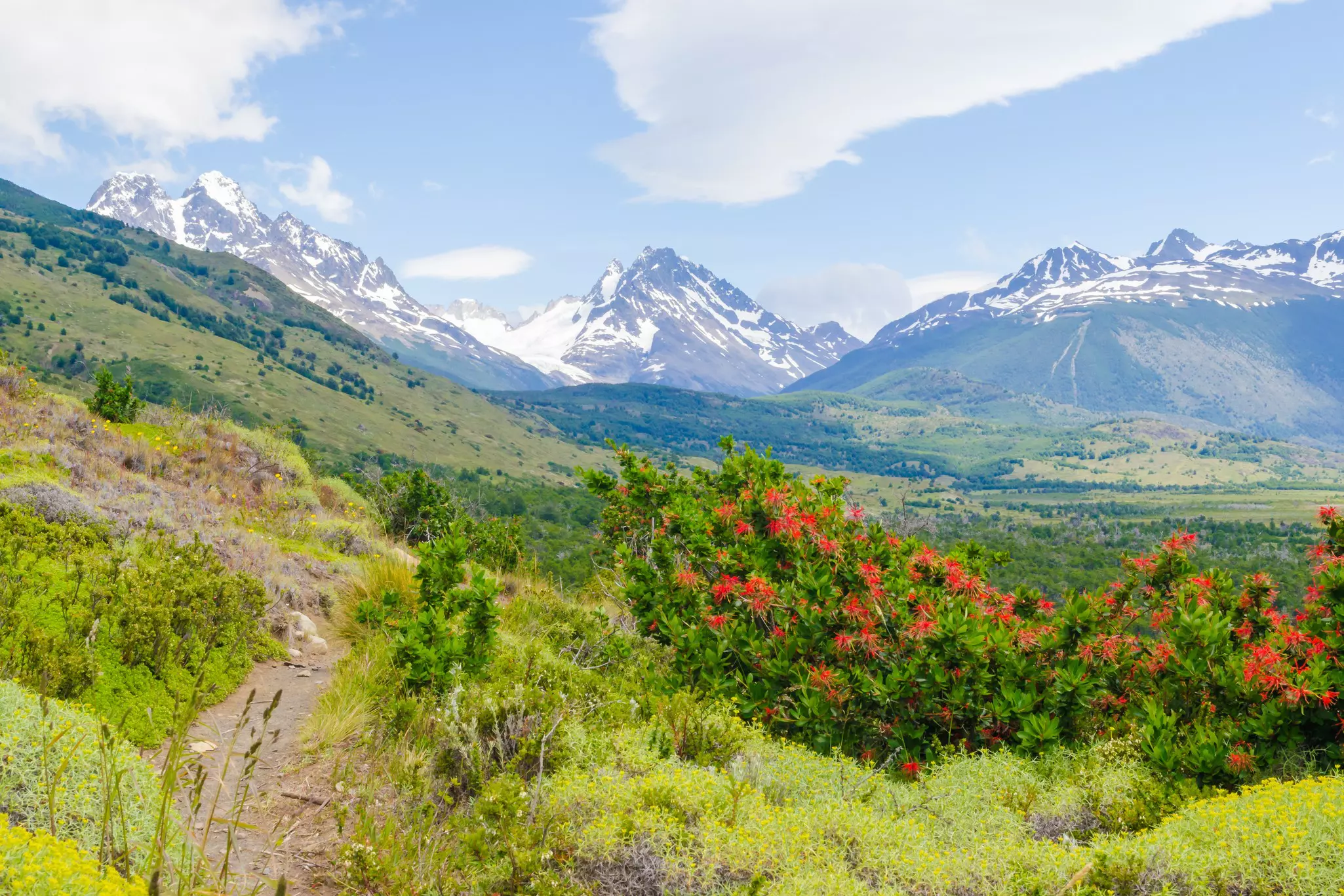
11. Jeinimeni–Avilés Valley Trek, Parque Nacional Patagonia
Best for spotting guanacos
Distance: 50km one way
Time commitment: 3–4 days
Difficulty: challenging
Gazing over the vast Parque Nacional Patagonia and its mountains, beech forests, lagoons and guanaco-dotted steppe, it’s hard to believe that much of this land was once grazing pasture. Today, the recovering 3045-sq-km park is one of the region’s top attractions, its vast expanses rich in wildlife.
An introduction to the parks’ scope begins in the Sector Lago Jeinimeni, with its namesake Gatorade-blue lake, a habitat for flocks of flamingos. After vigorous days of traversing the windy terrain, you’ll arrive at the Avilés Valley, crossing a river bridge, hiking down one side of a river canyon and possibly spotting Andean condors along the way.
Planning tip: This trail requires navigational skills since there are minimal markings. Arrange exit transport in advance, as you’ll be far from civilization with no public transportation or cell phone signal.
Top tips for hiking in Chile
Patagonia hiking is best in the southern hemisphere's summer months of December to March. Hike the Atacama Desert from June to January, and Middle Chile between September and November.
For travelers with disabilities, local company Wheel the World has made trails up and down Chile (even complicated ones like the W Trek) accessible, thanks to specially trained guides and lightweight trekking wheelchairs.
Always be a responsible hiker. Carry out your trash, be cautious with campfires and don’t feed wildlife. Pay the required fees before traversing private property. Leave livestock gates as you find them.
If you’re really inspired to keep going, the 2800km Route of the Parks ranges between Puerto Montt and Cape Horn – a full third of Chile’s long length – connecting 17 national parks and more than 60 towns.
This article was partially adapted from Lonely Planet’s Chile & Rapa Nui guide, published in October 2025.
Advertisement
Take your Chile trip with Lonely Planet Journeys
Time to book that trip to Chile
Lonely Planet Journeys takes you there with fully customizable trips to top destinations – all crafted by our local experts.


Explore related stories

Feb 5, 20258 min read
How to get your cell phone connected in Chile: eSIMs, wi-fi and mobile networks