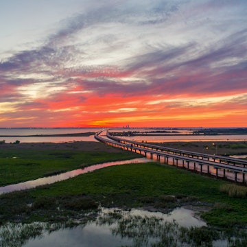

Take a short boardwalk hike to Bald Rock for soaring views from the highest point in Alabama © JimVallee / Getty Images
With no National Parks and only one small National Monument, Alabama’s great outdoors fly somewhat under the radar. But don’t let that mislead you – from Appalachian foothills to pine forests to bayous, the state has a wide range of terrain that is well worth exploring.
Here are five of our favorite natural escapes in the Yellowhammer State.

Expand your horizon at Cheaha State Park
If it’s far-reaching overlooks that you’re after, head to Mt Cheaha, the highest point in Alabama at 2,407 feet. It's within Cheaha State Park, created in 1933 as part of a Civilian Conservation Corps project – the park boasts a lake, cabins and chalets that are popular draws for regional visitors. You can drive to the mountain's peak on a paved road punctuated by scenic overlooks. For an easy way to enjoy unending views of the surrounding fertile, green valley, walk the short Pulpit Rock or Bald Rock trails. Dogs are allowed on both trails, but must be leashed, and the Bald Rock trail has a boardwalk that makes the view accessible to wheelchairs and strollers. Time your hike for sunset or sunrise, when the valley explodes with color.
Uncommon solitude can often be found at the park’s campsites and longer trails, which are much less frequented than Bald Rock or Pulpit Rock. For a moderate backwood hikes, try either Cave Creek Trail or Cheaha Mountain. Both are seven-mile round-trip sections of the 100-plus mile Pinhoti Trail, known as ‘Alabama's link to the Appalachian Trail,’ which runs through Cheaha State Park and neighboring Talladega National Forest.

Unplug in remote Talladega National Forest
Situated at the southern edge of the Appalachians and bordering Cheaha State Park to the north, Talladega National Forest spans over 600 square miles and is a top-notch destination for hiking, mountain biking and primitive camping. While many areas are accessible by gravel and dirt roads, much of the forest is difficult to navigate by car, making it popular with 4-wheel enthusiasts as well.
The forest contains gentle waterfalls, rippling rivers, rock bluffs and rare longleaf pines. Notable hikes in Talladega National Forest include the moderate, wildflower-strewn Skyway Loop Trail (18 miles), and the difficult Porters Gap to Adams Gap stretch (15 miles) of the Pinhoti Trail, which offers wildlife and mountain views. For an easier excursion, hike just under a mile down the Chinnabee Silent Trail from the trailhead at Lake Chinnabee to Devil’s Den, a popular swimming hole at the foot of a waterfall. Dogs are allowed in the forest, although they must be leashed on most trails. Hikers should bring bug spray and wear long pants, as the brush can get thick.

Observe wildlife in Bon Secour National Wildlife Refuge
At the opposite corner of Alabama, some 300 miles southeast on the panhandle, you’ll find Bon Secour National Wildlife Refuge in Gulf Shores. At just 11 square miles, the reserve is small by most protected land standards. But it packs a mighty punch and provides a quiet escape from the nearby crowds at the beach.
The refuge was established in 1980 as a safe harbor for migrating birds, and more than 300 species, including ospreys, herons and hummingbirds, can be found on the white sand beaches and amid the palmettos and live oaks. Other notable wildlife include red fox, coyotes, nesting sea turtles and alligators – not to mention mosquitoes and biting flies, so pack the bug spray.
The refuge is also home to a handful of short, well-marked trails. We recommend the 4-mile round-trip on Pine Beach Trail. This trek crosses the barrier island from the Gulf of Mexico to Mobile Bay, with the saltwater Little Lagoon on one side and freshwater Gator Lake on the other. An observation tower allows for stunning views. For a less strenuous, shorter sampling of Bon Secour’s delights, the wheelchair-accessible 1-mile Jeff Friend Loop has views of the Little Lagoon and wildlife-spotting opportunities.
The park is open seven days a week during daylight hours only, and no pets are allowed.

Go deep in Little River Canyon National Preserve
Created in 1992, Little River Canyon National Preserve is home to a namesake canyon that is one of the deepest in the Southeast. The park’s 15,288 acres, most high on Lookout Mountain, include many rare plants, the clear and clean Little River and three major waterfalls: DeSoto Falls, Little River Falls and Grace's High Falls. DeSoto State Park is at the northwestern edge of the preserve and has a lodge, restaurant and several campgrounds.
The trails here are all shorter than three miles and run easy to moderate – but they’re serenely stunning. Our favorites include the waterfall hikes to Little River Falls (1/2 mile, with an accessible boardwalk option) and DeSoto Falls (2 miles), as well as the wildflower-rich Beaver Pond Trail (1.6 miles). From Little River Falls, you can hike another 3/4 of a mile down to Hippie Hole, one of the state’s best swimming holes. Dogs are allowed in the preserve, but must be leashed.

Hike your heart out in Sipsey Wilderness
A hiker’s paradise, 25,770-acre Sipsey Wilderness within Bankhead National Forest is the largest wilderness area east of the Mississippi River. Within that favorable real estate, 12 memorable trails jet out in every direction, past rivers and streams, stands of virgin forest and sandstone cliffs. Top-rated treks include beginner-friendly Borden Creek Trail, a 5-mile round trip that offers waterfall views. Other trails are less clearly marked in order to keep the ‘wild’ in this wilderness; be sure to bring a map and a compass.
The best challenging trek in the Wilderness, however, is the 24-mile Sipsey Wilderness Loop. This epic, difficult circuit starts at the Randolph Loop Trailhead and links several trails to form a route that encompasses some of the best-known landmarks in the wilderness, like Big Tree, Alabama’s biggest white poplar, and Ship Rock, a large, jutting boulder shaped exactly like the prow of a ship.


